Highway 7 (Israel)
| |
|---|---|
|
כביש 7 Kvish Sheva' | |
 | |
| Route information | |
| Length: | 16 km (10 mi) |
| Major junctions | |
| West end: | |
| |
| East end: |
|
| Location | |
| Major cities: | Ashdod, Beit Rabban, Kannot, Gedera, Yad Binyamin, Yesodot |
| Highway system | |
| Highways | |

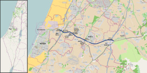
Highway 7 is a highway in the South District of Israel from Ashdod to Yesodot. It connects the Port of Ashdod with the Trans-Israel Highway (Highway 6).
Upgrade
The road was rebuilt to include additional lanes and interchanges to create a continuous controlled-access highway between Ashdod Interchange with Highway 4 in the west and Highway 3 in the east. Upon completion in August 2014, the section previously numbered Highway 41 between Highway 4 and Highway 40 was renumbered "7".[1][2][3]
Junctions (west to east)
| km | Name | Type | Meaning | Location | Roads crossed |
|---|---|---|---|---|---|
| 0 | מחלף אשדוד (Ashdod Interchange) |
|
Ashdod | | |
| 4.6 | מחלף בית רבן (Beit Rabban Interchange) |
|
House of Rabban | Beit Rabban, Gederot Regional Council, Kvutzat Yavne, Givat Washington, Yeshivat Kerem B'Yavneh |
|
| 7.3 | צומת כנות (Kannot Junction) Eliminated 2014[2] |
|
Rootstock | Kannot | local road |
| 7.7 | מחלף גדרה (Gedera Interchange)[1][2][3] |
|
presumed biblical location (probably incorrect) ult. hedge fence[4][5] |
Gedera, Kannot Industrial Park, Kannot |
|
| 14 | מחלף שורק (Sorek Interchange) |
|
Named after nearby Brook of Sorek |
Yad Binyamin | |
| 16 | צומת כביש 3 / כביש 7 (Highway 3 / Highway 7 Junction) |
|
named after intersecting highways |
Yad Binyamin, Yesodot |
|
See also
| Roads |
| ||||||
|---|---|---|---|---|---|---|---|
| Bus operators | |||||||
| Rail transport |
| ||||||
| Sea ports | |||||||
| Aviation |
| ||||||
| Cable cars | |||||||
| By city | |||||||
| Smart cards | |||||||
References
- 1 2 "Highway 7 completed - Gedera". ynet - Yediot Aharonot. 2014-08-27. Retrieved 2014-08-27.(Hebrew)
- 1 2 3 "Highway 7 - Between Ashdod Interchange and Gadera Interchange". National Roads Company of Israel. Retrieved 2013-06-25.(Hebrew)
- 1 2 "Gedera Interchange Upgrade Project was launched". Gedera Municipality. Retrieved 2012-10-22.(Hebrew)
- ↑ 1Chronicles 4:23
- ↑ Joshua 15:36
Coordinates: 31°48′03″N 34°46′41″E / 31.80083°N 34.77806°E
This article is issued from Wikipedia - version of the 8/6/2015. The text is available under the Creative Commons Attribution/Share Alike but additional terms may apply for the media files.