Hindmarsh Island
| Native name: <span class="nickname" ">Kumerangk | |
|---|---|
 Hindmarsh Island | |
| Geography | |
| Location | South Australia |
| Coordinates | 35°31′S 138°52′E / 35.517°S 138.867°ECoordinates: 35°31′S 138°52′E / 35.517°S 138.867°E |
| Area | 45.5 km2 (17.6 sq mi) |
| Length | 14.7 km (9.13 mi) |
| Width | 6.5 km (4.04 mi) |
| Coastline | 43.7 km (27.15 mi) |
| Highest elevation | 25 m (82 ft) |
| Administration | |
|
Australia | |
| Demographics | |
| Population | 1233~ |
Hindmarsh Island (Aboriginal: Kumerangk) is an island in the lower Murray River near the town of Goolwa, South Australia. It is a popular tourist destination, which has increased in popularity since the Hindmarsh Island bridge was opened in 2001. Hindmarsh Island is 100.1 kilometres (62.2 mi) south east of the Adelaide city centre, around a 1-hour and 30 minute drive.
History
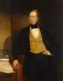
1830: The first European to set foot on Hindmarsh Island was Captain Charles Sturt. Sturt used the Island as a viewing point and from there he sighted the Murray Mouth.
1831: Captain Collet Barker surveyed the Murray Mouth but was killed by Indigenous Australians after swimming across the mouth.
1837: The island was named by Captain John William Dundas Blenkinsop after South Australia's first Governor, Sir John Hindmarsh.
1849: Dr. John Rankine was granted an occupational licence to become the island's first grazier. His nephew James Rankine was an early and longtime settler.
1853: Charles Price purchased section 20 (32 hectares (80 acres))on the island.
1856: A flour mill was constructed.
1857: A signal mast was erected at Barker Knoll to convey safe passage condition messages to vessels wishing to pass through the mouth.
1858: A public ferry began operations between Goolwa and the island. In the same year the first inter colonial telegraph line passed through the island to link Adelaide with Melbourne.
1861: The cemetery was surveyed.
1880s: Alberto and Selberto Forest were planted.
1900: A cheese factory was established by Percy Heggaton.
1868: Hereford cattle and Shropshire sheep arrived in South Australia, when Charles Price introduced them onto the island.
1914: An experimental barrage was constructed to link Hindmarsh Island with Mundoo Island.
1935: Construction of the permanent barrages took place with the aim of maintaining a consistent water level around the river Port of Goolwa and keeping salt water from the northern shore improving agricultural opportunities.
1965: Mains electricity arrived on the island
1970: Little penguins were present on Hindmarsh Island. Today, the colony is extinct. [1]
1985: Approximately an area of 1,405 square kilometres (542 sq mi) including the island was listed as a "wetland of international importance" under the Ramsar convention under the name of Coorong and Lakes Alexandrina and Albert Wetland.[2]
2001: Approximately a third of the island, the 10.81 square kilometres (4.17 sq mi) Wyndgate property, was added to the Coorong National Park.
2005: Hindmarsh Island Marina boasts the title of the largest freshwater marina in the Southern Hemisphere. [3]
Present: Hindmarsh Island today has fresh water on its northern shore and salt water on the southern shores, the waters being separated by a series of barrages.
The Hindmarsh Island Bridge
Length: 319 metres (1,047 ft)
Height: 19 metres (62 ft)
Width: 11 metres (36 ft)
Clearance Height: 14 metres (46 ft)
Building Company: Built Environs
Construction Commenced: October 1999 Construction Finished: March 2001

March 4, 2001 saw the official opening of the Hindmarsh Island Bridge linking the island to Goolwa. The bridge became a focus of national controversy when a group of local Indigenous people (the Ngarrindjeri) and some landowners objected to its construction. It was alleged that the Ngarrindjeri objectors fabricated the cultural significance of the island (the Secret Women's Business) in order to help fight the development.
A later Royal Commission decided that the Secret Women's Business was made up. Construction was blocked by the Keating Government but given the go-ahead by the Howard Government in 1996.
Five years after the Royal Commission findings, the Ngarrindjeri who had stated the bridge desecrated sites sacred to women were vindicated. Federal Court Judge, Mr Justice John von Doussa, in Chapman v Luminis Pty Ltd (No 5) found that "the evidence received by the Court on this topic is significantly different to that which was before the Royal Commission. Upon the evidence before this Court I am not satisfied that the restricted women's knowledge was fabricated or that it was not part of genuine Aboriginal tradition'.[4] Further, Justice von Doussa found the nine Ngarrindjeri women who testified about their beliefs to be 'credible witnesses who genuinely hold the beliefs and recollections expressed by them'.[5]
Geography

Area: 45.5 square kilometres (17.6 sq mi)
Coastline: 43.7 kilometres (27.2 mi) (not including marina)
Highest Elevation: 25 metres (82 ft) (35°30'30.28"S 138°49'21.83"E)
Salt Lakes Total: 49
Terrain: grassland, wooded forest, salt lakes and mangroves
Islands surrounding Hindmarsh Island
Mundoo Island (35°33'4.35"S 138°55'0.86"E) is a medium-sized island off the east coast of the island. Mundoo Island is a privately owned cattle station. The road acts also as a barrage to prevent the river water flowing though Murray Mouth into the ocean.
Area: 13.4 square kilometres (5.2 sq mi)
Perimeter: 27.3 kilometres (17.0 mi)
Distance from Hindmarsh Island: 103 metres (338 ft)
Rat Island/Grindstone Island (35°31'12.59"S 138°57'34.83"E) is a small private owned island 320 metres (1,050 ft) off the easternmost point of the island. It covers 13 hectares (32 acres) of land.
Area: 12 hectares (29 acres)
Perimeter: 1.8 kilometres (1.1 mi)
Distance from Hindmarsh Island: 344 metres (1,129 ft)
Varcoe Island (35°32'30.29"S 138°54'8.55"E) is an extremely small island, with a population of 0.
Area: 913 square metres (9,830 sq ft)
Perimeter: 117 metres (384 ft)
Distance from Hindmarsh Island: 380 metres (1,250 ft)
Bird Island/Gull Island (35°33'13.44"S 138°53'42.28"E) is small-sized island which has a population of 0, it is 100 metres (330 ft) off the southernmost point of the island.
Area: 46 hectares (113 acres)
Perimeter: 2.7 kilometres (1.7 mi)
Distance from Hindmarsh Island: 97 metres (318 ft)
Goose Island (35°30'3.98"S 138°56'9.47"E) is a small private island 420 metres (1,380 ft) off the north western area of the island. It has a population of 2, and very close to the coastline of Clayton Bay. Right next to Goose Island is Goat Island, which are 240 240 metres (790 ft) apart. Goose island does not have very much vegetation or greenery.
Area: 29 hectares (71 acres)
Perimeter: 2.5 kilometres (1.6 mi)
Distance from Hindmarsh Island: 413 metres (1,355 ft)
Goat Island (35°30'17.14"S 138°56'35.78"E) is a small private island 340 metres (1,120 ft) off the north eastern area of the island. Goat island has a population of 1, making it the smallest island by population. Goat island has more vegetation on it than Goose Island, because the ground is more damp and moist.
Area: 40 hectares (100 acres)
Perimeter: 3.3 kilometres (2.1 mi)
Distance from Hindmarsh Island: 296 metres (971 ft)
Limestone Island/Goose Island (35°29'30.29"S 138°49'56.99"E) is a small island, which is located in the Game Reserve. It is located 970 metres (3,180 ft) off the northern coast line of the island. It has a population of 0, and it was named Limestone Island because there is limestone rock formations on the island. The island is rarely set foot on by humans, and it has been known to flood in the middle of winter, making the island fully submerged in water. Limestone Island can be viewed very easily from Goolwa north because it is only 700 metres (2,300 ft) away.
Area: 15 hectares (37 acres)
Perimeter: 1,755 metres (5,758 ft)
Distance from Hindmarsh Island: 961 metres (3,153 ft)
Climate
Hindmarsh Island has a typical Mediterranean climate with hot, dry summers and mild winters.
| Climate data for Hindmarsh Island | |||||||||||||
|---|---|---|---|---|---|---|---|---|---|---|---|---|---|
| Month | Jan | Feb | Mar | Apr | May | Jun | Jul | Aug | Sep | Oct | Nov | Dec | Year |
| Record high °C (°F) | 43.0 (109.4) |
41.3 (106.3) |
39.1 (102.4) |
35.4 (95.7) |
28.9 (84) |
27.0 (80.6) |
22.9 (73.2) |
25.5 (77.9) |
31.4 (88.5) |
34.7 (94.5) |
41.5 (106.7) |
41.2 (106.2) |
43.0 (109.4) |
| Average high °C (°F) | 23.6 (74.5) |
24.4 (75.9) |
22.1 (71.8) |
20.6 (69.1) |
18.1 (64.6) |
15.8 (60.4) |
15.4 (59.7) |
16.0 (60.8) |
18.0 (64.4) |
19.9 (67.8) |
21.2 (70.2) |
21.9 (71.4) |
19.7 (67.5) |
| Average low °C (°F) | 15.4 (59.7) |
15.5 (59.9) |
13.9 (57) |
11.8 (53.2) |
9.7 (49.5) |
8.4 (47.1) |
7.7 (45.9) |
7.7 (45.9) |
9.0 (48.2) |
10.7 (51.3) |
12.4 (54.3) |
13.9 (57) |
11.3 (52.3) |
| Record low °C (°F) | 7.8 (46) |
9.1 (48.4) |
7.4 (45.3) |
5.0 (41) |
1.2 (34.2) |
−0.6 (30.9) |
2.0 (35.6) |
1.0 (33.8) |
3.4 (38.1) |
4.3 (39.7) |
5.8 (42.4) |
7.0 (44.6) |
−0.6 (30.9) |
| Average rainfall mm (inches) | 12.8 (0.504) |
14.4 (0.567) |
18.6 (0.732) |
27.7 (1.091) |
41.0 (1.614) |
59.8 (2.354) |
60.5 (2.382) |
53.0 (2.087) |
50.6 (1.992) |
40.6 (1.598) |
27.8 (1.094) |
30.4 (1.197) |
437.2 (17.212) |
| Average rainy days | 5.2 | 4.5 | 7.4 | 10.0 | 15.8 | 18.1 | 19.9 | 17.8 | 14.9 | 12.7 | 9.9 | 8.1 | 144.3 |
| Source: Bureau of Meteorology[6] | |||||||||||||
Places of Interest
Hindmarsh Island Caravan Park
Hindmarsh Island Caravan Park ( 35°30'13.17"S 138°48'53.30"E) is a caravan park located on the northern side of Hindmarsh Island on natural land. The land consists of camping grounds, forests and grasslands. It was developed in the late 1970s and opened in the early 1980s.
Area: 9.0 hectares (22.2 acres)
Perimeter: 1.29 km
Hindmarsh Island Monument
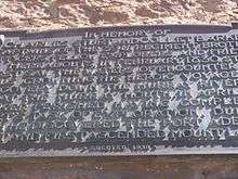
Hindmarsh Island Monument ( 35°30'38.59"S 138°49'45.71"E) is a monument statue dedicated to Sturt and Barker on the island, it was erected in 1930.
Height: 3.4 metres (11 ft)
Hindmarsh Island Airstrip

The Hindmarsh Island Airstrip ( 35°30'19.92"S 138°51'2.48"E) was developed in the 2008, for emergency aircraft landings like the Flying Doctor Service and the Private Cessnas, the runway is hardened dirt.
Length: 500 metres (1,600 ft)
Width: 12 metres (39 ft)
Hindmarsh Island Lookout/Down Hill Track
The Hindmarsh Island Lookout (35°30'32.04"S 138°47'33.07"E) was developed in the late 1990s for a viewing point to Goolwa for the Public. It has also been used as a downhill track for mountain bike users. It was built on a hill, 10 metres (33 ft) above sea level.
Area: 0.77 hectares (1.9 acres)
Perimeter: 430 metres (1,410 ft)
Lonely Island
Lonely Island (35°30'58.98"S 138°51'49.13"E) is the only island (Lonely Island) within an island (Hindmarsh Island) within an island (Australia) in the southern hemisphere. It is located the centre of a dried up salt lake, that does become full of water in winter.
Area: 10.49 hectares (1.21 acres)
Perimeter: 265 metres (869 ft)
Hindmarsh Island Weather Receiver

Hindmarsh Island Weather Receiver (35°31'10.20"S 138°49'4.17"E) is a weather receiver located next to the Hindmarsh Island Marina. It provides the Bureau of Meteorology with Hindmarsh Islands weather. Surrounded by a steel fence, it is out of bounds to the general public. The weather receiver was built in 2006.
Height: 7 metres (23 ft)
Hindmarsh Island River Murray Mouth Lookout
Hindmarsh Island River Murray Mouth Lookout (35°32'58.23"S 138°52'58.03"E) is a lookout on the south-west area of the Island. An observation of the Murray Mouth; where the river meets the ocean.
Area: 181 square metres (1,950 sq ft)
Perimeter: 58 metres (190 ft)
Lake Cloud
Lake Cloud (35°31'12.51"S 138°56'11.54"E) is the largest salt lake on the island. It is located on the western part of the Island.
Area: 7.7 hectares (19 acres)
Length: 410 metres (1,350 ft)
Lowest Point: −2 metres (−6.6 ft) (below sea level)
Narnu Farm

Narnu Farm (35°30'18.17"S 138°49'50.40"E) is an award-winning family friendly holiday destination & tourist attraction located on Hindmarsh Island, the farm full of animals & an accommodation experience.
Karinga Park Homestead
Karinga Park Homestead (35°30'14.40"S 138°49'10.56"E) is a homestead, that offers accommodation and a getaway experience. It covers 8.1 hectares (20 acres) of land, and which a majority of that space is a part of Alberto Forest.
Telstra Telephone Tower

The Telstra Telephone Tower (35°30'32.10"S,138°49'0.57"E) is an active Telstra Telephone Signal Tower that gives phone Telstra coverage for the population on Hindmarsh Island. The telephone tower is located in Alberto Forest, it increases on the hill towards the centre; this hill is the tallest point on Hindmarsh Island, which is why the Telephone Tower was built there.
Constructed: 2006
Height: 42 metres (138 ft)
ASL: 65 metres (213 ft)
Company: Telstra
Site Type: 3G 850
Hertz: 850Mhz
Hindmarsh Island Mangroves
Hindmarsh Island Mangroves (35°32'9.81"S 138°53'17.17"E) is Hindmarsh Island's only Mangrove, it is located at southern part of the island, approximately 1.2 km north of the Mundoo Channel. It has an area of 7.5 Hectares and has a perimeter of 943 m.
Hindmarsh Island Boat Ramps
Captain Sturt Parade Boat Ramp: 35°30'6.76"S 138°48'50.37"E
Valmai Tce Boat Ramp: 35°30'9.15"S 138°49'53.25"E
Randell Road Boat Ramp: 35°30'16.58"S 138°47'19.59"E
Monument Road Boat Ramp: 35°30'7.19"S 138°49'45.20"E
Marina Boat Ramp: 35°30'48.79"S 138°48'4.40"E
Sugars Ave Boat Ramp: 35°32'52.94"S 138°52'36.63"E
Mundoo Channel Drive Boat Ramp: 35°32'33.09"S 138°52'54.11"E
Ngarrindjeri Tribe
Ngarrindjeri Tribe (35°30'20.71"S 138°48'30.25"E) is the native Aboriginal Tribe of Hindmarsh Island. They are still present at the island, they live on a private property in Alberto Forest.
Clayton Regulator
Clayton Regulator (35°29'58.47"S 138°55'18.90"E) was a temporary sand water prevention barrage, that was constructed in 2008 during the drought to prevent water flowing out of the Murray River. It was de-constructed in late 2010.
Hindmarsh Island Cemetery

Hindmarsh Island Cemetery (35°30'35.40"S 138°51'39.31"E) is an old cemetery located in the centre of the Island, off Randell Road. The surveyor, on the 8 February 1861, fenced off 1 acre of land, expecting it to contain 630 graves. Today the cemetery is a popular attraction, some of the birth dates ranging from the late 1700s to the mid 1900s.
Hindmarsh Island Forests
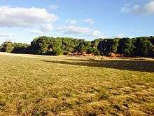
The forests located on the island covers up to 11%. Forests are spread out over different parts of the Island. On the west side of the Island there is a West Forest (Alberto Forest)and on the east side of the Island there East Forest (Selberto Forest). The forests that are present on the Island were originally planted in the 1880s to provide sound and wind protection for the residents and also prevents erosion and destruction of the land by the southern ocean.
Alberto Forest
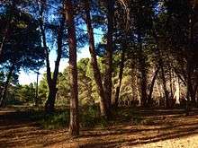
Alberto Forest (35°30'28.32"S, 138°48'59.26"E) is located on the west side of the Island, the northern part of Alberto Forest is the Hindmarsh Island Caravan Park (-35.503767"S, 138.814702"E). Also next to the Caravan Park is Karinga Park Homestead (35°30'14.35"S, 138°49'10.57"E) which also is a part of Alberto Forest. Other parts of the Alberto Forest collide with peoples properties. Same parts of the forest are used for timber and some of it is private land. The Alberto consists of Aleppo pines, they range from 15–25 metres (49–82 ft) tall. Its main purpose was to prevent erosion of the sand dune areas.
Perimeter: 6.89 kilometres (4.28 mi)
Area: 1.48 square kilometres (0.57 sq mi)
Selberto Forest
Selberto Forest (35°30'28.00"S, 138°54'28.43"E) is located on the east side of the island, the Forest mainly collides with residents properties. The trees in Selberto Forest consist of Aleppo pines (Pinus halepensis). The Selberto Forest trees range from 15–30 metres (49–98 ft)tall.
Perimeter: 10.1 kilometres (6.3 mi)
Area: 5.2 square kilometres (2.0 sq mi)
Animals
A wide range of biodiversity inhabits Hindmarsh Island, below is a list of animals that live on Hindmarsh Island.
Native species
- Kangaroo
This marsupial is mainly found in the forest and open grassland areas of Hindmarsh Island. These creatures are very sensitive to sound, and usually avoid humans.
- Blue tongue lizards
These skinks feed on a wide variety of insects, land snails, flowers, fruits and berries. The lizards often hide below the pine needles in the forest or between rocks.
- Australian white ibis
This species is widespread across much of Island. However it is very common along the coastline and in the forest. They often seek shade as much as they can. They are sometimes found as individual birds, but they are most often reported as a group.
- Purple swamphen
The Purple swamphen Purple swamphen is commonly found along the coast of the island near reeds and ponds.
- Red bellied black snake
The red-bellied black snake (Pseudechis porphyriacus) is a black snake with a distinctive red belly. It widely distributed on the Island. Its venom is capable of causing significant pain and numbness. The snake is hibernating in winter and is found in the forest and grasslands only in summer.
- Australian magpies
The Australian magpie (Cracticus tibicen) is a medium-sized black and white bird native to Australia. It is found all over the Island, making it the most common bird viewed on Hindmarsh Island.
- Barn Owl
The Barn owl (Tyto alba) is an owl that is only found around the coastline of Australia. It makes a distinctive sound, when it is positioned in a high tree mostly during the night. The forests on Hindmarsh Island are a popular place for the owls to live.
- Little penguins
The little penguin (Eudyptula minor) is the smallest species of penguin. The penguins used to be found along the south coast of the Island, until the 1970s when people where inhabiting the island, the penguins struggled for survival and eventually became extinct in the late 1970s.
Introduced species
- Cattle
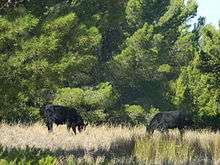

The bull was introduced to Hindmarsh Island in the 1960s. Some of the bulls were brought in to forests and into farm areas. Bulls in the forest are normally seen sitting in the shade or eating grass amongst the trees. People are warned not to interfere with the bulls in the forest, because they could become aggressive. Bulls are widespread across the island.
- European rabbits
The European rabbit (Oryctolagus cuniculus) is a European rabbit that was introduced to the island in the 1950s. They can vary in colour, sometimes gray, white or even black. They can blend into their surroundings very well; they are mostly found in the forest. They are very shy animals and tend to sprint away when approached by a human.
- Red Fox
The Red Fox has been present on the island since the 1850s, when they were introduced from Europe. They are extremely invasive creatures, and widely considered as pests. They mostly present on the southern coast of the island, where they enjoy the isolation. The Red Fox is an extremely shy animal, and will avoid humans when confronted.
See also
References
- ↑ Wiebken, A. Conservation Priorities for Little Penguin Populations in Gulf St Vincent SARDI, South Australia (June 2011). Retrieved 2014-01-26.
- ↑ "Coorong and Lakes Alexandrina and Albert Wetland Ramsar site" (PDF). Department of Environment Water and Natural Resources. 28 January 2014. Retrieved 19 January 2015.
- ↑ "Hindmarsh Island Marina Flooded Today!". Murray River Web Site. 2000. Retrieved 2006-10-12.
- ↑ "Chapman v Luminis Pty Ltd (No 5) [2001] FCA 1106 (21 August 2001)". p. Summary Para 12. Retrieved 8 January 2015.
- ↑ "Chapman v Luminis Pty Ltd (No 5) [2001] FCA 1106 (21 August 2001)". p. Para 317. Retrieved 8 January 2015.
- ↑ "Goolwa (Hindmarsh Island Marina)". Climate statistics for Australian locations. Bureau of Meteorology. January 2015. Retrieved 25 January 2015.
Further reading
| Wikimedia Commons has media related to Hindmarsh Island. |
- Bell, Diane (ed.) (2008). Listen to Ngarrindjeri Women Speaking. Melbourne: Spinifex Press.
- Bell, Diane. (2001). The word of a woman: Ngarrindjeri stories and a bridge to Hindmarsh Island. In Peggy Brock (Ed.), Words and Silences: Aboriginal Women, politics and land (pp. 117–138). Sydney: Allen and Unwin.
- Bell, Diane. (1998). Ngarrindjerri Wurruwarrin: A world that is, was, and will be. Melbourne: Spinifex Press.
- Berndt, Ronald M. and Catherine H. Berndt with John Stanton. (1993). A World That Was: The Yaraldi of the Murray River and the Lakes, South Australia. Melbourne: Melbourne University Press at the Miegunyah Press.
- Brodie, Veronica. (2007). My Side of the Bridge: The life story of Veronica Brodie as told to Mary-Anne Gale. Kent Town: Wakefield Press.
- Fergie, Deane. (1996) Secret envelopes and inferential tautologies. Journal of Australian Studies, 48, pp. 13–24.
- Hemming, Steven J. (1996). Inventing Ethnography. In Richard Nile and Lyndall Ryan (Eds.), Secret Women's Business: The Hindmarsh Affair, Journal of Australian Studies, 48, pp. 25–39. St Lucia, UQP.
- Hemming, Steven J. (1997). Not the slightest shred of evidence: A reply to Philip Clarke’s response to "Secret Women’s Business." Journal of Australian Studies, 5 (3) pp. 130–145.
- Hemming, Stephen J. and Tom Trevorrow. (2005). Kungun Ngarrindjeri Yunnan: archaeology, colonialism and re-claiming the future. In Claire Smith and H. Martin Wobst (Eds.) Indigenous Archaeologies: Decolonising Theory and Practice Routledge, pp. 243 – 261. New York: Routledge.
- Jenkin, Graham. (1979). Conquest of the Ngarrindjeri: The story of the lower Lakes Tribes. Adelaide: Rigby.
- Kartinyeri, Doreen. (1983). The Rigney Family Genealogy. Adelaide: The Aboriginal Research Centre in the University of Adelaide.
- Kartinyeri, Doreen.(1985). The Wanganeen Family Genealogy. Adelaide: The Aboriginal Research Centre in the University of Adelaide.
- Kartinyeri, Doreen.(1989). The Kartinyeri Family Genealogy. Volumes 1-2. Adelaide: South Australian Museum.
- Kartinyeri, Doreen.(1990) The Wilson Family Genealogies. Volumes 1-3. Adelaide: South Australian Museum.
- Kartinyeri, Doreen.(1996). Ngarrindjeri Anzacs. Raukkan: South Australian Museum and Raukkan Council.
- Kartinyeri, Doreen.(2006). Ngarrindjeri Nation: Genealogies of Ngarrindjeri families. Adelaide: Wakefield Press.
- Kenny, Chris. (1996). Women’s Business. Potts Point, NSW: Duffy and Snellgrove.
- Mathews, Jane. (1996). Commonwealth Hindmarsh Island Report pursuant to section 10 (4) of the Aboriginal and Torres Strait Islander Heritage Protection Act 1984. Canberra: Australian Government Printer.
- Mattingley, Christobel and Ken Hampton (Eds.) (1988). Survival in our own Land: Aboriginal experiences in South Australia since 1836, told by Nungas and others. Adelaide: Wakefield Press.
- Mead, Greg. (1995). A Royal Omission. South Australia: The Author.
- Muecke, Stephen and Adam Shoemaker. (Eds.) (2001). Legendary Tales of the Australian Aborigines, David Unaipon. Melbourne University Press at the Miegunyah Press.
- Saunders, Cheryl. (1994). Report to the Minister for Aboriginal and Torres Strait Islander Affairs on the significant Aboriginal area in the vicinity of Goolwa and Hindmarsh (Kumarangk) Island. Adelaide: South Australian Government Printer.
- Simons, Margaret. (2003). The Meeting of the Waters: The Hindmarsh Island Affair. Sydney: Hodder.
- Smith, W. Ramsay. (1930). Myths and Legends of the Australian Aboriginals. London: Harrap.
- Stevens, Iris. (1995). Report of the Hindmarsh Island Bridge Royal Commission. Adelaide: South Australian Government Printer.
- Sturt, Charles. (1833). Two Expeditions into the Interior of Southern Australia. Two volumes. London: Smith, Elder and Co.
- Taplin, George. (1873). The Narrinyeri. Reprinted in J.D. Woods (Ed.), The Native Tribes of South Australia (pp. 1–156). Adelaide: E.S. Wigg & Son.
- Tindale, Norman B. (1931-4). Journal of Researches in the South East of South Australia, 1. Adelaide: Anthropology Archives. South Australian Museum.
- Trevorrow, Tom, Christine Finnimore, Steven Hemming, George Trevorrow, Matt Rigney, Veronica Brodie and Ellen Trevorrow. (2007). They took our land and then our children. Meningie: Ngarrindjeri Lands and Progress Association.
- Unaipon, David. (1924-5). Legendary Tales of the Australian Aborigines. Ms copy (MLA 1929 Cyreel 1134). Sydney: Mitchell Library.
| West coast of Eyre Peninsula |
| ||||||||||||||
|---|---|---|---|---|---|---|---|---|---|---|---|---|---|---|---|
| Spencer Gulf |
| ||||||||||||||
| Investigator Strait | |||||||||||||||
| Kangaroo Island |
| ||||||||||||||
| Gulf St Vincent | |||||||||||||||
| Backstairs Passage | |||||||||||||||
| Encounter Bay and adjoining waters | |||||||||||||||
| South east coast | |||||||||||||||
| Mainland |
| ||||||||||||||
| |||||||||||||||