Hodgen, Oklahoma
| Hodgen | |
|---|---|
| Unincorporated community | |
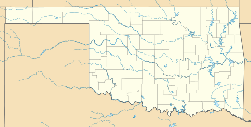 Hodgen  Hodgen Location within the state of Oklahoma | |
| Coordinates: 34°50′30″N 94°37′53″W / 34.84167°N 94.63139°WCoordinates: 34°50′30″N 94°37′53″W / 34.84167°N 94.63139°W | |
| Country | United States |
| State | Oklahoma |
| County | Le Flore |
| Time zone | Central (CST) (UTC-6) |
| • Summer (DST) | CDT (UTC-5) |
Hodgen is a small, unincorporated community in Le Flore County, Oklahoma, United States. The post office was established April 25, 1910.
Hodgen (formerly Hodgens) was named for James M. Hodgens, a railroad official.[1]
Geography
Climate
| Climate data for Hodgen, Oklahoma | |||||||||||||
|---|---|---|---|---|---|---|---|---|---|---|---|---|---|
| Month | Jan | Feb | Mar | Apr | May | Jun | Jul | Aug | Sep | Oct | Nov | Dec | Year |
| Average high °F (°C) | 50.9 (10.5) |
55.3 (12.9) |
64.4 (18) |
74 (23) |
80.8 (27.1) |
88.3 (31.3) |
93.9 (34.4) |
93 (34) |
85.1 (29.5) |
75.7 (24.3) |
63.3 (17.4) |
53.8 (12.1) |
73.2 (22.9) |
| Average low °F (°C) | 22.2 (−5.4) |
26.5 (−3.1) |
35.8 (2.1) |
46.3 (7.9) |
54 (12) |
61.9 (16.6) |
65.6 (18.7) |
64.2 (17.9) |
58.1 (14.5) |
45.7 (7.6) |
35.6 (2) |
26.7 (−2.9) |
45.2 (7.3) |
| Average precipitation inches (mm) | 2.6 (66) |
3.1 (79) |
4.6 (117) |
4.5 (114) |
6.7 (170) |
4 (100) |
3.8 (97) |
3.2 (81) |
4.6 (117) |
4.4 (112) |
4.1 (104) |
3.6 (91) |
49.1 (1,247) |
| Source #1: weather.com | |||||||||||||
| Source #2: Weatherbase.com [2] | |||||||||||||
References
- ↑ Heavener Historical Society (2013). Heavener (LeFlore County) Oklahoma. Xlibris Corporation. p. 266.
- ↑ "Historical Weather for Hodgen, Oklahoma, United States".
Municipalities and communities of Le Flore County, Oklahoma, United States | ||
|---|---|---|
| Cities | 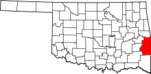 | |
| Towns | ||
| CDP | ||
| Other unincorporated communities | ||
| Footnotes | ‡This populated place also has portions in an adjacent county or counties | |
This article is issued from Wikipedia - version of the 11/2/2016. The text is available under the Creative Commons Attribution/Share Alike but additional terms may apply for the media files.