Poteau, Oklahoma
| Poteau, Oklahoma | |
|---|---|
| City | |
|
The LeFlore County Courthouse is one of five sites in Poteau listed on the National Register of Historic Places | |
 Location of Poteau, Oklahoma | |
| Coordinates: 35°3′31″N 94°37′48″W / 35.05861°N 94.63000°WCoordinates: 35°3′31″N 94°37′48″W / 35.05861°N 94.63000°W | |
| Country | United States |
| State | Oklahoma |
| County | Le Flore |
| Government | |
| • Mayor | Jeff Shockley |
| Area | |
| • Total | 31.7 sq mi (82.0 km2) |
| • Land | 28.6 sq mi (74.2 km2) |
| • Water | 3.0 sq mi (7.8 km2) |
| Elevation | 489 ft (149 m) |
| Population (2010)[1] | |
| • Total | 8,520 |
| • Estimate (2014)[2] | 8,665 |
| • Density | 270/sq mi (100/km2) |
| Time zone | Central (CST) (UTC-6) |
| • Summer (DST) | CDT (UTC-5) |
| ZIP code | 74953 |
| Area code(s) | 539/918 |
| FIPS code | 40-60350[3] |
| GNIS feature ID | 1096874[4] |
| Website | City of Poteau |

Poteau (/ˈpoʊtoʊ/ POH-toh) is a city in, and county seat of, Le Flore County, Oklahoma, United States.[5] The population was 8,520 as of the 2010 census.[1]
History
Poteau was founded in 1885, its name being derived from the nearby Poteau River.[6] A group of French explorers gave the river its present name during the early 18th Century. Poteau is a French word meaning post.[7]
The Fort Smith and Southern Railway built a rail line through the Poteau area in 1886-1887, en route to Paris, Texas, including a station within the city itself. The Poteau post office opened in 1887 and the Kansas City, Pittsburg and Gulf Railroad (acquired by the Kansas City Southern Railway in 1900) began serving the town in 1896. Poteau was officially incorporated in 1898.[7]
Geography
According to the United States Census Bureau, the city has a total area of 31.7 square miles (82 km2), of which 28.6 square miles (74 km2) is land and 3.0 square miles (7.8 km2), or 9.54%, is water. It is about 12 miles (19 km) west of the Oklahoma-Arkansas border.[7]
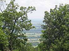
The city is located in the valley below Cavanal Hill, the "World's Highest Hill."
The Poteau River, the only river in Oklahoma that flows north, is located near the city. It flows into Arkansas where it meets with the Arkansas River at Belle Point in Fort Smith.
Demographics
| Historical population | |||
|---|---|---|---|
| Census | Pop. | %± | |
| 1900 | 1,182 | — | |
| 1910 | 1,830 | 54.8% | |
| 1920 | 2,679 | 46.4% | |
| 1930 | 3,169 | 18.3% | |
| 1940 | 4,020 | 26.9% | |
| 1950 | 4,776 | 18.8% | |
| 1960 | 4,428 | −7.3% | |
| 1970 | 5,500 | 24.2% | |
| 1980 | 7,089 | 28.9% | |
| 1990 | 7,210 | 1.7% | |
| 2000 | 7,939 | 10.1% | |
| 2010 | 8,520 | 7.3% | |
| Est. 2015 | 8,732 | [8] | 2.5% |
| U.S. Decennial Census[9] 2014 Estimate[2] | |||
As of the census[3] of 2000, there were 7,939 people, 3,013 households, and 2,042 families residing in the city. The population density was 277.2 people per square mile (107.0/km²). There were 3,351 housing units at an average density of 117.0 per square mile (45.2/km²). The racial makeup of the city was 82.14% White, 2.24% African American, 10.00% Native American, 0.38% Asian, 0.03% Pacific Islander, 1.39% from other races, and 3.83% from two or more races. Hispanic or Latino of any race were 5.82% of the population.
There were 3,013 households out of which 31.6% had children under the age of 18 living with them, 50.0% were married couples living together, 13.3% had a female householder with no husband present, and 32.2% were non-families. 28.3% of all households were made up of individuals and 14.9% had someone living alone who was 65 years of age or older. The average household size was 2.48 and the average family size was 3.02.
In the city the population was spread out with 24.6% under the age of 18, 12.8% from 18 to 24, 26.4% from 25 to 44, 19.9% from 45 to 64, and 16.3% who were 65 years of age or older. The median age was 35 years. For every 100 females there were 91.0 males. For every 100 females age 18 and over, there were 88.3 males.
The median income for a household in the city was $26,178, and the median income for a family was $31,226. Males had a median income of $24,595 versus $20,625 for females. The per capita income for the city was $15,175. About 19.3% of families and 22.1% of the population were below the poverty line, including 31.8% of those under age 18 and 13.4% of those age 65 or over.
Education
The Poteau Public School System includes Poteau Primary School, Poteau Upper Elementary School, Pansy Kidd Middle School and Poteau Senior High School.[10] Pansy Kidd Middle School is named in honor of Pansy Ingle Kidd (1890-1978), who taught in Poteau for over 40 years and was nicknamed the "Dean of Poteau's Teachers."[11]
In 1955, Dr. John Montgomery, a black veterinarian, petitioned the Poteau Public School Board to eliminate the racial segregation of its schools.[12] The board approved his petition, resulting in the integration of the school system and marking Poteau as the first city in Oklahoma to allow African Americans to learn alongside white students in its primary and secondary schools.[12]
Carl Albert State College, formerly known as Poteau Junior College, is one of the 13 state colleges found in Oklahoma.
Kiamichi Technology Center, the largest division of the Oklahoma CareerTech System has a branch location in Poteau.
Notable People
- Kenneth Corn - former Oklahoma State Senator and Oklahoma State Representative who was a candidate for Lieutenant Governor of Oklahoma in 2010.
- Ron Fortner - radio and television anchor.
- Billy Hoffman - country music singer; raised in Poteau.
- Mick Thompson - current Oklahoma State Banking Commissioner and former Oklahoma State Representative.
- Jackson Burns - Actor, writer, producer and stunt coordinator.
See Also
- Cavanal Hill
- Carl Albert State College
- Pansy Kidd Middle School
References
- 1 2 "American FactFinder". United States Census Bureau. Retrieved 2014-08-29.
- 1 2 "Population Estimates". United States Census Bureau. Retrieved May 30, 2015.
- 1 2 "American FactFinder". United States Census Bureau. Retrieved 2008-01-31.
- ↑ "US Board on Geographic Names". United States Geological Survey. 2007-10-25. Retrieved 2008-01-31.
- ↑ "Find a County". National Association of Counties. Retrieved 2011-06-07.
- ↑ "History". City of Poteau, Oklahoma. Retrieved 7 July 2014.
- 1 2 3 Harold Crain, "Poteau," Encyclopedia of Oklahoma History and Culture. Accessed March 20, 2015.
- ↑ "Annual Estimates of the Resident Population for Incorporated Places: April 1, 2010 to July 1, 2015". Retrieved July 2, 2016.
- ↑ United States Census Bureau. "Census of Population and Housing". Retrieved August 28, 2014.
- ↑ "Welcome to Poteau Public Schools," Poteau Public Schools, accessed March 25, 2015.
- ↑ "History of Our School". Pansy Kidd Middle School. Retrieved 2008-09-20.
- 1 2 Curtis, Gene. "Only in Oklahoma: Vet brought desegregation to 'Little Dixie'," Tulsa World, October 7, 2007. Accessed March 25, 2015.
External links
| Wikivoyage has a travel guide for Poteau. |
- City of Poteau
- Poteau Chamber of Commerce
- Buckley Public Library
- Carl Albert State College
- Oklahoma Digital Maps: Digital Collections of Oklahoma and Indian Territory
Municipalities and communities of Le Flore County, Oklahoma, United States | ||
|---|---|---|
| Cities | 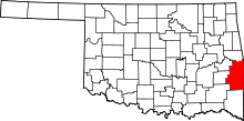 | |
| Towns | ||
| CDP | ||
| Other unincorporated communities | ||
| Footnotes | ‡This populated place also has portions in an adjacent county or counties | |