Cowlington, Oklahoma
| Cowlington, Oklahoma | |
|---|---|
| Town | |
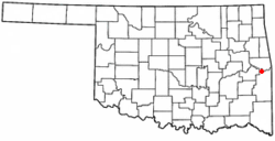 Location of Cowlington, Oklahoma | |
| Coordinates: 35°18′26″N 94°47′29″W / 35.30722°N 94.79139°WCoordinates: 35°18′26″N 94°47′29″W / 35.30722°N 94.79139°W | |
| Country | United States |
| State | Oklahoma |
| County | Le Flore |
| Area | |
| • Total | 0.9 sq mi (2.4 km2) |
| • Land | 0.9 sq mi (2.4 km2) |
| • Water | 0.0 sq mi (0.0 km2) |
| Elevation | 469 ft (143 m) |
| Population (2010) | |
| • Total | 155 |
| • Density | 145.3/sq mi (56.1/km2) |
| Time zone | Central (CST) (UTC-6) |
| • Summer (DST) | CDT (UTC-5) |
| FIPS code | 40-17850[1] |
| GNIS feature ID | 1102933[2] |
Cowlington is a town in Le Flore County, Oklahoma, United States. It is part of the Fort Smith, Arkansas-Oklahoma Metropolitan Statistical Area. The population was 155 at the 2010 census, a gain of 16.5 percent from 133 at the 2000 census.[3]
History
The fertile soil of the Arkansas bottom land, in which the present town of Cowlington is located, attracted settlement as soon as the Choctaw tribe migrated to Indian Territory. Many of these inhabitants fled during the American Civil War, returning only when hostilities had ceased. White men also came after the war and began leasing land. Among these were Coke and Fowler Cowling. A settlement formed that was informally known as Short Mountain. A post office named Cowlington, to honor the Cowling family, opened in the community in 1884.[4]
Cowlington's economy was largely based on agricultural services. Area production included wheat, potatoes, cotton, and livestock. Two floods along the Arkansas River, in 1898 and 1904, devastated the local economy, but the town recovered. Two tornados caused extensive damage during the 1920s More residents began to move away. Even Fowler Cowlington decided to sell his land and moved away. The onset of the Great Depression caused many other people to move away, as well.[4]
Construction of the Robert S. Kerr Lock and Dam between 1964 and 1970 coincided with a large increase in Cowlington's population to a high of 751 residents at the 1970 U. S. Census. Tourism became a significant portion of the local economy, although the population declined again.[4]
Geography
Cowlington is located at 35°18′26″N 94°47′29″W / 35.30722°N 94.79139°W (35.307146, -94.791413).[5] It is 2 miles (3.2 km) south of Robert S. Kerr Lock and Dam (part of the McClellan-Kerr Arkansas River Navigation System). The town is also 10.5 miles (16.9 km) south of Sallisaw.[4]
According to the United States Census Bureau, the town has a total area of 0.9 square miles (2.3 km2), all of it land.
Demographics
| Historical population | |||
|---|---|---|---|
| Census | Pop. | %± | |
| 1900 | 272 | — | |
| 1910 | 378 | 39.0% | |
| 1920 | 344 | −9.0% | |
| 1930 | 265 | −23.0% | |
| 1940 | 224 | −15.5% | |
| 1950 | 83 | −62.9% | |
| 1960 | 74 | −10.8% | |
| 1970 | 751 | 914.9% | |
| 1980 | 546 | −27.3% | |
| 1990 | 756 | 38.5% | |
| 2000 | 133 | −82.4% | |
| 2010 | 155 | 16.5% | |
| Est. 2015 | 150 | [6] | −3.2% |
As of the census[1] of 2000, there were 133 people, 55 households, and 38 families residing in the town. The population density was 145.3 people per square mile (55.8/km²). There were 67 housing units at an average density of 73.2 per square mile (28.1/km²). The racial makeup of the town was 74.44% White, 8.27% Native American, 3.76% from other races, and 13.53% from two or more races. Hispanic or Latino of any race were 3.76% of the population.
There were 55 households out of which 27.3% had children under the age of 18 living with them, 52.7% were married couples living together, 9.1% had a female householder with no husband present, and 30.9% were non-families. 30.9% of all households were made up of individuals and 16.4% had someone living alone who was 65 years of age or older. The average household size was 2.42 and the average family size was 3.03.
In the town the population was spread out with 27.8% under the age of 18, 7.5% from 18 to 24, 27.1% from 25 to 44, 19.5% from 45 to 64, and 18.0% who were 65 years of age or older. The median age was 36 years. For every 100 females there were 95.6 males. For every 100 females age 18 and over, there were 95.9 males.
The median income for a household in the town was $16,591, and the median income for a family was $19,167. Males had a median income of $16,875 versus $23,125 for females. The per capita income for the town was $9,323. There were 6.3% of families and 9.6% of the population living below the poverty line, including no under eighteens and 8.7% of those over 64.
References
- 1 2 "American FactFinder". United States Census Bureau. Archived from the original on September 11, 2013. Retrieved 2008-01-31.
- ↑ "US Board on Geographic Names". United States Geological Survey. 2007-10-25. Retrieved 2008-01-31.
- ↑ CensusViewer:Cowlington, Oklahoma Population. Retrieved September 14, 2012.
- 1 2 3 4 Jeremy Henson, "Cowlington," Encyclopedia of Oklahoma History and Culture. Accessed March 20, 2015.
- ↑ "US Gazetteer files: 2010, 2000, and 1990". United States Census Bureau. 2011-02-12. Retrieved 2011-04-23.
- ↑ "Annual Estimates of the Resident Population for Incorporated Places: April 1, 2010 to July 1, 2015". Retrieved July 2, 2016.
- ↑ "Census of Population and Housing". Census.gov. Archived from the original on May 11, 2015. Retrieved June 4, 2015.
External links
- Encyclopedia of Oklahoma History and Culture - Cowlington
- Oklahoma Digital Maps: Digital Collections of Oklahoma and Indian Territory
Municipalities and communities of Le Flore County, Oklahoma, United States | ||
|---|---|---|
| Cities | 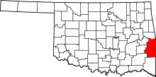 | |
| Towns | ||
| CDP | ||
| Other unincorporated communities | ||
| Footnotes | ‡This populated place also has portions in an adjacent county or counties | |