Houston, Delaware
| Houston, Delaware | |
|---|---|
| Town | |
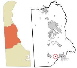 Location in Kent County and the state of Delaware. | |
| Coordinates: 38°55′3″N 75°30′25″W / 38.91750°N 75.50694°WCoordinates: 38°55′3″N 75°30′25″W / 38.91750°N 75.50694°W | |
| Country | United States |
| State | Delaware |
| County | Kent |
| Area | |
| • Total | 0.4 sq mi (1.0 km2) |
| • Land | 0.4 sq mi (1.0 km2) |
| • Water | 0.0 sq mi (0.0 km2) |
| Elevation | 49 ft (15 m) |
| Population (2010) | |
| • Total | 374 |
| • Density | 1,144.4/sq mi (441.9/km2) |
| Time zone | Eastern (EST) (UTC-5) |
| • Summer (DST) | EDT (UTC-4) |
| ZIP code | 19954 |
| Area code(s) | 302 |
| FIPS code | 10-36760 |
| GNIS feature ID | 0214127 |
Houston is a town in Kent County, Delaware, United States. It is part of the Dover, Delaware Metropolitan Statistical Area. The population was 374 at the 2010 census.[1] It was named for John W. Houston.[2]
Geography
Houston is located at 38°55′3″N 75°30′25″W / 38.91750°N 75.50694°W (38.917365, -75.507003).[3]
According to the United States Census Bureau, the town has a total area of 0.4 square miles (1.0 km2), all of it land.
Demographics
| Historical population | |||
|---|---|---|---|
| Census | Pop. | %± | |
| 1930 | 254 | — | |
| 1940 | 296 | 16.5% | |
| 1950 | 332 | 12.2% | |
| 1960 | 421 | 26.8% | |
| 1970 | 317 | −24.7% | |
| 1980 | 357 | 12.6% | |
| 1990 | 487 | 36.4% | |
| 2000 | 430 | −11.7% | |
| 2010 | 374 | −13.0% | |
| Est. 2015 | 391 | [4] | 4.5% |
As of the census[6] of 2000, there were 430 people, 151 households, and 115 families residing in the town. The population density was 1,144.4 people per square mile (436.9/km²). There were 166 housing units at an average density of 441.8 per square mile (168.7/km²). The racial makeup of the town was 89.30% White, 8.37% African American, 0.70% Native American, 0.47% from other races, and 1.16% from two or more races. Hispanic or Latino of any race were 4.65% of the population.
There were 151 households out of which 39.7% had children under the age of 18 living with them, 64.2% were married couples living together, 8.6% had a female householder with no husband present, and 23.2% were non-families. 22.5% of all households were made up of individuals and 10.6% had someone living alone who was 65 years of age or older. The average household size was 2.85 and the average family size was 3.24.
In the town the population was spread out with 30.5% under the age of 18, 7.2% from 18 to 24, 32.6% from 25 to 44, 17.2% from 45 to 64, and 12.6% who were 65 years of age or older. The median age was 33 years. For every 100 females there were 103.8 males. For every 100 females age 18 and over, there were 94.2 males.
The median income for a household in the town was $39,545, and the median income for a family was $46,563. Males had a median income of $29,643 versus $20,208 for females. The per capita income for the town was $15,919. About 1.7% of families and 5.8% of the population were below the poverty line, including 4.0% of those under age 18 and 14.3% of those age 65 or over.
References
- ↑ http://www.stateplanning.delaware.gov/census_data_center/
- ↑ Gannett, Henry (1905). The Origin of Certain Place Names in the United States. Govt. Print. Off. p. 161.
- ↑ "US Gazetteer files: 2010, 2000, and 1990". United States Census Bureau. 2011-02-12. Retrieved 2011-04-23.
- ↑ "Annual Estimates of the Resident Population for Incorporated Places: April 1, 2010 to July 1, 2015". Retrieved July 2, 2016.
- ↑ "Census of Population and Housing". Census.gov. Retrieved June 4, 2015.
- ↑ "American FactFinder". United States Census Bureau. Retrieved 2008-01-31.
Municipalities and communities of Kent County, Delaware, United States | ||
|---|---|---|
| Cities | ||
| Towns | ||
| CDPs | ||
| Unincorporated communities |
| |
| Hundreds | ||
| Footnotes | ‡This populated place also has portions in an adjacent county or counties | |