Smyrna, Delaware
| Town of Smyrna | |
| Town | |
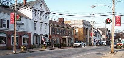 South Main Street in Smyrna | |
| Country | United States |
|---|---|
| State | Delaware |
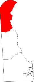
| Counties | Kent, New Castle |
| Elevation | 33 ft (10.1 m) |
| Coordinates | 39°17′49″N 75°36′28″W / 39.29694°N 75.60778°WCoordinates: 39°17′49″N 75°36′28″W / 39.29694°N 75.60778°W |
| Area | 3.8 sq mi (9.8 km2) |
| - land | 3.7 sq mi (10 km2) |
| - water | 0.1 sq mi (0 km2), 2.63% |
| Population | 10,023 (2010) |
| Density | 2,637.6/sq mi (1,018/km2) |
| Timezone | EST (UTC-5) |
| - summer (DST) | EDT (UTC-4) |
| ZIP code | 19977 |
| Area code | 302 |
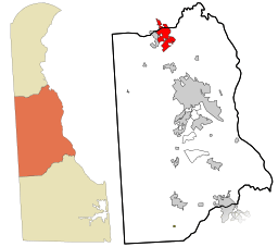 Location in Kent County and the state of Delaware. | |
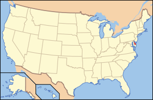 Location of Delaware in the United States | |
| Website: www.smyrnadelaware.com | |
Smyrna is a town in Kent and New Castle counties in the U.S. state of Delaware. It is part of the Dover, Delaware Metropolitan Statistical Area. According to the Census Bureau, as of 2010, the population of the town is 10,023.[1]
The international jurist John Bassett Moore was born in Smyrna, as were politicians Louis McLane and James Williams.
History
The Bannister Hall and Baynard House, Belmont Hall, David J. Cummins House, Timothy Cummins House, Duck Creek Village, George Farmhouse, Ivy Dale Farm, Mount Pleasant, Moore House, Peterson and Mustard's Hermitage Farm, Savin-Wilson House, Short's Landing Hotel Complex, Smyrna Historic District, John M. Voshell House, and Woodlawn are listed on the National Register of Historic Places.[2]
Geography
Smyrna is located at 39°17′49″N 75°36′28″W / 39.29694°N 75.60778°W (39.296815, -75.607708).[3]
According to the United States Census Bureau, the town has a total area of 3.8 square miles (9.8 km2), of which, 3.7 square miles (9.6 km2) of it is land and 0.1 square miles (0.26 km2) of it (2.13%) is water.
Demographics
| Historical population | |||
|---|---|---|---|
| Census | Pop. | %± | |
| 1860 | 1,873 | — | |
| 1870 | 2,110 | 12.7% | |
| 1880 | 2,428 | 15.1% | |
| 1890 | 2,455 | 1.1% | |
| 1900 | 2,168 | −11.7% | |
| 1910 | 1,843 | −15.0% | |
| 1920 | 1,953 | 6.0% | |
| 1930 | 1,958 | 0.3% | |
| 1940 | 1,870 | −4.5% | |
| 1950 | 2,346 | 25.5% | |
| 1960 | 3,241 | 38.2% | |
| 1970 | 4,243 | 30.9% | |
| 1980 | 4,750 | 11.9% | |
| 1990 | 5,231 | 10.1% | |
| 2000 | 5,679 | 8.6% | |
| 2010 | 10,023 | 76.5% | |
| Est. 2015 | 11,319 | [4] | 12.9% |
As of the census[6] of 2000, there were 5,679 people, 2,114 households, and 1,462 families residing in the town. The population density was 1,541.9 people per square mile (595.8/km²). There were 2,242 housing units at an average density of 608.7 per square mile (235.2/km²). The racial makeup of the town was 72.88% White, 22.42% African American, 0.51% Native American, 0.56% Asian, 0.07% Pacific Islander, 1.44% from other races, and 2.11% from two or more races. Hispanic or Latino of any race were 3.42% of the population.
There were 2,114 households out of which 36.7% had children under the age of 18 living with them, 45.9% were married couples living together, 18.4% had a female householder with no husband present, and 30.8% were non-families. 24.9% of all households were made up of individuals and 10.4% had someone living alone who was 65 years of age or older. The average household size was 2.56 and the average family size was 3.02.
In the town the population was spread out with 27.1% under the age of 18, 8.7% from 18 to 24, 29.1% from 25 to 44, 18.3% from 45 to 64, and 16.9% who were 65 years of age or older. The median age was 35 years. For every 100 females there were 82.7 males. For every 100 females age 18 and over, there were 77.0 males.
The median income for a household in the town was $36,212, and the median income for a family was $42,355. Males had a median income of $32,500 versus $22,135 for females. The per capita income for the town was $17,443. About 7.9% of families and 10.5% of the population were below the poverty line, including 14.0% of those under age 18 and 6.2% of those age 65 or over.
Notable people
- Billy Bailey, convicted murderer, the last (as of November 2012) to be hanged in the US (1996)
- Edward G. Budd, founder of the Budd Company
- John Bassett Moore, international lawyer
- Chuck Wicks, country music singer and Dancing with the Stars contestant
References
- ↑ "Smyrna town, Delaware - Population Finder - American FactFinder". Population Finder. U.S. Census Bureau, Population Division. Retrieved January 18, 2010.
- ↑ National Park Service (2010-07-09). "National Register Information System". National Register of Historic Places. National Park Service.
- ↑ "US Gazetteer files: 2010, 2000, and 1990". United States Census Bureau. 2011-02-12. Retrieved 2011-04-23.
- ↑ "Annual Estimates of the Resident Population for Incorporated Places: April 1, 2010 to July 1, 2015". Retrieved July 2, 2016.
- ↑ "Census of Population and Housing". Census.gov. Retrieved June 4, 2015.
- ↑ "American FactFinder". United States Census Bureau. Retrieved 2008-01-31.
External links
Municipalities and communities of Kent County, Delaware, United States | ||
|---|---|---|
| Cities | ||
| Towns | ||
| CDPs | ||
| Unincorporated communities |
| |
| Hundreds | ||
| Footnotes | ‡This populated place also has portions in an adjacent county or counties | |