Irwin, Idaho
| Irwin, Idaho | |
|---|---|
| City | |
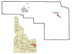 Location in Bonneville County and the state of Idaho | |
| Coordinates: 43°23′18″N 111°16′5″W / 43.38833°N 111.26806°WCoordinates: 43°23′18″N 111°16′5″W / 43.38833°N 111.26806°W | |
| Country | United States |
| State | Idaho |
| County | Bonneville |
| Area[1] | |
| • Total | 2.45 sq mi (6.35 km2) |
| • Land | 2.45 sq mi (6.35 km2) |
| • Water | 0 sq mi (0 km2) |
| Elevation | 5,325 ft (1,623 m) |
| Population (2010)[2] | |
| • Total | 219 |
| • Estimate (2012[3]) | 220 |
| • Density | 89.4/sq mi (34.5/km2) |
| Time zone | Mountain (MST) (UTC-7) |
| • Summer (DST) | MDT (UTC-6) |
| ZIP code | 83428 |
| Area code(s) | 208 |
| FIPS code | 16-40510 |
| GNIS feature ID | 0397812 |
Irwin is a city in Bonneville County, Idaho, United States. It is part of the Idaho Falls, Idaho Metropolitan Statistical Area. The population was 219 at the 2010 census.
Geography
Irwin is located at 43°23′18″N 111°16′5″W / 43.38833°N 111.26806°W (43.388220, -111.268118).[4]
According to the United States Census Bureau, the city has a total area of 2.45 square miles (6.35 km2), all of it land.[1]
Demographics
| Historical population | |||
|---|---|---|---|
| Census | Pop. | %± | |
| 1950 | 147 | — | |
| 1960 | 330 | 124.5% | |
| 1970 | 228 | −30.9% | |
| 1980 | 113 | −50.4% | |
| 1990 | 108 | −4.4% | |
| 2000 | 157 | 45.4% | |
| 2010 | 219 | 39.5% | |
| Est. 2015 | 224 | [5] | 2.3% |
2010 census
As of the census[2] of 2010, there were 219 people, 103 households, and 70 families residing in the city. The population density was 89.4 inhabitants per square mile (34.5/km2). There were 166 housing units at an average density of 67.8 per square mile (26.2/km2). The racial makeup of the city was 99.1% White, 0.5% Asian, and 0.5% from two or more races. Hispanic or Latino of any race were 0.5% of the population.
There were 103 households of which 15.5% had children under the age of 18 living with them, 62.1% were married couples living together, 4.9% had a female householder with no husband present, 1.0% had a male householder with no wife present, and 32.0% were non-families. 25.2% of all households were made up of individuals and 9.7% had someone living alone who was 65 years of age or older. The average household size was 2.13 and the average family size was 2.53.
The median age in the city was 52.4 years. 11.9% of residents were under the age of 18; 5.1% were between the ages of 18 and 24; 21% were from 25 to 44; 38.4% were from 45 to 64; and 23.7% were 65 years of age or older. The gender makeup of the city was 51.6% male and 48.4% female.
2000 census
As of the census[7] of 2000, there were 157 people, 71 households, and 47 families residing in the city. The population density was 73.8 people per square mile (28.5/km²). There were 125 housing units at an average density of 58.8 per square mile (22.7/km²). The racial makeup of the city was 98.09% White, 0.64% Asian, 1.27% from other races. Hispanic or Latino of any race were 1.91% of the population.
There were 71 households out of which 22.5% had children under the age of 18 living with them, 60.6% were married couples living together, 2.8% had a female householder with no husband present, and 32.4% were non-families. 31.0% of all households were made up of individuals and 15.5% had someone living alone who was 65 years of age or older. The average household size was 2.21 and the average family size was 2.73.
In the city the population was spread out with 19.1% under the age of 18, 5.7% from 18 to 24, 17.2% from 25 to 44, 34.4% from 45 to 64, and 23.6% who were 65 years of age or older. The median age was 48 years. For every 100 females there were 109.3 males. For every 100 females age 18 and over, there were 98.4 males.
The median income for a household in the city was $31,250, and the median income for a family was $42,813. Males had a median income of $28,333 versus $27,250 for females. The per capita income for the city was $17,896. About 3.5% of families and 9.7% of the population were below the poverty line, including 23.4% of those under the age of eighteen and none of those sixty five or over.
References
- 1 2 "US Gazetteer files 2010". United States Census Bureau. Retrieved 2012-12-18.
- 1 2 "American FactFinder". United States Census Bureau. Retrieved 2012-12-18.
- ↑ "Population Estimates". United States Census Bureau. Retrieved 2013-06-03.
- ↑ "US Gazetteer files: 2010, 2000, and 1990". United States Census Bureau. 2011-02-12. Retrieved 2011-04-23.
- ↑ "Annual Estimates of the Resident Population for Incorporated Places: April 1, 2010 to July 1, 2015". Retrieved July 2, 2016.
- ↑ "Census of Population and Housing". Census.gov. Retrieved June 4, 2015.
- ↑ "American FactFinder". United States Census Bureau. Retrieved 2008-01-31.
Municipalities and communities of Bonneville County, Idaho, United States | ||
|---|---|---|
| Cities | ||
| CDP | ||
| Unincorporated communities | ||
| Footnotes | ‡This populated place also has portions in an adjacent county or counties | |