Bonneville County, Idaho
| Bonneville County, Idaho | ||
|---|---|---|
| ||
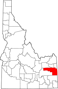 Location in the U.S. state of Idaho | ||
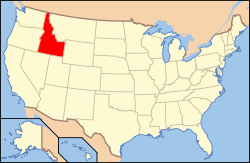 Idaho's location in the U.S. | ||
| Founded | February 7, 1911 | |
| Named for | Benjamin Bonneville | |
| Seat | Idaho Falls | |
| Largest city | Idaho Falls | |
| Area | ||
| • Total | 1,901 sq mi (4,924 km2) | |
| • Land | 1,866 sq mi (4,833 km2) | |
| • Water | 35 sq mi (91 km2), 1.8% | |
| Population (est.) | ||
| • (2015) | 110,089 | |
| • Density | 56/sq mi (22/km²) | |
| Congressional district | 2nd | |
| Time zone | Mountain: UTC-7/-6 | |
| Website |
www | |

Bonneville County is a county located in the U.S. state of Idaho. As of the 2010 census, the county had a population of 104,234,[1] making it the fourth-most populous county in Idaho and the most populous in eastern Idaho. Its county seat and largest city is Idaho Falls.[2] Bonneville County was established in 1911 and named after Benjamin Bonneville (1796–1878), a French-born officer in the U.S. Army, fur trapper, and explorer in the American West.[3]
Bonneville County is part of the Idaho Falls, ID Metropolitan Statistical Area.
The county was partitioned from Bingham County, which was part of Oneida County until 1885.[4]
Geography
According to the U.S. Census Bureau, the county has a total area of 1,901 square miles (4,920 km2), of which 1,866 square miles (4,830 km2) is land and 35 square miles (91 km2) (1.8%) is water.[5] The Snake River flows northwest through the Bonneville County, beginning at the Wyoming border as the Palisades Reservoir. The river exits the county about midway on its northern border, turns and re-enters approximately 20 miles (32 km) west to flow southwest through Idaho Falls .
Adjacent counties
- Madison County - north
- Teton County - north
- Teton County, Wyoming - northeast
- Lincoln County, Wyoming - southeast
- Caribou County - south
- Bingham County - west
- Jefferson County - northwest
Major highways
National protected areas
- Caribou National Forest (part)
- Grays Lake National Wildlife Refuge (part)
- Targhee National Forest (part)
Demographics
| Historical population | |||
|---|---|---|---|
| Census | Pop. | %± | |
| 1920 | 17,501 | — | |
| 1930 | 19,664 | 12.4% | |
| 1940 | 25,697 | 30.7% | |
| 1950 | 30,210 | 17.6% | |
| 1960 | 46,906 | 55.3% | |
| 1970 | 51,250 | 9.3% | |
| 1980 | 65,980 | 28.7% | |
| 1990 | 72,207 | 9.4% | |
| 2000 | 82,522 | 14.3% | |
| 2010 | 104,234 | 26.3% | |
| Est. 2015 | 110,089 | [6] | 5.6% |
| U.S. Decennial Census[7] 1790-1960[8] 1900-1990[9] 1990-2000[10] 2010-2013[1] | |||
2000 census
As of the census[11] of 2000, there were 82,522 people, 28,753 households, and 21,449 families residing in the county. The population density was 44 people per square mile (17/km²). There were 30,484 housing units at an average density of 16 per square mile (6/km²). The racial makeup of the county was 92.79% White, 0.49% Black or African American, 0.65% Native American, 0.82% Asian, 0.07% Pacific Islander, 3.72% from other races, and 1.46% from two or more races. 6.91% of the population were Hispanic or Latino of any race. 25.3% were of English, 14.3% German and 12.2% American ancestry according to Census 2000.
There were 28,753 households out of which 40.60% had children under the age of 18 living with them, 62.00% were married couples living together, 9.30% had a female householder with no husband present, and 25.40% were non-families. 21.40% of all households were made up of individuals and 7.80% had someone living alone who was 65 years of age or older. The average household size was 2.83 and the average family size was 3.33.
In the county, the population was spread out with 32.10% under the age of 18, 9.50% from 18 to 24, 27.20% from 25 to 44, 21.00% from 45 to 64, and 10.20% who were 65 years of age or older. The median age was 32 years. For every 100 females there were 99.40 males. For every 100 females age 18 and over, there were 96.20 males.
The median income for a household in the county was $41,805, and the median income for a family was $48,216. Males had a median income of $38,745 versus $22,514 for females. The per capita income for the county was $18,326. About 7.40% of families and 10.10% of the population were below the poverty line, including 12.20% of those under age 18 and 5.90% of those age 65 or over.
2010 census
As of the 2010 United States Census, there were 104,234 people, 36,629 households, and 26,787 families residing in the county.[12] The population density was 55.9 inhabitants per square mile (21.6/km2). There were 39,731 housing units at an average density of 21.3 per square mile (8.2/km2).[13] The racial makeup of the county was 90.6% white, 0.8% Asian, 0.8% American Indian, 0.6% black or African American, 0.1% Pacific islander, 5.1% from other races, and 2.1% from two or more races. Those of Hispanic or Latino origin made up 11.4% of the population.[12] In terms of ancestry, 23.4% were English, 17.4% were German, 9.9% were American, and 7.8% were Irish.[14]
Of the 36,629 households, 40.4% had children under the age of 18 living with them, 58.7% were married couples living together, 10.1% had a female householder with no husband present, 26.9% were non-families, and 22.4% of all households were made up of individuals. The average household size was 2.81 and the average family size was 3.32. The median age was 31.7 years.[12]
The median income for a household in the county was $50,445 and the median income for a family was $58,346. Males had a median income of $46,498 versus $29,008 for females. The per capita income for the county was $23,218. About 8.1% of families and 11.0% of the population were below the poverty line, including 13.9% of those under age 18 and 6.6% of those age 65 or over.[15]
Communities
Cities
- Ammon
- Idaho Falls
- Iona
- Irwin
- Ririe (partially)
- Swan Valley
- Ucon
Census-designated place
Unincorporated communities
- Beachs Corner
- Bone
- Osgood
- Palisades
Ghost towns
- Herman
- Caribou City
See also
References
- 1 2 "State & County QuickFacts". United States Census Bureau. Retrieved June 28, 2014.
- ↑ "Find a County". National Association of Counties. Archived from the original on 2011-05-31. Retrieved 2011-06-07.
- ↑ Idaho.gov - Bonneville County Archived August 13, 2009, at the Wayback Machine. - accessed 2009-05-31
- ↑ Idaho.gov - Bingham County Archived August 14, 2009, at the Wayback Machine. - accessed 2009-05-31
- ↑ "US Gazetteer files: 2010, 2000, and 1990". United States Census Bureau. 2011-02-12. Retrieved 2011-04-23.
- ↑ "County Totals Dataset: Population, Population Change and Estimated Components of Population Change: April 1, 2010 to July 1, 2015". Retrieved July 2, 2016.
- ↑ "U.S. Decennial Census". United States Census Bureau. Archived from the original on May 11, 2015. Retrieved June 28, 2014.
- ↑ "Historical Census Browser". University of Virginia Library. Retrieved June 28, 2014.
- ↑ "Population of Counties by Decennial Census: 1900 to 1990". United States Census Bureau. Retrieved June 28, 2014.
- ↑ "Census 2000 PHC-T-4. Ranking Tables for Counties: 1990 and 2000" (PDF). United States Census Bureau. Retrieved June 28, 2014.
- ↑ "American FactFinder". United States Census Bureau. Archived from the original on 2013-09-11. Retrieved 2008-01-31.
- 1 2 3 "DP-1 Profile of General Population and Housing Characteristics: 2010 Demographic Profile Data". United States Census Bureau. Retrieved 2016-01-04.
- ↑ "Population, Housing Units, Area, and Density: 2010 - County". United States Census Bureau. Retrieved 2016-01-04.
- ↑ "DP02 SELECTED SOCIAL CHARACTERISTICS IN THE UNITED STATES – 2006-2010 American Community Survey 5-Year Estimates". United States Census Bureau. Retrieved 2016-01-04.
- ↑ "DP03 SELECTED ECONOMIC CHARACTERISTICS – 2006-2010 American Community Survey 5-Year Estimates". United States Census Bureau. Retrieved 2016-01-04.
External links
 |
Jefferson County | Madison County and Teton County | Teton County, Wyoming | |
| Bingham County | |
|||
| ||||
| | ||||
| Caribou County | Lincoln County, Wyoming |
Municipalities and communities of Bonneville County, Idaho, United States | ||
|---|---|---|
| Cities | ||
| CDP | ||
| Unincorporated communities | ||
| Footnotes | ‡This populated place also has portions in an adjacent county or counties | |
Coordinates: 43°23′N 111°36′W / 43.38°N 111.60°W