Ishikari, Hokkaido
"Ishikari" redirects here. For the vessel Ishikari, see JDS Ishikari (DE-226). For other uses, see Ishikari (disambiguation).
| Ishikari 石狩市 | ||
|---|---|---|
| City | ||
| ||
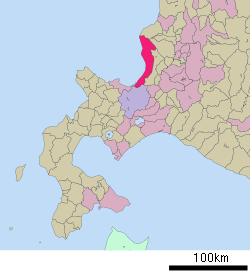 Location of Ishikari in Hokkaido (Ishikari Subprefecture) | ||
 Ishikari Location in Japan | ||
| Coordinates: 43°10′N 141°19′E / 43.167°N 141.317°ECoordinates: 43°10′N 141°19′E / 43.167°N 141.317°E | ||
| Country | Japan | |
| Region | Hokkaidō | |
| Prefecture | Hokkaido (Ishikari Subprefecture) | |
| Government | ||
| • Mayor | Katsusuke Taoka | |
| Area | ||
| • Total | 721.86 km2 (278.71 sq mi) | |
| Population (March 31, 2015) | ||
| • Total | 59,275 | |
| • Density | 82/km2 (210/sq mi) | |
| Symbols | ||
| • Tree | Daimyo oak | |
| • Flower | Rugosa rose | |
| • Bird | Common gull | |
| Time zone | Japan Standard Time (UTC+9) | |
| City hall address |
1-30-2, Hanakawa Kita Roku-jō, Ishikari-shi, Hokkaidō 061-3292 | |
| Website |
www | |

Ishikari (石狩市 Ishikari-shi, Ainu: Iskarun) is a city located in Ishikari Subprefecture, Hokkaido, Japan.
As of February 29, 2012, the city has an estimated population of 60,673, with 26,583 households and a density of 84.05 persons per km2. The total area is 721.86 km2 (279 sq mi).
On October 1, 2005, the village of Atsuta, from Atsuta District, and the village of Hamamasu, from Hamamasu District, merged into Ishikari.
History
- 1902 Ishikari town was founded.
- 1907 Ishikari town and Hanakawa village were merged to form Ishikari town.
- 1996 Ishikari town became Ishikari city.
- 2005 Atsuta village and Hamamasu village were merged into Ishikari city.
Sister cities
International
-
 Campbell River, British Columbia, Canada (since 1983)[1]
 -
 Vanino, Russia (since 1993)
 -
 Pengzhou, China (since 2000)
Domestic
- Wajima, Ishikawa (since 2012)
- Onna, Okinawa (since 2013)
Education
University
- Fuji Women's University, Hanakawa campus[2]
High schools
- Ishikari Minami High School (石狩南高校)
- Ishikari Shōyō High School (石狩翔陽高校)
It also hosts Christ for the Nations Japan bible school,[3] an official associate of the Christ for the Nations Institute in Texas.
References
External links
| Wikimedia Commons has media related to Ishikari, Hokkaidō. |
- Official website (Japanese)
- Official website (English)
This article is issued from Wikipedia - version of the 1/18/2016. The text is available under the Creative Commons Attribution/Share Alike but additional terms may apply for the media files.