Wassamu, Hokkaido
| Wassamu 和寒町 | |
|---|---|
| Town | |
|
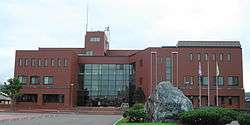
Wassamu town hall | |
 Location of Wassamu in Hokkaido (Kamikawa Subprefecture) | |
 Wassamu Location in Japan | |
| Coordinates: 44°1′N 142°25′E / 44.017°N 142.417°ECoordinates: 44°1′N 142°25′E / 44.017°N 142.417°E | |
| Country | Japan |
| Region | Hokkaido |
| Prefecture | Hokkaido (Kamikawa Subprefecture) |
| District | Kamikawa (Teshio) |
| Area | |
| • Total | 224.83 km2 (86.81 sq mi) |
| Population (2007) | |
| • Total | 4,164 |
| • Density | 19/km2 (48/sq mi) |
| Time zone | Japan Standard Time (UTC+9) |
| Website |
www |
Wassamu (和寒町 Wassamu-chō) is a town located in Kamikawa (Teshio) District, Kamikawa Subprefecture, Hokkaido, Japan.
As of 2007, the town has an estimated population of 4,164 and a population density of 19 persons per km². The total area is 224.83 km².
The town flower is the Katakuri.
Wassamu has 6 schools, a middle school, a high school including the prefectural high school, a post office and a square.
It is linked with the Dōō Expressway at Interchange 12 which was first opened on October 4, 2000 and extended to Kembuchi-Shibetsu on October 4, 2003. Wassamu is also linked by train and Route 40 and prefectural roads 48 and 99.
External links
 Media related to Wassamu, Hokkaidō at Wikimedia Commons
- Official website (Japanese)
This article is issued from Wikipedia - version of the 3/17/2016. The text is available under the Creative Commons Attribution/Share Alike but additional terms may apply for the media files.