Jacksonville Commercial Historic District
|
Jacksonville Commercial Historic District | |
 | |
  | |
| Location | 1st from Mulberry to W. Hickory Sts., Jacksonville, Arkansas |
|---|---|
| Coordinates | 34°51′57″N 92°6′39″W / 34.86583°N 92.11083°WCoordinates: 34°51′57″N 92°6′39″W / 34.86583°N 92.11083°W |
| Area | 3 acres (1.2 ha) |
| NRHP Reference # | 15000631[1] |
| Added to NRHP | February 8, 2016 |
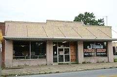
The Jacksonville Commercial Historic District encompasses a 1-1/2 block section of 1st Street in Jacksonville, Arkansas, between Main Street and 2nd Street. The area contains six commercial buildings, constructed between 1925 and 1962, a period when the railroad was an important element of the city's growth. (The railroad tracks lie across 1st Street from the commercial strip. The buildings are mostly single-story brick or stucco buildings with vernacular style.[2]
The district was listed on the National Register of Historic Places in 2016.
See also
References
- ↑ National Park Service (2009-03-13). "National Register Information System". National Register of Historic Places. National Park Service.
- ↑ "NRHP nomination for Jacksonville Commercial Historic District" (PDF). Arkansas Preservation. Retrieved 2016-02-22.
| Topics | |
|---|---|
| Lists by states |
|
| Lists by insular areas | |
| Lists by associated states | |
| Other areas | |
| |
This article is issued from Wikipedia - version of the 12/2/2016. The text is available under the Creative Commons Attribution/Share Alike but additional terms may apply for the media files.