Jeromesville, Ohio
| Jeromesville, Ohio | |
|---|---|
| Village | |
|
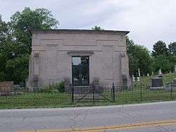
Mausoleum in Jeromesville Cemetery (note that inscription reads "Jeromeville") | |
 Location of Jeromesville, Ohio | |
 Location of Jeromesville in Ashland County | |
| Coordinates: 40°48′15″N 82°11′45″W / 40.80417°N 82.19583°WCoordinates: 40°48′15″N 82°11′45″W / 40.80417°N 82.19583°W | |
| Country | United States |
| State | Ohio |
| County | Ashland |
| Incorporated | February 14,1815 |
| Government | |
| • Mayor | Mr. Randy Spade |
| • Council President | Mr. William T. Nethero |
| Area[1] | |
| • Total | 0.36 sq mi (0.93 km2) |
| • Land | 0.36 sq mi (0.93 km2) |
| • Water | 0 sq mi (0 km2) |
| Elevation[2] | 1,007 ft (307 m) |
| Population (2010)[3] | |
| • Total | 562 |
| • Estimate (2012[4]) | 557 |
| • Density | 1,561.1/sq mi (602.7/km2) |
| Time zone | Eastern (EST) (UTC-5) |
| • Summer (DST) | EDT (UTC-4) |
| ZIP code | 44840 |
| Area code(s) | 419 |
| FIPS code | 39-39060[5] |
| GNIS feature ID | 1085470[2] |
| Website | http://www.jeromesville.org/ |
Jeromesville is a village in Ashland County, Ohio, United States. The population was 562 at the 2010 census.
History
Jeromesville was platted in 1815 on the site of a former Indian village.[6] It is named for John Baptiste Jerome, a French fur trader and pioneer settler.[7][8]The original spelling was "Jeromeville"[9] A post office has been in operation at Jeromesville since 1816.[10]
Geography
Jeromesville is located at 40°48′15″N 82°11′45″W / 40.80417°N 82.19583°W (40.804034, -82.195698).[11]
According to the United States Census Bureau, the village has a total area of 0.36 square miles (0.93 km2), all land.[1]
Demographics
| Historical population | |||
|---|---|---|---|
| Census | Pop. | %± | |
| 1870 | 328 | — | |
| 1880 | 314 | −4.3% | |
| 1890 | 301 | −4.1% | |
| 1900 | 308 | 2.3% | |
| 1910 | 314 | 1.9% | |
| 1920 | 408 | 29.9% | |
| 1930 | 403 | −1.2% | |
| 1940 | 474 | 17.6% | |
| 1950 | 513 | 8.2% | |
| 1960 | 540 | 5.3% | |
| 1970 | 559 | 3.5% | |
| 1980 | 582 | 4.1% | |
| 1990 | 582 | 0.0% | |
| 2000 | 478 | −17.9% | |
| 2010 | 562 | 17.6% | |
| Est. 2015 | 562 | [12] | 0.0% |
2010 census
As of the census[3] of 2010, there were 562 people, 208 households, and 154 families residing in the village. The population density was 1,561.1 inhabitants per square mile (602.7/km2). There were 234 housing units at an average density of 650.0 per square mile (251.0/km2). The racial makeup of the village was 99.1% White and 0.9% Native American. Hispanic or Latino of any race were 1.1% of the population.
There were 208 households of which 41.3% had children under the age of 18 living with them, 51.9% were married couples living together, 17.3% had a female householder with no husband present, 4.8% had a male householder with no wife present, and 26.0% were non-families. 21.6% of all households were made up of individuals and 7.2% had someone living alone who was 65 years of age or older. The average household size was 2.70 and the average family size was 3.14.
The median age in the village was 33.3 years. 32.4% of residents were under the age of 18; 5.9% were between the ages of 18 and 24; 26.7% were from 25 to 44; 24.3% were from 45 to 64; and 10.7% were 65 years of age or older. The gender makeup of the village was 49.6% male and 50.4% female.
2000 census
As of the census[5] of 2000, there were 478 people, 202 households, and 128 families residing in the village. The population density was 1,309.6 people per square mile (512.7/km²). There were 210 housing units at an average density of 575.4 per square mile (225.2/km²). The racial makeup of the village was 96.86% White, 0.42% African American, 1.26% Native American, and 1.46% from two or more races. Hispanic or Latino of any race were 2.30% of the population.
There were 202 households out of which 30.7% had children under the age of 18 living with them, 51.0% were married couples living together, 10.4% had a female householder with no husband present, and 36.6% were non-families. 30.2% of all households were made up of individuals and 12.9% had someone living alone who was 65 years of age or older. The average household size was 2.37 and the average family size was 2.96.
In the village the population was spread out with 26.4% under the age of 18, 6.1% from 18 to 24, 31.8% from 25 to 44, 22.4% from 45 to 64, and 13.4% who were 65 years of age or older. The median age was 37 years. For every 100 females there were 92.0 males. For every 100 females age 18 and over, there were 88.2 males.
The median income for a household in the village was $41,000, and the median income for a family was $46,250. Males had a median income of $31,576 versus $21,667 for females. The per capita income for the village was $16,864. About 2.3% of families and 6.1% of the population were below the poverty line, including 7.4% of those under age 18 and 3.8% of those age 65 or over.
Education
Jeromesville Public Schools belong to the Hillsdale Local School District. The district has one elementary school, one middle school, and one high school. Students attend Hillsdale High School.[14]
References
- 1 2 "US Gazetteer files 2010". United States Census Bureau. Retrieved 2013-01-06.
- 1 2 "US Board on Geographic Names". United States Geological Survey. 2007-10-25. Retrieved 2008-01-31.
- 1 2 "American FactFinder". United States Census Bureau. Retrieved 2013-01-06.
- ↑ "Population Estimates". United States Census Bureau. Retrieved 2013-06-17.
- 1 2 "American FactFinder". United States Census Bureau. Retrieved 2008-01-31.
- ↑ Overman, William Daniel (1958). Ohio Town Names. Akron, OH: Atlantic Press. p. 66.
- ↑ Baughman, Abraham J. (1909). History of Ashland County, Ohio, Volume 1. S. J. Clarke Publishing Company. p. 183.
- ↑ Gannett, Henry (1905). The Origin of Certain Place Names in the United States. Govt. Print. Off. p. 169.
- ↑ File:Jeromeville Ohio map 1897.png
- ↑ "Ashland County". Jim Forte Postal History. Retrieved 27 December 2015.
- ↑ "US Gazetteer files: 2010, 2000, and 1990". United States Census Bureau. 2011-02-12. Retrieved 2011-04-23.
- ↑ "Annual Estimates of the Resident Population for Incorporated Places: April 1, 2010 to July 1, 2015". Retrieved July 2, 2016.
- ↑ "Census of Population and Housing". Census.gov. Retrieved June 4, 2015.
- ↑ "Hillsdale Local School District". Hillsdale Local School District. Retrieved August 4, 2012.
Municipalities and communities of Ashland County, Ohio, United States | ||
|---|---|---|
| City | 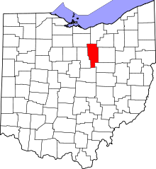 | |
| Villages | ||
| Townships | ||
| CDP | ||
| Unincorporated communities | ||
| Footnotes | ‡This populated place also has portions in an adjacent county or counties | |