Jesmond, New South Wales
| Jesmond Newcastle, New South Wales | |||||||||||||
|---|---|---|---|---|---|---|---|---|---|---|---|---|---|
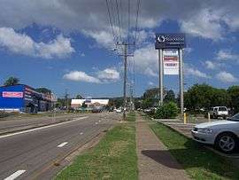 Blue Gum Road, Jesmond, viewing south, location of Stockland Jesmond Shopping Centre. | |||||||||||||
|
Jesmond | |||||||||||||
| Coordinates | 32°54′13″S 151°41′39″E / 32.90361°S 151.69417°ECoordinates: 32°54′13″S 151°41′39″E / 32.90361°S 151.69417°E | ||||||||||||
| Population | 2,441 (2006 census)[1] | ||||||||||||
| • Density | 1,877.7/km2 (4,863/sq mi) | ||||||||||||
| Postcode(s) | 2299 | ||||||||||||
| Area | 1.3 km2 (0.5 sq mi)[Note 1] | ||||||||||||
| Time zone | AEST (UTC+10) | ||||||||||||
| • Summer (DST) | AEDT (UTC+11) | ||||||||||||
| Location | |||||||||||||
| LGA(s) | City of Newcastle[2] | ||||||||||||
| Region | Hunter[2] | ||||||||||||
| County | Northumberland[3] | ||||||||||||
| Parish | Newcastle[3] | ||||||||||||
| State electorate(s) | Wallsend[4] | ||||||||||||
| Federal Division(s) | Newcastle[5] | ||||||||||||
| |||||||||||||
Jesmond is a suburb of the City of Newcastle LGA, located about 9.5 km (6 mi) west of the Newcastle CBD in the Hunter Region of New South Wales, Australia.[2][6] It is both a commercial centre and dormitory suburb of Newcastle. Residents include Australian and international students attending the University of Newcastle in adjacent Callaghan. The suburb also has numerous aged housing facilities. The suburb is very multicultural due to many international university students.[7] According to the 2006 Census there were 2,442 people in 1,144 dwellings (in 2001 there were 2376 people in 1140 dwellings).[7]
History
Originally known as "Dark Creek", Jesmond was the location of orchards and steam saw-mills. A village was established in the area by 1883 with around 600 residents. A soap works was established in the area in the 1880s.[7] There is some contradiction as to the source of "Jesmond" as the suburb's name with different sources attributing it to the Tyneside town in the North of England and "Jesmond Dene", a park in Jesmond.[3][8]
Schools
Jesmond has access to a number of schools including, Heaton Primary, Jesmond Primary and the Jesmond Campus of Callaghan College.[7]
Shopping and transport
Jesmond's commercial centre is situated on Blue Gum Road. There are a number of mixed businesses as well as a large shopping mall. The area serves Newcastle with a district centre function and as a transport junction with main roads in east-west and northern directions.[7]
Jesmond's Stockland Shopping Centre is on Blue Gum Road, approximately 9 km (6 mi) west-north-west of the Newcastle CBD. The centre includes major stores such as Woolworths and Big W, as well as 74 specialty stores. The centre has parking for over 900 cars.[9]
Recreation and sport
Jesmond Park and Heaton Park are Jesmond's two main public parks for sport events, complemented by the facilities at Callaghan Campus (Y11-Y12 only). Jesmond Park, situated with a bushland setting to its southern boundary, is a popular destination for family barbecues and wedding photography given its extensive rose garden.
Jesmond Football Club, "The Rams", are the local soccer team based at Jesmond Park. The club was founded in 1928 and has a long and proud history. Heaton Park also features an oval-shaped concrete skateboarding bowl.
Notes
- ↑ Area calculation is based on 1:100000 map 9232 NEWCASTLE
References
- ↑ Australian Bureau of Statistics (25 October 2007). "Jesmond (State Suburb)". 2006 Census QuickStats. Retrieved 4 April 2011. Map
- 1 2 3 "Suburb Search - Local Council Boundaries - Hunter (HT) - Newcastle City Council". New South Wales Division of Local Government. Retrieved 4 April 2011.
- 1 2 3 "Jesmond". Geographical Names Register (GNR) of NSW. Geographical Names Board of New South Wales. Retrieved 4 April 2011.
- ↑ "Wallsend". New South Wales Electoral Commission. 31 March 2011. Retrieved 4 April 2011.
- ↑ "Newcastle". Australian Electoral Commission. 15 June 2016. Retrieved 15 June 2016.
- ↑ "Jesmond". Land and Property Management Authority - Spatial Information eXchange. New South Wales Land and Property Information. Retrieved 4 April 2011.
- 1 2 3 4 5 "Jesmond". About Newcastle. Newcastle City Council. 1 April 2011. Retrieved 17 July 2011.
- ↑ "Hunter Valley Place Names and their Meanings". Newcastle City Council. Retrieved 4 April 2011.
- ↑ "Stockland Jesmond". Shopping Centres - NSW. Stockland. Retrieved 17 July 2011.