Kachemak, Alaska
| Kachemak | |
|---|---|
| City | |
 | |
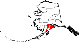
 Kachemak Location in Alaska | |
| Coordinates: 59°40′24″N 151°25′59″W / 59.67333°N 151.43306°WCoordinates: 59°40′24″N 151°25′59″W / 59.67333°N 151.43306°W | |
| Country | United States |
| State | Alaska |
| Borough | Kenai Peninsula |
| Incorporated | August 29, 1961[1] |
| Government | |
| • Mayor | William Overway[2] |
| • State senator | Gary Stevens (R) |
| • State rep. | Paul Seaton (R) |
| Area | |
| • Total | 1.6 sq mi (4.2 km2) |
| • Land | 1.6 sq mi (4.2 km2) |
| • Water | 0.0 sq mi (0.0 km2) |
| Elevation | 105 ft (32 m) |
| Population (2010) | |
| • Total | 472 |
| • Density | 295.0/sq mi (112.4/km2) |
| Time zone | Alaska (AKST) (UTC-9) |
| • Summer (DST) | AKDT (UTC-8) |
| Area code | 907 |
| FIPS code | 02-36550 |
| GNIS feature ID[3] | 1413247 |
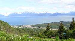
Kachemak, locally known as Kachemak City, is a small city in the southern portion of the Kenai Peninsula Borough, Alaska, United States.[3] The city consists of several subdivisions and other miscellaneous properties along an approximately 2-mile (3.2 km) stretch of East End Road, adjoining the northeast corner of the much larger (both in terms of area and population) city of Homer. The population was 431 at the 2000 census[4] and 472 as of the 2010 census.
Geography
Kachemak is located at 59°40′24″N 151°25′59″W / 59.67333°N 151.43306°W (59.673395, -151.433170).[5]
The city lies just east of Homer on the north side of Kachemak Bay in south central Alaska.
According to the United States Census Bureau, the city has a total area of 1.6 square miles (4.1 km2), all of it land.
Demographics
| Historical population | |||
|---|---|---|---|
| Census | Pop. | %± | |
| 1970 | 76 | — | |
| 1980 | 403 | 430.3% | |
| 1990 | 365 | −9.4% | |
| 2000 | 431 | 18.1% | |
| 2010 | 476 | 10.4% | |
| Est. 2015 | 487 | [6] | 2.3% |
As of the census of 2000,[4] there were 431 people, 169 households, and 107 families residing in the city. The population density was 268.0 people per square mile (103.4/km²). There were 219 housing units at an average density of 136.2 per square mile (52.5/km²). The racial makeup of the city was 87.47% White, 5.80% Native American, 0.93% Asian, 0.23% from other races, and 5.57% from two or more races. 1.62% of the population were Hispanic or Latino of any race.
There were 169 households out of which 29.6% had children under the age of 18 living with them, 55.0% were married couples living together, 6.5% had a female householder with no husband present, and 36.1% were non-families. 24.3% of all households were made up of individuals and 7.1% had someone living alone who was 65 years of age or older. The average household size was 2.52 and the average family size was 3.06.
In the city the age distribution of the population shows 23.9% under the age of 18, 8.1% from 18 to 24, 21.6% from 25 to 44, 33.9% from 45 to 64, and 12.5% who were 65 years of age or older. The median age was 43 years. For every 100 females there were 113.4 males. For every 100 females age 18 and over, there were 106.3 males.
The median income for a household in the city was $43,068, and the median income for a family was $44,432. Males had a median income of $31,667 versus $26,908 for females. The per capita income for the city was $21,030. About 1.8% of families and 5.9% of the population were below the poverty line, including none of those under age 18 and 6.9% of those age 65 or over.
Note that in the 2010 Census Kachemak city FIPS Place Code (PLACE) should be 36540; it is incorrectly shown as 36550.[8]
References
- ↑ 1996 Alaska Municipal Officials Directory. Juneau: Alaska Municipal League/Alaska Department of Community and Regional Affairs. January 1996. p. 72.
- ↑ 2015 Alaska Municipal Officials Directory. Juneau: Alaska Municipal League. 2015. p. 78.
- 1 2 "City of Kachemak". Geographic Names Information System. United States Geological Survey.
- 1 2 "American FactFinder". United States Census Bureau. Retrieved 2008-01-31.
- ↑ "US Gazetteer files: 2010, 2000, and 1990". United States Census Bureau. 2011-02-12. Retrieved 2011-04-23.
- ↑ "Annual Estimates of the Resident Population for Incorporated Places: April 1, 2010 to July 1, 2015". Retrieved July 2, 2016.
- ↑ "Census of Population and Housing". Census.gov. Retrieved June 4, 2015.
- ↑ 2010 Census Summary File 1, Geography Note 2., Retrieved 15-May-2014.