Kamiah, Idaho
| Kamiah, Idaho | |
|---|---|
| City | |
|
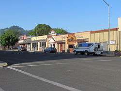
Main Street in May 2012 | |
 Location in Lewis County and the state of Idaho | |
| Coordinates: 46°13′37″N 116°1′40″W / 46.22694°N 116.02778°WCoordinates: 46°13′37″N 116°1′40″W / 46.22694°N 116.02778°W | |
| Country | United States |
| State | Idaho |
| Counties | Lewis (& Idaho) |
| Government | |
| • Mayor | Dale Schneider [1] |
| Area[2] | |
| • Total | 1.17 sq mi (3.0 km2) |
| • Land | 1.08 sq mi (2.8 km2) |
| • Water | 0.09 sq mi (0.2 km2) |
| Elevation | 1,240 ft (380 m) |
| Population (2010)[3] | |
| • Total | 1,295 |
| • Estimate (2012[4]) | 1,316 |
| • Density | 1,199.1/sq mi (463.0/km2) |
| Time zone | Pacific (PST) (UTC-8) |
| • Summer (DST) | PDT (UTC-7) |
| ZIP code | 83536 |
| Area code(s) | 208 |
| FIPS code | 16-42400 |
| GNIS feature ID | 0396726 |
| Website | kamiahchamber.com |
| Historical population | |||
|---|---|---|---|
| Census | Pop. | %± | |
| 1910 | 324 | — | |
| 1920 | 653 | 101.5% | |
| 1930 | 487 | −25.4% | |
| 1940 | 568 | 16.6% | |
| 1950 | 812 | 43.0% | |
| 1960 | 1,245 | 53.3% | |
| 1970 | 1,307 | 5.0% | |
| 1980 | 1,478 | 13.1% | |
| 1990 | 1,157 | −21.7% | |
| 2000 | 1,160 | 0.3% | |
| 2010 | 1,295 | 11.6% | |
| Est. 2015 | 1,273 | [5] | −1.7% |
Kamiah (![]() i/ˈkæmi.aɪ/ KAM-ee-eye) is a city in Idaho and Lewis counties in the U.S. state of Idaho. The largest city in Lewis County, it extends only a small distance into Idaho County, south of Lawyer Creek. The population was 1,295 at the 2010 census, up from 1,160 in 2000. The city lies in the narrow valley of the Clearwater River; downstream are Orofino and Lewiston, at the confluence with the Snake River.
i/ˈkæmi.aɪ/ KAM-ee-eye) is a city in Idaho and Lewis counties in the U.S. state of Idaho. The largest city in Lewis County, it extends only a small distance into Idaho County, south of Lawyer Creek. The population was 1,295 at the 2010 census, up from 1,160 in 2000. The city lies in the narrow valley of the Clearwater River; downstream are Orofino and Lewiston, at the confluence with the Snake River.
History
The Kamiah area has been inhabited by the Nez Perce for centuries.[7][8] The name "Kamiah" is Nez Perce for "many rope litters," as Nez Perce manufactured "Kamia" ropes in the area to fish steelhead. Also according to Nez Perce tradition, the Appaloosa horse was first bred in the area.
On their return trip east, the Lewis and Clark Expedition camped in the Kamiah area for several weeks during the spring of 1806, waiting for snows to melt.[9][10]
Kamiah is the character name of the Nez Perce/Blackfoot woman in Across the Wide Missouri, a 1951 'mountain men' film set in the 1830s. Similar in fame to Sacagawea of the Lewis & Clark expedition, Kamiah led her associated mountain men's troop over the Bitterroot Range to her homeland (Three Forks, Montana for Sacagawea).
Hohots Ilppilp was the leader around Kamiah from at least the time of Lewis and Clark until the 1840s. When the first leader for all the Nez Perce was appointed, it was Hohots Ilppilp's grandson Ellis who lived in this area and maintained large herds of sheep, cattle and over a thousand horses.[11]
Kamiah is within the Nez Perce Indian Reservation.[12] Similar to the opening of lands in Oklahoma, the U.S. government opened the reservation for white settlement 121 years ago in November 1895. The proclamation had been signed less than two weeks earlier by President Cleveland.[13][14][15][16]
Geography
Kamiah is located at 46°13′37″N 116°1′40″W / 46.22694°N 116.02778°W (46.226811, -116.027728),[17] at an elevation of 1,240 feet (378 m) above sea level.
According to the United States Census Bureau, the city has a total area of 1.17 square miles (3.03 km2), of which 1.08 square miles (2.80 km2) is land and 0.09 square miles (0.23 km2) is water.[2]
Climate
According to the Köppen climate classification system, Kamiah has a hot-summer continental climate (Köppen Dfa).
| Climate data for Kamiah (1913-2012) | |||||||||||||
|---|---|---|---|---|---|---|---|---|---|---|---|---|---|
| Month | Jan | Feb | Mar | Apr | May | Jun | Jul | Aug | Sep | Oct | Nov | Dec | Year |
| Record high °F (°C) | 59 (15) |
66 (19) |
81 (27) |
88 (31) |
98 (37) |
104 (40) |
107 (42) |
110 (43) |
103 (39) |
89 (32) |
72 (22) |
58 (14) |
110 (43) |
| Average high °F (°C) | 39 (4) |
47.7 (8.7) |
55.3 (12.9) |
64.1 (17.8) |
72.9 (22.7) |
79.3 (26.3) |
93.2 (34) |
91.6 (33.1) |
81.2 (27.3) |
62.5 (16.9) |
45.6 (7.6) |
36.1 (2.3) |
64 (18) |
| Average low °F (°C) | 26.4 (−3.1) |
27.7 (−2.4) |
31.4 (−0.3) |
35.9 (2.2) |
41.4 (5.2) |
48.9 (9.4) |
53.6 (12) |
51.3 (10.7) |
45.1 (7.3) |
37 (3) |
31.2 (−0.4) |
24.7 (−4.1) |
37.9 (3.3) |
| Record low °F (°C) | −5 (−21) |
2 (−17) |
10 (−12) |
22 (−6) |
27 (−3) |
32 (0) |
38 (3) |
36 (2) |
26 (−3) |
12 (−11) |
4 (−16) |
−3 (−19) |
−5 (−21) |
| Average precipitation inches (mm) | 2.1 (53) |
1.64 (41.7) |
2.17 (55.1) |
2.45 (62.2) |
2.49 (63.2) |
2.36 (59.9) |
0.82 (20.8) |
0.9 (23) |
1.33 (33.8) |
1.94 (49.3) |
2.41 (61.2) |
2.04 (51.8) |
22.63 (574.8) |
| Average snowfall inches (cm) | 6.1 (15.5) |
1.9 (4.8) |
0.9 (2.3) |
0.1 (0.3) |
0 (0) |
0 (0) |
0 (0) |
0 (0) |
0 (0) |
0 (0) |
0.9 (2.3) |
5.4 (13.7) |
15.3 (38.9) |
| Average precipitation days | 12 | 10 | 12 | 12 | 11 | 10 | 4 | 5 | 6 | 9 | 13 | 12 | 116 |
| Source: WRCC[18] | |||||||||||||
Demographics
2010 census
As of the census[3] of 2010, there were 1,295 people, 596 households, and 325 families residing in the city. The population density was 1,199.1 inhabitants per square mile (463.0/km2). There were 642 housing units at an average density of 594.4 per square mile (229.5/km2). The racial makeup of the city was 82.2% White, 0.4% African American, 8.9% Native American, 0.7% Asian, 0.3% Pacific Islander, 3.7% from other races, and 3.9% from two or more races. Hispanic or Latino of any race were 5.5% of the population.
There were 596 households of which 25.0% had children under the age of 18 living with them, 39.1% were married couples living together, 9.6% had a female householder with no husband present, 5.9% had a male householder with no wife present, and 45.5% were non-families. 39.9% of all households were made up of individuals and 22.1% had someone living alone who was 65 years of age or older. The average household size was 2.17 and the average family size was 2.91.
The median age in the city was 45.7 years. 23.9% of residents were under the age of 18; 5.7% were between the ages of 18 and 24; 19.7% were from 25 to 44; 26.7% were from 45 to 64; and 24% were 65 years of age or older. The gender makeup of the city was 48.3% male and 51.7% female.
2000 census
As of the census[19] of 2000, there were 1,160 people, 531 households, and 302 families residing in the city. The population density was 1,050.8 people per square mile (407.2/km²). There were 607 housing units at an average density of 549.8 per square mile (213.1/km²). The racial makeup of the city was 88.88% White, 0.26% African American, 8.02% Native American, 0.34% Asian, 0.09% Pacific Islander, 1.47% from other races, and 0.95% from two or more races. Hispanic or Latino of any race were 4.14% of the population.
There were 531 households out of which 22.2% had children under the age of 18 living with them, 44.6% were married couples living together, 9.2% had a female householder with no husband present, and 43.1% were non-families. 38.4% of all households were made up of individuals and 23.5% had someone living alone who was 65 years of age or older. The average household size was 2.17 and the average family size was 2.87.
In the city the population was spread out with 24.0% under the age of 18, 6.0% from 18 to 24, 20.9% from 25 to 44, 26.1% from 45 to 64, and 23.0% who were 65 years of age or older. The median age was 44 years. For every 100 females there were 88.0 males. For every 100 females age 18 and over, there were 83.8 males.
The median income for a household in the city was $21,793, and the median income for a family was $33,424. Males had a median income of $25,982 versus $19,688 for females. The per capita income for the city was $14,111. About 12.5% of families and 18.5% of the population were below the poverty line, including 22.6% of those under age 18 and 12.2% of those age 65 or over.
Economy
The city's largest employer was the Three Rivers Timber sawmill, which employed 108 before its closure in late 2008.[20][21] After nearly two years, the mill was sold and restarted in August 2010 as Blue North Forest Products.[22][23][24]
Notable people
- Chief Lawyer, Nez Perce leader, is buried at Nikesa Cemetery in East Kamiah
- Ken Hobart, former CFL quarterback, graduated from Kamiah High School in 1979
References
- ↑ Idaho Transportation Dept. - Council approves CV Aero Club contract - 2011-01-21
- 1 2 "US Gazetteer files 2010". United States Census Bureau. Retrieved 2012-12-18.
- 1 2 "American FactFinder". United States Census Bureau. Retrieved 2012-12-18.
- ↑ "Population Estimates". United States Census Bureau. Retrieved 2013-06-03.
- ↑ "Annual Estimates of the Resident Population for Incorporated Places: April 1, 2010 to July 1, 2015". Retrieved July 2, 2016.
- ↑ "Census of Population and Housing". Census.gov. Retrieved June 4, 2015.
- ↑ "Kamiah holds place in history as center of Nez Perce activities". Lewiston Morning Tribune. Idaho. October 6, 1955. p. 6-LCSE.
- ↑ "There is usually a logical reason for the name a town ends up with". Lewiston Morning Tribune. Idaho. February 25, 1990. p. 11-Centennial.
- ↑ Ruark, Janice (November 19, 1976). "Kamiah historic camp of famed Lewis, Clark". Spokane Daily Chronicle. Washington. p. 3.
- ↑ Kamiah ID Chamber of Commerce Accessed 3 February 2008
- ↑ Alvin M. Josephy, The Nez Perce and the Opening of the Northwest, p. 223
- ↑ "The Nez Perce Reservation with a Map Insert of Idaho" (PDF). Nez Perce Tribe. Geographic Information Systems. Retrieved April 6, 2016.
- ↑ Hamilton, Ladd (June 25, 1961). "Heads were popping up all over the place". Lewiston Morning Tribune. Idaho. p. 14.
- ↑ Brammer, Rhonda (July 24, 1977). "Unruly mobs dashed to grab land when reservation opened". Lewiston Morning Tribune. Idaho. p. 6E.
- ↑ "3,000 took part in "sneak" when Nez Perce Reservation was opened". Lewiston Morning Tribune. Idaho. November 19, 1931. p. 3.
- ↑ "Nez Perce Reservation". Spokesman-Review. December 11, 1921. p. 5.
- ↑ "US Gazetteer files: 2010, 2000, and 1990". United States Census Bureau. 2011-02-12. Retrieved 2011-04-23.
- ↑ "KAMIAH, ID (104793)". Western Regional Climate Center. Retrieved November 26, 2015.
- ↑ "American FactFinder". United States Census Bureau. Retrieved 2008-01-31.
- ↑ Spokesman-Review - Former millworkers scratch for jobs - 2009-10-25
- ↑ All Business.com - Proposed mill sale could bring jobs to Kamiah - 2010-06-16
- ↑ Idaho Commerce Dept. - Kamiah mill sells, will reopen in August and hopes to hire 60 employees - 2010-06-24
- ↑ koze950.com - Sawmill operations restart at former Three Rivers Mill near Kamiah - 2010-08-31
- ↑ Idaho Labor Dept. - Lewis County - 2010 - accessed 2012-02-21
External links
Municipalities and communities of Lewis County, Idaho, United States | ||
|---|---|---|
| Cities | ||
| Unincorporated community | ||
| Footnotes | ‡This populated place also has portions in an adjacent county or counties | |
Municipalities and communities of Idaho County, Idaho, United States | ||
|---|---|---|
| Cities | ||
| CDP | ||
| Unincorporated communities | ||
| Ghost towns | ||
| Footnotes | ‡This populated place also has portions in an adjacent county or counties | |