Riggins, Idaho
| Riggins, Idaho | |
|---|---|
| City | |
| Motto: "Idaho's Whitewater Capital"[1] | |
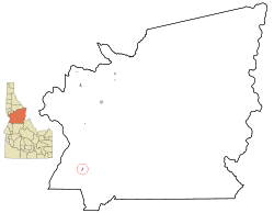 Location in Idaho County and the state of Idaho | |
| Coordinates: 45°25′20″N 116°18′57″W / 45.42222°N 116.31583°WCoordinates: 45°25′20″N 116°18′57″W / 45.42222°N 116.31583°W | |
| Country | United States |
| State | Idaho |
| County | Idaho |
| Area[2] | |
| • Total | 0.45 sq mi (1.17 km2) |
| • Land | 0.43 sq mi (1.11 km2) |
| • Water | 0.02 sq mi (0.05 km2) |
| Elevation | 1,821 ft (555 m) |
| Population (2010)[3] | |
| • Total | 419 |
| • Estimate (2012[4]) | 419 |
| • Density | 974.4/sq mi (376.2/km2) |
| Time zone | Mountain (UTC-7) |
| • Summer (DST) | Mountain (UTC-6) |
| ZIP code | 83549 |
| Area code(s) | 208 |
| FIPS code | 16-67870 |
| GNIS feature ID | 0389360 |
| Website | Riggins Idaho Camber of Commerce Website |

| Historical population | |||
|---|---|---|---|
| Census | Pop. | %± | |
| 1950 | 287 | — | |
| 1960 | 588 | 104.9% | |
| 1970 | 533 | −9.4% | |
| 1980 | 527 | −1.1% | |
| 1990 | 443 | −15.9% | |
| 2000 | 410 | −7.4% | |
| 2010 | 419 | 2.2% | |
| Est. 2015 | 418 | [5] | −0.2% |
Riggins is a city in Idaho County, Idaho, United States. It is nestled deep in a canyon at the confluence of the Salmon River and the Little Salmon River in west central Idaho, approximately 150 highway miles (240 km) north of Boise, and 120 highway miles (190 km) south-southeast of Lewiston. The elevation of Riggins is 1,821 feet (555 m) above sea level, and the population was 419 at the 2010 census. US-95, the only highway for the state connecting the Panhandle to the south, runs through Riggins as Main Street. Along this route, Riggins is the northwesternmost town in the Mountain time zone. The Pacific time zone begins just north of Riggins, upon crossing the Salmon River.
History
Riggins was named for Richard L. Riggins, local businessman and postmaster.[7] Riggins was named for Richard Riggins' father, Fred Riggins, who carried the mail to the area for years.
Geography
Riggins is located at 45°25′20″N 116°18′57″W / 45.42222°N 116.31583°W (45.422125, -116.315848).[8]
According to the United States Census Bureau, the city has a total area of 0.45 square miles (1.17 km2), of which, 0.43 square miles (1.11 km2) is land and 0.02 square miles (0.05 km2) is water.[2]
Climate
According to the Köppen climate classification system, Riggins qualifies as having a humid subtropical climate (Köppen Cfa), a climate type quite untypical for the region. However, due to cold winter months, Riggins's climate nearly qualifies as a dry, hot summer humid continental climate (Köppen Dsa).
| Climate data for Riggins (1896-2012) | |||||||||||||
|---|---|---|---|---|---|---|---|---|---|---|---|---|---|
| Month | Jan | Feb | Mar | Apr | May | Jun | Jul | Aug | Sep | Oct | Nov | Dec | Year |
| Record high °F (°C) | 64 (18) |
72 (22) |
83 (28) |
95 (35) |
103 (39) |
108 (42) |
113 (45) |
115 (46) |
110 (43) |
95 (35) |
80 (27) |
69 (21) |
115 (46) |
| Average high °F (°C) | 41.8 (5.4) |
48.9 (9.4) |
56.5 (13.6) |
65.3 (18.5) |
73.4 (23) |
80.8 (27.1) |
92.2 (33.4) |
91.7 (33.2) |
80.9 (27.2) |
66.9 (19.4) |
51.2 (10.7) |
42.5 (5.8) |
66 (19) |
| Average low °F (°C) | 27.8 (−2.3) |
30.6 (−0.8) |
34.2 (1.2) |
39.1 (3.9) |
45.3 (7.4) |
51.5 (10.8) |
57.5 (14.2) |
56.9 (13.8) |
49.6 (9.8) |
41.1 (5.1) |
34.3 (1.3) |
29.1 (−1.6) |
41.4 (5.2) |
| Record low °F (°C) | −10 (−23) |
−12 (−24) |
3 (−16) |
18 (−8) |
25 (−4) |
22 (−6) |
36 (2) |
36 (2) |
20 (−7) |
16 (−9) |
−13 (−25) |
−8 (−22) |
−13 (−25) |
| Average precipitation inches (mm) | 1.12 (28.4) |
1.13 (28.7) |
1.61 (40.9) |
1.68 (42.7) |
2.12 (53.8) |
1.83 (46.5) |
0.72 (18.3) |
0.74 (18.8) |
1.07 (27.2) |
1.29 (32.8) |
1.39 (35.3) |
1.33 (33.8) |
16.04 (407.4) |
| Average snowfall inches (cm) | 2.8 (7.1) |
1.6 (4.1) |
0.7 (1.8) |
0.1 (0.3) |
0 (0) |
0 (0) |
0 (0) |
0 (0) |
0 (0) |
0 (0) |
0.4 (1) |
2.2 (5.6) |
7.9 (20.1) |
| Average precipitation days | 8 | 8 | 10 | 10 | 10 | 9 | 4 | 4 | 5 | 7 | 9 | 9 | 93 |
| Source: WRCC[9] | |||||||||||||
Demographics
2010 census
As of the census[3] of 2010, there were 419 people, 239 households, and 116 families residing in the city. The population density was 974.4 inhabitants per square mile (376.2/km2). There were 306 housing units at an average density of 711.6 per square mile (274.8/km2). The racial makeup of the city was 96.9% White, 0.7% Native American, 1.4% from other races, and 1.0% from two or more races. Hispanic or Latino of any race were 1.7% of the population.
There were 239 households of which 13.8% had children under the age of 18 living with them, 34.3% were married couples living together, 9.6% had a female householder with no husband present, 4.6% had a male householder with no wife present, and 51.5% were non-families. 46.0% of all households were made up of individuals and 19.6% had someone living alone who was 65 years of age or older. The average household size was 1.75 and the average family size was 2.33.
The median age in the city was 53.3 years. 12.6% of residents were under the age of 18; 6.2% were between the ages of 18 and 24; 16.8% were from 25 to 44; 35.4% were from 45 to 64; and 29.1% were 65 years of age or older. The gender makeup of the city was 51.1% male and 48.9% female.
2000 census
As of the census[10] of 2000, there were 410 people, 204 households, and 111 families residing in the city. The population density was 1,361.3 people per square mile (527.7/km²). There were 253 housing units at an average density of 840.0 per square mile (325.6/km²). The racial makeup of the city was 98.29% White, 0.49% Native American, 0.24% from other races, and 0.98% from two or more races.
There were 204 households out of which 15.7% had children under the age of 18 living with them, 45.1% were married couples living together, 6.9% had a female householder with no husband present, and 45.1% were non-families. 39.2% of all households were made up of individuals and 23.5% had someone living alone who was 65 years of age or older. The average household size was 2.01 and the average family size was 2.64.
In the city the population was spread out with 17.6% under the age of 18, 3.2% from 18 to 24, 18.5% from 25 to 44, 33.2% from 45 to 64, and 27.6% who were 65 years of age or older. The median age was 52 years. For every 100 females there were 100.0 males. For every 100 females age 18 and over, there were 101.2 males.
The median income for a household in the city was $20,972, and the median income for a family was $30,000. Males had a median income of $27,361 versus $16,250 for females. The per capita income for the city was $17,330. About 19.2% of families and 25.3% of the population were below the poverty line, including 50.0% of those under age 18 and 9.5% of those age 65 or over.
Arts and culture
The Riggins Rodeo in early May can be viewed from the grandstands or from the hillside overlooking the arena.
Parks and recreation
Riggins is a hub for outdoor adventures in North Central Idaho. Rafting, kayaking, fishing, and hunting are available and campgrounds surround the area, allowing access to view the scenery and wildlife. Visitors can pan for gold in the river gravel, and guides and outfitters can provide assistance.
The Seven Devils Mountains and the Hells Canyon National Recreation Area are just a few miles southwest of town.
Notable people
Comedian Dan Cummins grew up in Riggins.[11]
References
- ↑ "Riggins Chamber of Commerce". Riggins Chamber of Commerce. Retrieved September 2, 2012.
- 1 2 "US Gazetteer files 2010". United States Census Bureau. Archived from the original on January 24, 2012. Retrieved 2012-12-18.
- 1 2 "American FactFinder". United States Census Bureau. Retrieved 2012-12-18.
- ↑ "Population Estimates". United States Census Bureau. Archived from the original on June 17, 2013. Retrieved 2013-06-03.
- ↑ "Annual Estimates of the Resident Population for Incorporated Places: April 1, 2010 to July 1, 2015". Retrieved July 2, 2016.
- ↑ "Census of Population and Housing". Census.gov. Archived from the original on May 11, 2015. Retrieved June 4, 2015.
- ↑ "Profile for Riggins, Idaho, ID". ePodunk. Retrieved September 2, 2012.
- ↑ "US Gazetteer files: 2010, 2000, and 1990". United States Census Bureau. 2011-02-12. Retrieved 2011-04-23.
- ↑ "RIGGINS, ID (107706)". Western Regional Climate Center. Retrieved November 26, 2015.
- ↑ "American FactFinder". United States Census Bureau. Archived from the original on September 11, 2013. Retrieved 2008-01-31.
- ↑ "The Adam Carolla Show - Dan Cummins, 50 minute mark". The Adam Carolla Show (podcast). 14 March 2011. Retrieved 7 April 2011.
External links
| Wikimedia Commons has media related to Riggins, Idaho. |
- City of Riggins City Council, Economic Development, Community Events
- Idaho Department of Commerce profile
- North Central Idaho Travel Information
- Public Lands Map
- Rapid River Fish Hatchery
- Salmon River Chamber of Commerce Portal style website, Government, Business, Library, Recreation and more
- Salmon River Joint School District 243 Local schools, Employment Opportunities, Academics, Athletics, Community Information and more
- Riggins EMS services Pre-hospital Medical Care, Training Opportunities, Contact Information
- City-Data.com Comprehensive Statistical Data and more about Riggins
Municipalities and communities of Idaho County, Idaho, United States | ||
|---|---|---|
| Cities | ||
| CDP | ||
| Unincorporated communities | ||
| Ghost towns | ||
| Footnotes | ‡This populated place also has portions in an adjacent county or counties | |