Kangra district
| Kangra काँगड़ा ཀངྒརཱ | |
|---|---|
| District | |
 | |
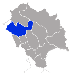 Location in Himachal Pradesh, India | |
 Kangra Location of the district headquarters in India | |
| Coordinates: 32°13′0″N 76°19′0″E / 32.21667°N 76.31667°ECoordinates: 32°13′0″N 76°19′0″E / 32.21667°N 76.31667°E | |
| Country |
|
| State | Himachal Pradesh |
| Talukas | |
| Headquarters | Dharamshala |
| Government | |
| • Divisonal Commissioner | Ms Nandita Gupta,IAS |
| • Superintendent of Police | DILJEET THAKUR, IPS |
| Area | |
| • Total | 5,739 km2 (2,216 sq mi) |
| Population (2011) | |
| • Total | 1,507,223 |
| • Density | 263/km2 (680/sq mi) |
| Languages | |
| • Official | Hindi |
| Time zone | IST (UTC+5:30) |
| PIN | 176xxx |
| Telephone | 91 1892 xxxxxx |
| Largest city | Dharamsala |
| Gender ratio | 1013 females/1000 males |
| Literacy rate | 86.49% |
| Lok Sabha Constituency | Kangra |
| Vidhan Sabha Constituencies |
|
| Climate | ETh (Köppen) |
| Avg. summer temperature | 32 °C (90 °F) |
| Avg. winter temperature | 20 °C (68 °F) |
| Website |
hpkangra |
Kangra is the most populous[1] district of the Indian state of Himachal Pradesh, India. Dharamshala is the administrative headquarters of the district. It is home of Masroor Rock Cut Temple, also known as Himalayan Pyramids and wonder of the world for being likely contender for the UNESCO World Heritage Site.
History
Kangra is known for having the oldest serving Royal Dynasty in the world Katoch. Kangra became a district of British India in 1846, when it was ceded to British India at the conclusion of the First Anglo-Sikh War. The British district included the present-day districts of Kangra, Hamirpur, Kullu, and Lahul and Spiti. Kangra District was part of the British province of Punjab. The administrative headquarters of the district were initially at Kangra, but were moved to Dharamshala in 1855.[2][3]
Geography
The Kangra District of Himachal Pradesh is situated in the Western Himalayas between 31°2 to 32°5 N and 75° to 77°45 E. The district has a geographical area of 5,739 km. which constitutes 10.31% of the geographical area of the State. According to 2001 census, the total population of the district was 1,339,030, which is the highest in the state (22.50% of the population). The altitude of the district ranges from 427 to 6401m above mean sea level, with the lowest being in the plains areas bordering Gurdaspur district of Punjab in the west and Una and Hamirpur districts of H.P to the south while the highest being amidst the Dhauladhar mountain range which forms the border with Chamba and Kullu districts. The district has considerable diversity in its soils, physiography, land use patterns and cropping systems. On the basis of these, the district has further been divided into five sub-regions i.e. Pir Panjal, Dhauladhar, Kangra Shiwalik, Kangra Valley and Beas Basin.
The Beas is one of the major rivers of this district and contributes to the fertility of the land here. The district is bounded by the Himachal Pradesh district of Chamba and Lahaul valley of the Lahaul and Spiti district to the north, Kullu to the east, Mandi to the south-east, and Hamirpur and Una to the south. The district shares a border with the states of Punjab to the west. Due to the hilly terrain, not very much of the land is cultivated. The region is covered with uniform patches of barren land, as well as small forests.
Dharamshala, the district headquarters, is also the headquarters of the Tibetan government-in-exile, headed by the His Holiness the Dalai Lama. Jwalamukhi, also known as Jwala ji, is famous for its ancient temple of the goddess of the same name, and features holy flames that run on natural gas. Other important temples include Brajeshwari Devi temple, Chamunda Devi temple, Chintpurni temple, Bhagsunag Temple in McLeodGanj, Mahakal and Baijnath's Shiva temple in Baijnath. There are also important,major Muslim worship Place In kangra district Jama Masjid Dharamshala, Buddhist temples in Dharamshala, Sidhbari and the Bir Tibetan Colony in Bir. Historical villages of Pragpur and Garli are also located here.
Climate
The topography of Kangra District is varied, with elevations ranging from 400m altitude at Milawan to 5500m at Bara Bhangal. The Indora block of Kangra District lies in a semi-humid, sub-tropical zone where annual precipitation averages approximately 1000mm with a mean temperature of about 24 °C, Dehragopipur and Nurpur blocks lies in a humid, sub-tropical zone where the annual rainfall is between 900–2350mm and mean temperature ranging between 2° and 24 °C. Palampur and Dharamsala lie in a wet, temperate zone where the temperature ranges from 15 to 19 °C and annual rainfall is about 2500mm, making Dharamsala the wettest place in Himachal Pradesh. (avg. of the last fifty five years). Other parts of the Kangra district lie in hill areas where the mean annual temperature varies from 13 to 20 °C and annual rainfall is 1800– 3000mm.
The winter lasts from mid-October to March, during which the temperature ranges from 0 to 20 °C. The winds cause winter rains. Summers last from April until June, and are hot (temp 25 to 38 °C) and dry. They are generally followed by a wet monsoon which ends in autumn.The climate in the region is cool and soothing, especially near the Chamundaji sub-region, due to the presence of many pine tree forests. Due to deforestation in the name of development, however, the clean and serene environment of the region may be threatened.
| Climate data for Dharamshala | |||||||||||||
|---|---|---|---|---|---|---|---|---|---|---|---|---|---|
| Month | Jan | Feb | Mar | Apr | May | Jun | Jul | Aug | Sep | Oct | Nov | Dec | Year |
| Average high °C (°F) | 13.5 (56.3) |
17.8 (64) |
21.6 (70.9) |
26.9 (80.4) |
29.1 (84.4) |
30.5 (86.9) |
27.2 (81) |
26.1 (79) |
24.6 (76.3) |
23.7 (74.7) |
19.8 (67.6) |
16.4 (61.5) |
23.1 (73.6) |
| Average low °C (°F) | 5.1 (41.2) |
10.3 (50.5) |
14.7 (58.5) |
16.3 (61.3) |
20.1 (68.2) |
22.9 (73.2) |
21.4 (70.5) |
20.2 (68.4) |
17.5 (63.5) |
14.8 (58.6) |
10.7 (51.3) |
7.4 (45.3) |
15.1 (59.2) |
| Average precipitation mm (inches) | 114.5 (4.508) |
100.7 (3.965) |
98.8 (3.89) |
48.6 (1.913) |
59.1 (2.327) |
202.7 (7.98) |
959.7 (37.783) |
909.2 (35.795) |
404.8 (15.937) |
66.3 (2.61) |
16.7 (0.657) |
54.0 (2.126) |
3,054.4 (120.252) |
Demographics
According to the 2011 census Kangra district has a population of 1,507,223,[1] roughly equal to the nation of Gabon[4] or the US state of Hawaii.[5] This gives it a ranking of 331st in India (out of a total of 640).[1] The district has a population density of 263 inhabitants per square kilometre (680/sq mi) .[1] Its population growth rate over the decade 2001-2011 was 12.56%.[1] Kangra has a sex ratio of 1013 females for every 1000 males,[1] and a literacy rate of 86.49%.[1]
The native people are the Kangri people and the native language is Kangri, which is very similar to Punjabi. The majority of the people are Hindu Brahmins, Rajputs, Banias and SC/OBC, although many Tibetans and others who follow Buddhism have also settled here recently. There are also minority populations of Sikhs, Muslims, and Christians.
The traditional dress for men was the kurta, pyjamas, and a woolen jacket used in winter. Women generally wear the salwar kameez and with the salwar Kameez girls and women take chuenni ("Chaddru" in local language.)
General information
- Sub divisions in Kangra: Kangra, Palampur, Dharamshala, Nurpur, Dehra Gopipur, Baijnath, Jwali and Jaisinghpur,Nagrota Bagwan,Shahpur.
- Tehsils in Kangra: Nurpur, Nagrota, Indora, Jwali, Kangra, Palampur, Badoh, Kasba Kotla, Jaswan, Dehra Gopipur, Khundiyan, Jaisinghpur, Baijnath, Fatehpur, Dharamshala and Shahpur.
- Sub-Tehsils in Kangra: Harchakkian, Dhira, Rakkad, Thural, Nagrota Surian, Kotla, Gangath and Multhan.
Economy
The Economy of Kangra District consists mostly of agriculture and farming. Tea cultivation plays a vital in the economy. "Kangra Tea" is famous worldwide for its rich aroma, colour and taste. A few other industries that have been established in the region, including water packaging, construction materials, and potato chips.
The areas of Palampur and Baijnath are surrounded by lush, green tea estates. Tourism is also an important part of the economy, with Bir in particular becoming a strong hub for ecotourism and aerosports.
This area was significantly damaged by an earthquake on April 4, 1905.
Upon Indian Independence in 1947, Punjab province was partitioned between India and Pakistan, and the eastern portion, including Kangra, became the Indian state of Punjab. Lahul and Spiti became a separate district in 1960, and Kullu in 1962. In 1966, Kangra and Una districts were added to Himachal Pradesh, which became a Union territory of India, and an Indian state in 1971. Hamirpur District was separated from Kangra in 1972. The twin township and riyasat of Haripur-Guler is also an important part of Kangra District that gave refuge to people during the Mughal period and offered patronage to them to make the famous Guler style paintings. The village of Pragpur is also one of the most important historical parts of Kangra region.
Masroor Rock Cut Temple

Within the Masroor Rock Cut Temple complex, there are 15 rock-cut temples in Indo-Aryan style and are richly carved. It is a unique monolithic structure in the sub-Himalayan region.
The main shrine contains three stone images of Rama, Lakshmana and Sita. The temple complex is located on a hill and also has a large rectangular water pond. The temple complex is believed to be built by the Pandava during their exile, exact date is not known. As per records ancient name of the city Kangra was Bhimnagar founded by Bhima one of the Pandava brothers.
See also
Notes and references
- 1 2 3 4 5 6 7 "District Census 2011". Census2011.co.in. 2011. Retrieved 2011-09-30.
- ↑ Kangra District The Imperial Gazetteer of India, v. 14, p. 380. .
- ↑ Dharamshala The Imperial Gazetteer of India, v. 11, p. 301.
- ↑ US Directorate of Intelligence. "Country Comparison:Population". Retrieved 2011-10-01.
Gabon
1,576,665 - ↑ "2010 Resident Population Data". U. S. Census Bureau. Retrieved 2011-09-30.
Hawaii
1,360,301
Further reading
- Hutchinson, J. & J. PH Vogel (1933). History of the Panjab Hill States, Vol. I. 1st edition: Govt. Printing, Pujab, Lahore, 1933. Reprint 2000. Department of Language and Culture, Himachal Pradesh. Chapter V Kangra State, pp. 99–198.
External links
| Wikimedia Commons has media related to Kangra. |
 |
Gurdaspur district, Punjab | Chamba district | Lahaul and Spiti district | |
| |
Kullu district | |||
| ||||
| | ||||
| Hoshiarpur district, Punjab | Una district | Mandi district Hamirpur district |
