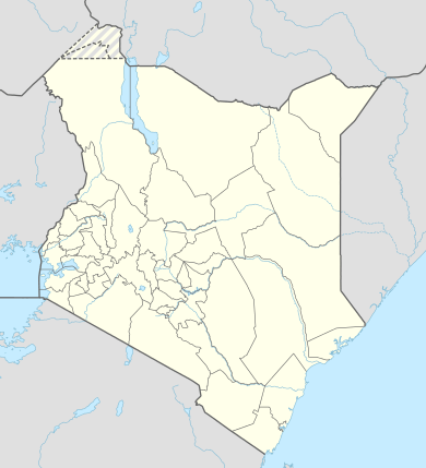
Kangundo
| Kangundo | |
|---|---|
| Town Council | |
 Kangundo Location of Kangundo-Tala | |
| Coordinates: 1°21′S 37°22′E / 1.35°S 37.37°ECoordinates: 1°21′S 37°22′E / 1.35°S 37.37°E | |
| Country |
|
| County | Machakos County |
| Elevation | 1,544 m (5,068 ft) |
| Population (2009) | |
| • Metro | 218,557[1] |
| Time zone | EAT (UTC+3) |
| Climate | Cwb |
Kangundo is a town in Kenya's Machakos County in the lower eastern region of Kenya. It is usually classified as being one town with Tala, due to their close proximity.
Kangundo-Tala
Officially Kangundo-Tala's population is the 9th largest of any urban area in Kenya. Tala is part of Kangundo town council.[2]
Towns in Machakos County
| Town | Population (2009) | Rank in Kenya (Population Size) |
|---|---|---|
| Kangundo-Tala | 218,557 | 9 |
| Machakos | 150,041 | 13 |
| Athi River | 139,380 | 15 |
| Kathiani | 3,365 | 195 |
| Masii | 2,501 | 211 |
* 2009 census. Source:[1]
Nairobi Metro
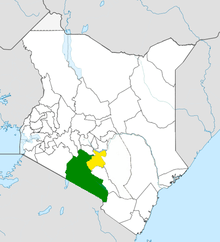
Machakos County (yellow) within Nairobi Metro (green)
Machakos County is within Greater Nairobi which consists of 4 out of 47 counties in Kenya but the area generates about 60% of the nations wealth.[3][4] The counties are:
| Area | County | Area (km2) | Population Census 2009 | Cities/Towns/Municipalities in the Counties |
|---|---|---|---|---|
| Core Nairobi | Nairobi County | 694.9 | 3,138,369 | Nairobi |
| Northern Metro | Kiambu County | 2,449.2 | 1,623,282 | Kiambu, Thika, Limuru, Ruiru, Karuri, Kikuyu |
| Southern Metro | Kajiado County | 21,292.7 | 687,312 | Kajiado, Olkejuado, Bissil, Ngong, Kitengela, Kiserian, Ongata Rongai |
| Eastern Metro | Machakos County | 5,952.9 | 1,098,584 | Kangundo-Tala, Machakos, Athi River |
| Totals | Nairobi Metro | 30,389.7 | 6,547,547 |
Source: NairobiMetro/ Kenya Census
See also
References
- 1 2 https://www.opendata.go.ke/Population/2009-Census-Vol-1-Table-3-Rural-and-Urban-Populati/e7c7-w67t/1
- ↑ Electoral Commission of Kenya: Registration centres by electoral area and constituency
- ↑ http://196.200.27.243:8080/xmlui/bitstream/handle/123456789/111/Nairobi.pdf?sequence=3
- ↑ http://www.nairobimetro.go.ke/index.php?option=com_docman&task=doc_download&gid=43&Itemid=90.
Nairobi metropolitan area | ||
|---|---|---|
Population - 7.8 million | ||
| Counties |  | |
| Major city 3.8 million | ||
| Urban Centres over 200K | ||
| Other major Urban Centres | ||
| Future developments | ||
This article is issued from Wikipedia - version of the 9/15/2016. The text is available under the Creative Commons Attribution/Share Alike but additional terms may apply for the media files.