King's Lynn and West Norfolk
| Borough of King's Lynn and West Norfolk | |
|---|---|
| Borough | |
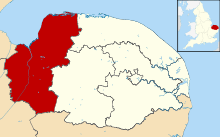 Shown within Norfolk | |
| Sovereign state | United Kingdom |
| Constituent country | England |
| Region | East of England |
| Administrative county | Norfolk |
| Admin. HQ | King's Lynn |
| Government | |
| • Type | King's Lynn and West Norfolk Borough Council |
| • Leadership: | Leader & Cabinet |
| • Executive: | Conservative |
| • MPs: |
Henry Bellingham (C) Elizabeth Truss (C) |
| Area | |
| • Total | 555 sq mi (1,438 km2) |
| Area rank | 12th |
| Population (mid-2014 est.) | |
| • Total | 150,026 |
| • Rank | Ranked 127th |
| • Density | 270/sq mi (100/km2) |
| Time zone | Greenwich Mean Time (UTC+0) |
| • Summer (DST) | British Summer Time (UTC+1) |
| ONS code |
33UE (ONS) E07000146 (GSS) |
| Ethnicity | 98.7% White |
| Website | west-norfolk.gov.uk |
King's Lynn and West Norfolk is a local government district and borough in Norfolk, England. Its council is based in the town of King's Lynn. The population of the Local Authority at the 2011 Census was 147,451.[1]
History
The district was formed in 1974 by the merger of the Municipal Borough of King's Lynn, Hunstanton and Downham Market urban districts along with Docking Rural District, Downham Rural District, Freebridge Lynn Rural District and Marshland Rural District. The district was originally known as just West Norfolk, and adopted its present name in 1981.
Politics
Elections to the borough council are held every four years, with all of the 62 councillors, representing 42 wards, on the council being elected at each election. After being under no overall control from the 1999 election, the Conservative party gained a majority at the 2003 election and has held one ever since.
Following the United Kingdom local elections, 2011 and subsequent defections [2] the political composition of King's Lynn and West Norfolk council is as follows:
| Year | Conservative | Labour | UKIP | Liberal Democrats | Independent |
|---|---|---|---|---|---|
| 2014 | 39 | 12 | 6 | 2 | 2 |
Composition
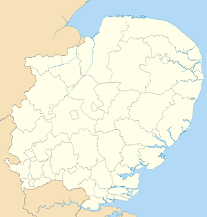
The district comprises the urban area of King's Lynn itself, together with 102 surrounding parishes. At the time of the 2001 census, the district had an area of 1,473 km², of which 28 km² was in the urban area and 1,445 km² in the surrounding parishes. The district had a population of 135,345 in 58,338 households, with 34,564 in 15,285 households living in the urban area, whilst 100,781 people in 43,053 households lived in the surrounding parishes.[3]
The urban area of King's Lynn itself is unparished. The remainder of the district lies within the following civil parishes:
References
- ↑ "Local Authority population 2011". Neighbourhood Statistics. Office for National Statistics. Retrieved 26 July 2016.
- ↑ http://www.edp24.co.uk/news/politics/nigel_farage_says_ukip_has_all_to_play_for_after_five_west_norfolk_councillors_join_1_3884015
- ↑ Office for National Statistics & Norfolk County Council (2001). Census population and household counts for unparished urban areas and all parishes. Retrieved December 2, 2005.
| Boroughs or districts | |
|---|---|
| Major settlements |
|
| Topics | |
Coordinates: 52°45′18″N 0°23′46″E / 52.7549°N 0.3962°E