St Edmundsbury
Coordinates: 52°15′05″N 0°41′48″E / 52.2514°N 0.6968°E
| St Edmundsbury Borough of St Edmundsbury | |
|---|---|
| Borough & Non-metropolitan district | |
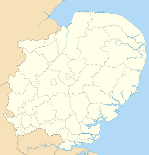
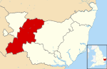 St Edmundsbury shown within Suffolk | |
| Sovereign state | United Kingdom |
| Constituent country | England |
| Region | East of England |
| Non-metropolitan county | Suffolk |
| Status | Non-metropolitan district |
| Admin HQ | Bury St Edmunds |
| Incorporated | 1 April 1974 |
| Government | |
| • Type | Non-metropolitan district council |
| • Body | St Edmundsbury Borough Council |
| • Leadership | Leader (Cllr John Griffiths) & Cabinet (Conservative) |
| • MPs |
Matthew Hancock Jo Churchill James Cartlidge |
| Area | |
| • Total | 253.7 sq mi (657.0 km2) |
| Area rank | 60th (of 326) |
| Population (mid-2014 est.) | |
| • Total | 112,073 |
| • Rank | 205th (of 326) |
| • Density | 440/sq mi (170/km2) |
| • Ethnicity | 98.0% White |
| Time zone | GMT (UTC0) |
| • Summer (DST) | BST (UTC+1) |
| ONS code |
42UF (ONS) E07000204 (GSS) |
| OS grid reference | TL8406364939 |
| Website | www.StEdmundsbury.gov.uk |
St Edmundsbury is a local government district and borough in Suffolk, England. It is named after its main town, Bury St Edmunds. The second town in the district is Haverhill. The population of the district was 111,008 at the 2011 Census.[1]
The district was formed on 1 April 1974 under the Local Government Act 1972 (with the abolition of West Suffolk) by the merger of the Borough of Bury St Edmunds, Haverhill Urban District, Clare Rural District and Thingoe Rural District.
Until March 2009, its main offices were in Bury St Edmunds (Angel Hill and Western Way). Thereafter, a purpose built complex, West Suffolk House housed both St Edmundsbury and Suffolk County Council staff.[2]
In 2008, the Council submitted a proposal to the Boundary Commission which would see it as central to a new West Suffolk unitary council.[3] Despite the considerable energies used to promote this concept[4] the proposal was rejected and no unitary scheme for Suffolk was adopted. (For more details see also Suffolk.)
In October 2011, St Edmundsbury Borough Council and Forest Heath District Council agreed to have one chief executive, a shared management team and a combined workforce, creating initial savings of more than £2million.[5]
List of communities
- Ampton
- Bardwell
- Barnardiston
- Barnham
- Barningham
- Barrow
- Bradfield Combust with Stanningfield
- Bradfield St Clare
- Bradfield St George
- Brockley
- Bury St Edmunds
- Cavendish
- Chedburgh
- Chevington
- Clare
- Coney Weston
- Cowlinge
- Culford
- Denham
- Denston
- Depden
- Euston
- Fakenham Magna
- Flempton
- Fornham All Saints
- Fornham St Genevieve
- Fornham St Martin
- Great Barton
- Great Bradley
- Great Livermere
- Great Thurlow
- Great Whelnetham
- Great Wratting
- Hargrave
- Haverhill
- Hawkedon
- Hawstead
- Hengrave
- Hepworth
- Honington
- Hopton
- Horringer
- Hundon
- Ickworth
- Ingham
- Ixworth
- Ixworth Thorpe
- Kedington
- Knettishall
- Lackford
- Lidgate
- Little Bradley
- Little Livermere
- Little Thurlow
- Little Whelnetham
- Little Wratting
- Market Weston
- Nowton
- Ousden
- Pakenham
- Poslingford
- Rede
- Risby
- Rushbrooke with Rougham
- Sapiston
- Stansfield
- Stanton
- Stoke-by-Clare
- Stradishall
- The Saxhams
- Thelnetham
- Timworth
- Troston
- West Stow
- Westley
- Whepstead
- Wickhambrook
- Withersfield
- Wixoe
- Wordwell
See also
References
- ↑ "Local Authority population 2011". Neighbourhood Statistics. Office for National Statistics. Retrieved 15 August 2016.
- ↑ St Edmundsbury website
- ↑ St Edmundsbury website
- ↑ They work for you.com
- ↑ EADT
| Boroughs or districts | |
|---|---|
| Major settlements | |
| Topics | |