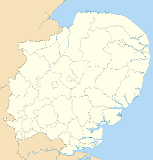
North Hertfordshire
| North Hertfordshire District | |
|---|---|
| Non-metropolitan district | |
 North Hertfordshire shown within Hertfordshire | |
| Sovereign state | United Kingdom |
| Constituent country | England |
| Region | East of England |
| Non-metropolitan county | Hertfordshire |
| Status | Non-metropolitan district |
| Admin HQ | Letchworth |
| Incorporated | 1 April 1974 |
| Government | |
| • Type | Non-metropolitan district council |
| • Body | North Hertfordshire District Council |
| • Leadership | Leader and Cabinet (Conservative) |
| • MPs |
Oliver Heald Peter Lilley Stephen McPartland |
| Area | |
| • Total | 144.9 sq mi (375.4 km2) |
| Area rank | 108th (of 326) |
| Population (mid-2014 est.) | |
| • Total | 131,046 |
| • Rank | 162nd (of 326) |
| • Density | 900/sq mi (350/km2) |
| • Ethnicity[1] |
91.4% White 4.0% S.Asian 1.9% Black 1.8% Mixed Race 0.9% Chinese or other |
| Time zone | GMT (UTC0) |
| • Summer (DST) | BST (UTC+1) |
| ONS code |
26UF (ONS) E07000099 (GSS) |
| OS grid reference | TL2355435083 |
| Website |
www |
North Hertfordshire is a local government district in Hertfordshire, England. Its council is based in Letchworth.
The district was formed on 1 April 1974 by the amalgamation of the urban districts of Baldock, Hitchin, Letchworth, and Royston and the Hitchin Rural District.
From eastward clockwise, it borders the districts of East Hertfordshire, Stevenage, Welwyn Hatfield, St Albans in Hertfordshire, Central Bedfordshire, Luton, Central Bedfordshire again, and South Cambridgeshire.
Towns
- Baldock
- Hitchin
- Letchworth
- Royston
- Most of the Great Ashby development north east of Stevenage falls within North Hertfordshire.
Villages
- Ashwell
- Barley
- Barkway
- Bygrave
- Caldecote
- Clothall
- Codicote
- Graveley
- Great Offley
- Great Wymondley
- Holwell
- Kings Walden
- Kimpton
- Knebworth
- Hexton
- Hinxworth
- Langley
- Lilley
- Little Wymondley
- Ickleford
- Kelshall
- Newnham
- Norton
- Nuthampstead
- Old Letchworth
- Offley
- Pirton
- Preston
- Radwell
- Reed
- Rushden
- St Ippollitts
- St Paul's Walden
- Therfield
- Wallington
- Walsworth
- Weston
- Willian
- Whitwell
References
Coordinates: 52°00′N 0°12′W / 52.0°N 0.2°W
| Wikimedia Commons has media related to North Hertfordshire. |
This article is issued from Wikipedia - version of the 9/19/2016. The text is available under the Creative Commons Attribution/Share Alike but additional terms may apply for the media files.
