Koregaon Bhima
| Koregaon Bhima कोरेगाव-भिमा Koregaon (कोरेगाव) | |
|---|---|
| Village | |
 Koregaon Bhima  Koregaon Bhima Location in Maharashtra, India | |
| Coordinates: IN 18°38′44″N 074°03′33″E / 18.64556°N 74.05917°ECoordinates: IN 18°38′44″N 074°03′33″E / 18.64556°N 74.05917°E | |
| Country |
|
| State | Maharashtra |
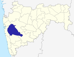
| District | Pune |
| Taluka | Shirur |
| Government | |
| • Type | Panchayati raj (India) |
| • Body | Gram panchayat |
| Population (2001) | |
| • Total | 8,999 |
| Languages | |
| • Official | Marathi |
| Time zone | IST (UTC+5:30) |
| ISO 3166 code | IN-MH |
| Website |
maharashtra |
Koregaon Bhima is a panchayat village[1] and census town[2] in the state of Maharashtra, India,[3] on the left (north) bank of the Bhima River.[4] Administratively, Koregaon Bhima is under Shirur Taluka of Pune District in Maharashtra.[2] There is only the single town of Koregaon Bhima in the Koregaon Bhima gram panchayat.[2] The town of Koregaon Bhima is 10 km along the SH 60 motorway southwest of the village of Shikrapur, and 28 km by road northeast of the city of Pune.
History
The Battle of Koregaon took place on January 1, 1818 between the army of Baji Rao II of the Maratha Empire, and a small East India Company force consisting mostly of Mahars with British officiers. The Koregaon pillar, an obelisk, stands at the battle site, and commemorates the brave and victorious Mahar soldiers.[5]
Demographics
In the 2001 census, the village of Koregaon Bhima had 8,999 inhabitants, with 5,178 males (57.5%) and 3,821 females (42.5%), for a gender ratio of 738 females per thousand males.[6]
Notes
- ↑ 2011 Village Panchayat Code for Koregaon Bhima = 188591, "Reports of National Panchayat Directory: Village Panchayat Names of Shirur, Pune, Maharashtra". Ministry of Panchayati Raj, Government of India.
- 1 2 3 2011 Census Village code for Koregaon Bhima = 555672, "Reports of National Panchayat Directory: List of Census Villages mapped for: Koregaon Bhima Gram Panchayat, Shirur, Pune, Maharashtra". Ministry of Panchayati Raj, Government of India.
- ↑ 2001 Census Village code for Koregaon Bhima = 03050100, "2001 Census of India: List of Villages by Tehsil: Maharashtra" (PDF). Registrar General & Census Commissioner, India. p. 592. Archived (PDF) from the original on 13 November 2012.
- ↑ Poona India, Sheet NE 43-06 (topographic map, scale 1:250,000), Series U-502, United States Army Map Service, May 1960
- ↑ Kumbhojkar, Shraddha (2012). "Contesting Power, Contesting Memories - The History of the Koregaon Memorial". The Economic and Political Weekly. Retrieved 2012-10-19.(subscription required)
- ↑ "Census 2001 Population Finder: Maharashtra: Pune: Shirur: Koregaon Bhima". Office of The Registrar General & Census Commissioner, Ministry of Home Affairs, Government of India. Archived from the original on 11 May 2013.
External links
- "Official Website of Pune District".
- "Delimitation of PC and AC - 2004 Shirur Taluka, Pune District, Maharashtra (Administrative Units)" (Map). Pune District.
Pune district topics | ||||||||||||||||||||||||||||||||
|---|---|---|---|---|---|---|---|---|---|---|---|---|---|---|---|---|---|---|---|---|---|---|---|---|---|---|---|---|---|---|---|---|
| History |
| |||||||||||||||||||||||||||||||
| Geography |
| |||||||||||||||||||||||||||||||
| Cities and towns |
| |||||||||||||||||||||||||||||||
| Transport | ||||||||||||||||||||||||||||||||
| Culture | ||||||||||||||||||||||||||||||||
| Education | ||||||||||||||||||||||||||||||||
| Constituencies | ||||||||||||||||||||||||||||||||