L'Anse Indian Reservation
| L'Anse Indian Reservation Keweenaw Bay Indian Community | ||
|---|---|---|
| Reservation | ||
| ||
 L'Anse Indian Reservation Location within the state of Michigan. | ||
| Coordinates: 46°46′36″N 88°29′46″W / 46.77667°N 88.49611°W | ||
| Country | United States | |
| State | Michigan | |
| Counties | Baraga, Marquette | |
| Established | 1854 | |
| Re-establishment of tribal government | 1934 | |
| Government | ||
| • Governing Body | Tribal Council of the Keweenaw Bay Indian Community | |
| • Tribal President | Warren C. Swartz [1] | |
| • Tribal Vice President | Jennifer Misegan | |
| Area | ||
| • Total | 92.132 sq mi (238.622 km2) | |
| Population (2000) | ||
| • Total | 3,672 | |
| Time zone | Eastern (EST) (UTC-5) | |
| • Summer (DST) | EDT (UTC-4) | |
| Website | http://www.kbic-nsn.gov/ | |

| Total population | |
|---|---|
| (Enrolled members: 3,159 (1999)) | |
| Regions with significant populations | |
|
| |
| Languages | |
| English, Ojibwe | |
| Religion | |
| Christianity | |
| Related ethnic groups | |
| Odawa, Potawatomie |

The L'Anse Indian Reservation is the land base of the federally recognized Keweenaw Bay Indian Community of the historic Lake Superior Band of Chippewa Indians. (The Keweenaw Bay Indian Community was defined in 1934 by the Indian Reorganization Act as the successor apparent of the L’Anse and Ontonagon bands).[2] The reservation is located primarily in two non-contiguous sections on either side of the Keweenaw Bay in Baraga County in the Upper Peninsula of the U.S. state of Michigan.
The largest section lies in northern L'Anse Township and western Arvon Township on the east side of Keweenaw Bay, while the smaller section lies in northern Baraga Township on the west side of Keweenaw Bay. There is also a much smaller (43.07 acre) part of the reservation in northern Chocolay Township in northeastern Marquette County.
The total land area of the reservation is 92.132 sq mi (238.622 km²). As of the 2000 census, 3,672 persons resided in this territory, of whom more than 69 percent self-identified as white people. Some 24.4 percent identified as being Native American. Most of the village of Baraga and part of the village of L'Anse are on reservation land. In 1999, tribal enrollment was 3,159 according to the Bureau of Indian Affairs 1999 Labor Force Report.
History
This area was historically the territory of the L'Anse Band of the Lake Superior Band of Chippewa Indians, a large, decentralized group of loosely associated bands around southern Lake Superior.
The European-American community of L'Anse developed around a French fur trading post set up in colonial times at the site of an Ojibwa village on the bay. It continued to develop after the British took control of New France following the Seven Years' War. After the War of 1812 between Britain and the United States, negotiations settled the border with Canada, and this area became part of the United States.
As European-American settlers moved into Michigan in the early 19th century, the United States increased pressure on the Lake Superior Band of Ojibwa to cede their lands to allow unrestricted development. The Treaty of 1842, by which the Chippewa ceded lands to the federal government, was one of the largest land cession agreements ever made between the U.S. federal government and Indian tribes. It includes provisions and stipulations that the Chippewa retain their rights to fish, hunt and gather on these ceded lands.
The L’Anse Reservation is both the oldest and largest reservation in Michigan. It was established under the Chippewa Treaty of 1854. The United States Supreme Court has interpreted this treaty as creating permanent homelands for the Chippewa (Ojibwa Anishnaabeg) band signatories to the treaty. The US ultimately acquired land and set up other reservations in Michigan for Chippewa based on this treaty, for instance for the Bay Mills Indian Community.
The L’Anse Reservation consists of 54,000 acres (220 km²) with approximately 14,000 acres (57 km²) owned by the tribal community. Two thirds of the land is held in tribal common ownership and the remaining third is owned by Indians in fee, restricted fee, or allotted lands status. The entire reservation encompasses nearly one third of the area of Baraga County.
Government
The Keweenaw Bay Indian Community re-established its tribal government under the Indian Reorganization Act of 1934, with its constitution for elected government adopted in 1936. It elects members to a tribal council and executive.
The Act, which encouraged tribes to reorganize their self-governments, also required that the Otonagon and L'Anse bands of the Lake Superior Band of Chippewa Indians be brought together as the federally recognized Keweenaw Bay Indian Community, defining it as the successor apparent of these two historic bands.[2] Each had reservations in Michigan established through 19th-century treaties with the federal government.
The Keweenaw Bay Community was among the four founding tribes of the Inter-Tribal Council of Michigan, Inc. established in 1966 during a period of rising Indian activism in the United States and Canada. Others were the Bay Mills Indian Community, Hannahville Indian Community, and Saginaw Chippewa Indian Tribe; all were federally recognized at the time. They worked to pool resources, preserve communal land, improve the welfare of their peoples, and improve relations with state and federal governments. Working as a group, the tribes qualified for Community Action Program grants that helped fund improvements in living conditions for their peoples. The Council now represents 11 of the 12 federally recognized tribes in Michigan.
Membership
The Keweenaw Bay Indian Community establishes its own membership rules for the tribe.
Economy
The Keneewaw Indian Community operates a fish hatchery at Pequamining Bay on Lake Superior. It works to improve and preserve water quality in the lake to support fish and other natural populations.
The tribe also operates two casinos, the Ojibwa I on reservation land in Baraga County, and the Ojibwa II in a residential neighborhood in Chocolay Township, Marquette County. A 2000 land claims settlement with the state required the tribe to relocate the latter casino. The tribe proposed moving it to the defunct Marquette County Airport. As of December 2012 the location remained unsettled.[3]
Communities
References
- ↑ http://www.kbic-nsn.gov/council
- 1 2 "Lac Vieux Desert Band of Chippewa Indian Community", Inter-Tribal Council of Michigan, 2012
- ↑ John Pepin (December 21, 2012). "Snyder delays decision on casino at old airport". The Mining Journal. Marquette. Retrieved 2012-12-21.
- L'Anse Reservation and Off-Reservation Trust Land, Michigan United States Census Bureau
External links
- Background from the Inter-Tribal Council of Michigan
- Keweenaw Bay Indian Community Online
- Constitution and By-Laws of the Keweenaw Bay Indian Community
- Native Americans in Michigan Databases, Mainly Michigan website, includes "Durant Roll of 1908" and "Mt. Pleasant Indian School Register (1893 to 1932)"
Coordinates: 46°46′52″N 88°24′08″W / 46.78111°N 88.40222°W
| Federally recognized | |
|---|---|
| State recognized | |
Municipalities and communities of Baraga County, Michigan, United States | ||
|---|---|---|
| Villages |  | |
| Townships | ||
| Unincorporated communities | ||
| Indian reservation | ||
Municipalities and communities of Marquette County, Michigan, United States | ||
|---|---|---|
| Cities | 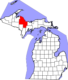 | |
| Charter townships | ||
| General law townships | ||
| CDPs | ||
| Other unincorporated communities | ||
| Indian reservation | ||