LaGrange, Ohio
| LaGrange, Ohio | |
|---|---|
| Village | |
|
Roundabout at intersection in LaGrange | |
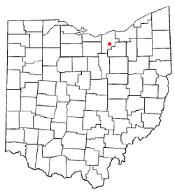 Location of LaGrange, Ohio | |
 Location of LaGrange in Lorain County | |
| Coordinates: 41°14′20″N 82°7′13″W / 41.23889°N 82.12028°WCoordinates: 41°14′20″N 82°7′13″W / 41.23889°N 82.12028°W | |
| Country | United States |
| State | Ohio |
| County | Lorain |
| Township | LaGrange |
| Government | |
| • Type | Village council |
| • Mayor | Kim E. Strauss |
| • Administrator | Walt Sukey |
| Area[1] | |
| • Total | 2.01 sq mi (5.21 km2) |
| • Land | 2.01 sq mi (5.21 km2) |
| • Water | 0 sq mi (0 km2) |
| Elevation[2] | 820 ft (250 m) |
| Population (2010)[3] | |
| • Total | 2,103 |
| • Estimate (2012[4]) | 2,099 |
| • Density | 1,046.3/sq mi (404.0/km2) |
| Time zone | Eastern (EST) (UTC-5) |
| • Summer (DST) | EDT (UTC-4) |
| ZIP code | 44050 |
| Area code(s) | 440 |
| FIPS code | 39-41230[5] |
| GNIS feature ID | 1064961[2] |

LaGrange is a village in Lorain County, Ohio, United States. The population was 2,103 at the 2010 census.
The village derives its name from Château de la Grange-Bléneau, the French home of Gilbert du Motier, Marquis de Lafayette, an officer in the American Revolutionary War.[6]
Geography
LaGrange is located at 41°14′20″N 82°7′13″W / 41.23889°N 82.12028°W (41.238903, -82.120371).[7]
According to the United States Census Bureau, the village has a total area of 2.01 square miles (5.21 km2), all land.[1]
Demographics
| Historical population | |||
|---|---|---|---|
| Census | Pop. | %± | |
| 1880 | 511 | — | |
| 1890 | 551 | 7.8% | |
| 1900 | 528 | −4.2% | |
| 1910 | 467 | −11.6% | |
| 1920 | 500 | 7.1% | |
| 1930 | 498 | −0.4% | |
| 1940 | 546 | 9.6% | |
| 1950 | 712 | 30.4% | |
| 1960 | 1,007 | 41.4% | |
| 1970 | 1,074 | 6.7% | |
| 1980 | 1,258 | 17.1% | |
| 1990 | 1,199 | −4.7% | |
| 2000 | 1,815 | 51.4% | |
| 2010 | 2,103 | 15.9% | |
| Est. 2015 | 2,133 | [8] | 1.4% |
2010 census
As of the census[3] of 2010, there were 2,103 people, 726 households, and 569 families residing in the village. The population density was 1,046.3 inhabitants per square mile (404.0/km2). There were 789 housing units at an average density of 392.5 per square mile (151.5/km2). The racial makeup of the village was 96.6% White, 0.4% African American, 0.7% Native American, 0.2% Asian, 0.4% from other races, and 1.7% from two or more races. Hispanic or Latino of any race were 1.9% of the population.
There were 726 households of which 40.6% had children under the age of 18 living with them, 60.9% were married couples living together, 12.5% had a female householder with no husband present, 5.0% had a male householder with no wife present, and 21.6% were non-families. 17.1% of all households were made up of individuals and 5.3% had someone living alone who was 65 years of age or older. The average household size was 2.73 and the average family size was 3.07.
The median age in the village was 41.4 years. 25.7% of residents were under the age of 18; 7% were between the ages of 18 and 24; 23.5% were from 25 to 44; 29.4% were from 45 to 64; and 14.4% were 65 years of age or older. The gender makeup of the village was 48.5% male and 51.5% female.
2000 census
As of the census[5] of 2000, there were 1,815 people, 618 households, and 501 families residing in the village. The population density was 1,031.9 people per square mile (398.2/km²). There were 648 housing units at an average density of 368.4 per square mile (142.2/km²). The racial makeup of the village was 97.19% White, 0.72% African American, 0.28% Native American, 0.17% Asian, 0.33% from other races, and 1.32% from two or more races. Hispanic or Latino of any race were 1.21% of the population.
There were 618 households out of which 45.6% had children under the age of 18 living with them, 68.8% were married couples living together, 8.9% had a female householder with no husband present, and 18.9% were non-families. 14.6% of all households were made up of individuals and 5.0% had someone living alone who was 65 years of age or older. The average household size was 2.94 and the average family size was 3.25.
In the village the population was spread out with 32.1% under the age of 18, 7.3% from 18 to 24, 33.3% from 25 to 44, 20.4% from 45 to 64, and 6.9% who were 65 years of age or older. The median age was 33 years. For every 100 females there were 94.7 males. For every 100 females age 18 and over, there were 92.2 males.
The median income for a household in the village was $50,750, and the median income for a family was $55,179. Males had a median income of $41,591 versus $26,302 for females. The per capita income for the village was $19,465. About 3.6% of families and 6.2% of the population were below the poverty line, including 5.4% of those under age 18 and 11.5% of those age 65 or over.
Statue
LaGrange's town square includes a tribute statue to the soldiers of the Civil War.[10]
Notable people
- Robert E. McKisson - a Republican politician and former mayor of Cleveland, Ohio.
References
- 1 2 "US Gazetteer files 2010". United States Census Bureau. Retrieved 2013-01-06.
- 1 2 "US Board on Geographic Names". United States Geological Survey. 2007-10-25. Retrieved 2008-01-31.
- 1 2 "American FactFinder". United States Census Bureau. Retrieved 2013-01-06.
- ↑ "Population Estimates". United States Census Bureau. Retrieved 2013-06-17.
- 1 2 "American FactFinder". United States Census Bureau. Retrieved 2008-01-31.
- ↑ Overman, William Daniel (1958). Ohio Town Names. Akron, OH: Atlantic Press. p. 72.
- ↑ "US Gazetteer files: 2010, 2000, and 1990". United States Census Bureau. 2011-02-12. Retrieved 2011-04-23.
- ↑ "Annual Estimates of the Resident Population for Incorporated Places: April 1, 2010 to July 1, 2015". Retrieved July 2, 2016.
- ↑ "Census of Population and Housing". Census.gov. Retrieved June 4, 2015.
- ↑ Photo at La Grange Soldiers' Monument
Municipalities and communities of Lorain County, Ohio, United States | ||
|---|---|---|
| Cities | 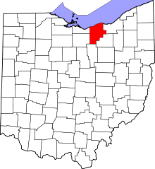 | |
| Villages | ||
| Townships | ||
| CDPs |
| |
| Unincorporated communities | ||
| Ghost town | ||
| Footnotes | ‡This populated place also has portions in an adjacent county or counties | |