Lake Albany

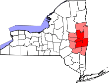
Glacial Lake Albany was a prehistoric North American proglacial lake that formed during the end of the Wisconsinan glaciation.[1][2] It existed between 15,000 and 12,600 years ago[3] and was created when meltwater from a retreating glacier, along with water from rivers such as the Iromohawk, became ice dammed in the Hudson Valley.[1][4] Organic materials in Lake Albany deposits have been carbon dated to approximately 11,700 years ago.[5] The lake spanned approximately 160 miles (260 km) from present-day Newburgh to Glens Falls.[1][3][6]
Lake Albany drained about 10,500 years ago through the Hudson River due to post-glacial rebound.[1][6][7] When the lake drained it exposed the sandy and gravelly glaciolacustrine deposits left by the glacier, along a broad plain just west of Schenectady, where the Mohawk emptied into the lake.[8] Dune and deltaic sands, containing lenses of silty sand, silt and clay,[9] compose the topsoil which now underlies the Albany Pine Bush.[10] Beneath the surficial deposits are lake-bottom silt and clay, which overlie till and shale bedrock.[9] A small rill caused by the lake's drainage created Patroon Creek, Sand Creek, Lisha Kill, Shaker Creek, Delphus Kill and the Salt Kill in the town of Colonie, New York.[11]
See also
- Champlain Sea
- Lake Albany
- Lake Hitchcock
- Lake Merrimack
- Lake Stowe
References
- 1 2 3 4 "Origins of the Albany Pine Bush". Albany Pine Bush Preserve Commission. Retrieved 2010-10-17.
- ↑ Dawicki, Shelley (2004-12-15). "Catastrophic Flooding from Ancient Lake May Have Triggered Cold Period". Retrieved 2010-10-17.
- 1 2 "How did this land form?" (PDF). SUNY ESF. August 2001. p. 2. Retrieved 2010-10-17.
- ↑ De Simone, David J.; Wall, Gary R.; Miller, Norton G.; Rayburn, John A.; Kozlowski, Andrew L. (May–June 2008). "Glacial Geology of the Northern Hudson through Southern Champlain Lowlands" (PDF). Northeastern Friends of the Pleistocene. University of Maine. Retrieved 2010-10-17.
- ↑ Franzi, David A.; Rayburn, John A.; Knuepfer, Peter L.K.; Cronin, Thomas M. (June 2007). "Late Quaternary History of Northeastern New York and Adjacent Parts of Vermont and Quebec" (PDF). Northeastern Friends of the Pleistocene. University of Maine. Retrieved 2010-10-17.
- 1 2 "Geological History of the New York Area". Skidmore College. Retrieved 2010-10-17.
- ↑ "State University of New York at Albany - Edward Durrell Stone's architecture, atmospheric science, and the geology under it". University at Albany, SUNY. Retrieved 2010-10-17.
- ↑ "Surficial Geology: Sand Dunes". New York State Geological Survey. Retrieved 2010-10-17.
- 1 2 Williams, John H.; Lapham, Wayne W.; Barringer, Thomas H. (1993). "Application of Electromagnetic Logging to Contamination Investigations in Glacial San-and-Gravel Aquifers". Ground Water Monitoring and Remediation Review. USGS. 13 (3): 130–131. doi:10.1111/j.1745-6592.1993.tb00082.x.
- ↑ Burger, Joanna (2006). Whispers in the Pines: a Naturalist in the Northeast. Rutgers University Press. p. 29. ISBN 978-0-8135-3794-8. Retrieved 2010-10-17.
- ↑ "Town of Colonie: A Draft Comprehensive Plan" (PDF). Town of Colonie. May 2005. p. 23. Retrieved 2010-10-20.
Further reading
- Reynolds, Richard J. (1997). "Hydrogeology of the Schodack-Kinderhook Area, Rensselaer and Columbia Counties, New York" (PDF). USGS. Retrieved 2010-10-17.
- Ruggiero, Kathleen M.; Rodbell, Donald T.; Garver, John I. (2008). "The Geological Evolution of Collins Lake, Scotia, New York, as Revealed From Sub-Bottom Profiles and Sediment Core Analysis". Union College. Retrieved 2010-10-17.
- "New York State Geological Association 39th Annual Meeting" (PDF). The New York State Geological Association. May 5–7, 1967. Retrieved 2010-10-17.