Leon, Kansas
| Leon, Kansas | |
|---|---|
| City | |
 Location within Butler County and Kansas | |
 KDOT map of Butler County (legend) | |
| Coordinates: 37°41′22″N 96°46′59″W / 37.68944°N 96.78306°WCoordinates: 37°41′22″N 96°46′59″W / 37.68944°N 96.78306°W | |
| Country | United States |
| State | Kansas |
| County | Butler |
| Founded | 1879 |
| Incorporated | 1882 |
| Area[1] | |
| • Total | 0.75 sq mi (1.94 km2) |
| • Land | 0.75 sq mi (1.94 km2) |
| • Water | 0 sq mi (0 km2) |
| Elevation | 1,352 ft (412 m) |
| Population (2010)[2] | |
| • Total | 704 |
| • Estimate (2015)[3] | 701 |
| • Density | 940/sq mi (360/km2) |
| Time zone | Central (CST) (UTC-6) |
| • Summer (DST) | CDT (UTC-5) |
| ZIP code | 67074 |
| Area code | 316 |
| FIPS code | 20-39450 [4] |
| GNIS feature ID | 0474831 [5] |
Leon is a city in Butler County, Kansas, United States. As of the 2010 census, the city population was 704.[6]
History
Leon was founded in 1879.[7] It was named after Leon, Iowa.[8] The first building, built in 1879, was the blacksmith shop of H. Belton.[9] Leon was incorporated as a city in 1882.[10]
Geography
Leon is located at 37°41′22″N 96°46′59″W / 37.689516°N 96.783109°W (37.689516, -96.783109).[11] According to the United States Census Bureau, the city has a total area of 0.75 square miles (1.94 km2), all of it land.[1] Leon is located in Little Walnut Township, Butler County, Kansas, and it is its principal city.
Demographics
| Historical population | |||
|---|---|---|---|
| Census | Pop. | %± | |
| 1880 | 113 | — | |
| 1890 | 456 | 303.5% | |
| 1900 | 527 | 15.6% | |
| 1910 | 494 | −6.3% | |
| 1920 | 427 | −13.6% | |
| 1930 | 587 | 37.5% | |
| 1940 | 573 | −2.4% | |
| 1950 | 518 | −9.6% | |
| 1960 | 541 | 4.4% | |
| 1970 | 510 | −5.7% | |
| 1980 | 667 | 30.8% | |
| 1990 | 707 | 6.0% | |
| 2000 | 645 | −8.8% | |
| 2010 | 704 | 9.1% | |
| Est. 2015 | 701 | [3] | −0.4% |
| U.S. Decennial Census | |||
2010 census
As of the census[2] of 2010, there were 704 people, 264 households, and 188 families residing in the city. The population density was 938.7 inhabitants per square mile (362.4/km2). There were 297 housing units at an average density of 396.0 per square mile (152.9/km2). The racial makeup of the city was 91.9% White, 0.6% African American, 2.0% Native American, 0.3% Asian, 1.6% from other races, and 3.7% from two or more races. Hispanic or Latino of any race were 3.0% of the population.
There were 264 households of which 38.3% had children under the age of 18 living with them, 50.0% were married couples living together, 11.7% had a female householder with no husband present, 9.5% had a male householder with no wife present, and 28.8% were non-families. 25.8% of all households were made up of individuals and 14% had someone living alone who was 65 years of age or older. The average household size was 2.67 and the average family size was 3.13.
The median age in the city was 34.6 years. 30.3% of residents were under the age of 18; 8.3% were between the ages of 18 and 24; 22.1% were from 25 to 44; 24.1% were from 45 to 64; and 15.2% were 65 years of age or older. The gender makeup of the city was 50.6% male and 49.4% female.
2000 census
As of the census[4] of 2000, there were 645 people, 245 households, and 175 families residing in the city. The population density was 1,090.8 people per square mile (422.1/km2). There were 269 housing units at an average density of 454.9 per square mile (176.0/km2). The racial makeup of the city was 93.64% White, 0.62% African American, 1.71% Native American, 1.55% from other races, and 2.48% from two or more races. Hispanic or Latino of any race were 4.96% of the population.
There were 245 households out of which 38.4% had children under the age of 18 living with them, 57.6% were married couples living together, 10.6% had a female householder with no husband present, and 28.2% were non-families. 24.5% of all households were made up of individuals and 11.8% had someone living alone who was 65 years of age or older. The average household size was 2.63 and the average family size was 3.18.
In the city the population was spread out with 31.6% under the age of 18, 7.4% from 18 to 24, 27.9% from 25 to 44, 19.2% from 45 to 64, and 13.8% who were 65 years of age or older. The median age was 33 years. For every 100 females there were 89.1 males. For every 100 females age 18 and over, there were 95.1 males.
The median income for a household in the city was $40,089, and the median income for a family was $48,000. Males had a median income of $35,938 versus $25,859 for females. The per capita income for the city was $18,953. About 6.7% of families and 6.6% of the population were below the poverty line, including 6.6% of those under age 18 and 12.8% of those age 65 or over.
Further reading
References
- 1 2 "US Gazetteer files 2010". United States Census Bureau. Retrieved 2012-07-06.
- 1 2 "American FactFinder". United States Census Bureau. Retrieved 2012-07-06.
- 1 2 "Annual Estimates of the Resident Population for Incorporated Places: April 1, 2010 to July 1, 2015". Retrieved July 2, 2016.
- 1 2 "American FactFinder". United States Census Bureau. Retrieved 2008-01-31.
- ↑ "US Board on Geographic Names". United States Geological Survey. 2007-10-25. Retrieved 2008-01-31.
- ↑ "2010 City Population and Housing Occupancy Status". U.S. Census Bureau. Retrieved March 6, 2011.
- ↑ Kansas State Historical Society (1916). Biennial Report of the Board of Directors of the Kansas State Historical Society. Kansas State Printing Plant. p. 152.
- ↑ "Profile for Leon, Kansas". ePodunk. Retrieved 5 June 2014.
- ↑ "William G. Cutler's History of the State of Kansas (1883)".
- ↑ Blackmar, Frank Wilson (1912). Kansas: A Cyclopedia of State History, Volume 2. Standard Publishing Company. p. 138.
- ↑ "US Gazetteer files: 2010, 2000, and 1990". United States Census Bureau. 2011-02-12. Retrieved 2011-04-23.
External links
| Wikimedia Commons has media related to Leon, Kansas. |
- City
- Schools
- USD 205, local school district
- USD 205 School District Boundary Map, KDOT
- Maps
- Leon City Map, KDOT
Municipalities and communities of Butler County, Kansas, United States | ||
|---|---|---|
| Cities | 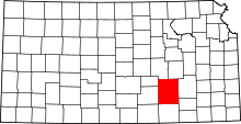 | |
| CDP | ||
| Unincorporated communities | ||
| Ghost towns | ||
| Townships | ||
| Footnotes | ‡This populated place also has portions in an adjacent county or counties | |