Lindsay, Oklahoma
| Lindsay, Oklahoma | |
|---|---|
| City | |
| Motto: Working hard as a community | |
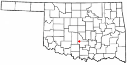 Location of Lindsay, Oklahoma | |
| Coordinates: 34°50′14″N 97°36′27″W / 34.83722°N 97.60750°WCoordinates: 34°50′14″N 97°36′27″W / 34.83722°N 97.60750°W | |
| Country | United States |
| State | Oklahoma |
| County | Garvin |
| Area | |
| • Total | 2.3 sq mi (6.1 km2) |
| • Land | 2.3 sq mi (6.1 km2) |
| • Water | 0.0 sq mi (0.0 km2) |
| Elevation | 974 ft (297 m) |
| Population (2000) | |
| • Total | 2,889 |
| • Density | 1,231.9/sq mi (475.6/km2) |
| Time zone | Central (CST) (UTC-6) |
| • Summer (DST) | CDT (UTC-5) |
| ZIP code | 73052 |
| Area code(s) | 405 |
| FIPS code | 40-43150[1] |
| GNIS feature ID | 1094691[2] |
Lindsay is a city in Garvin County, Oklahoma, United States. The population was 2,889 at the 2000 census. It once promoted itself as "The Broomcorn Capital of the World" but no longer uses that slogan, as broomcorn is no longer raised in the area.[3]
History
Lindsay was founded in January 1902, when the Atchison, Topeka and Santa Fe and the Chicago, Rock Island and Pacific railroad companies linked their lines halfway between Chickasha and Pauls Valley. Lindsay was named after Lewis Lindsay, a local area farmer that donated 440 acres of land for the townsite.[4]
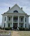 The Lindsay-Murray Mansion
Geography
Lindsay is located at 34°50′14″N 97°36′27″W / 34.83722°N 97.60750°W (34.837280, -97.607537).[5]
According to the United States Census Bureau, the city has a total area of 2.3 square miles (6.0 km2), all of it land.
Climate
| Climate data for Lindsay, Oklahoma | |||||||||||||
|---|---|---|---|---|---|---|---|---|---|---|---|---|---|
| Month | Jan | Feb | Mar | Apr | May | Jun | Jul | Aug | Sep | Oct | Nov | Dec | Year |
| Average high °F (°C) | 51.0 (10.6) |
56.6 (13.7) |
66.4 (19.1) |
75.8 (24.3) |
82.4 (28) |
89.4 (31.9) |
95.6 (35.3) |
95.1 (35.1) |
86.4 (30.2) |
76.8 (24.9) |
63.9 (17.7) |
53.6 (12) |
74.4 (23.6) |
| Average low °F (°C) | 25.3 (−3.7) |
30.0 (−1.1) |
39.0 (3.9) |
49.1 (9.5) |
57.6 (14.2) |
65.5 (18.6) |
69.8 (21) |
68.1 (20.1) |
60.9 (16.1) |
49.9 (9.9) |
38.6 (3.7) |
28.8 (−1.8) |
48.6 (9.2) |
| Average precipitation inches (mm) | 1.3 (33) |
1.8 (46) |
2.9 (74) |
3.4 (86) |
5.4 (137) |
4.0 (102) |
2.1 (53) |
2.4 (61) |
4.3 (109) |
3.7 (94) |
2.2 (56) |
1.7 (43) |
35.1 (892) |
| Source #1: weather.com | |||||||||||||
| Source #2: Weatherbase.com[6] | |||||||||||||
Demographics
| Historical population | |||
|---|---|---|---|
| Census | Pop. | %± | |
| 1910 | 1,156 | — | |
| 1920 | 1,543 | 33.5% | |
| 1930 | 1,713 | 11.0% | |
| 1940 | 1,792 | 4.6% | |
| 1950 | 3,021 | 68.6% | |
| 1960 | 4,258 | 40.9% | |
| 1970 | 3,705 | −13.0% | |
| 1980 | 3,454 | −6.8% | |
| 1990 | 2,947 | −14.7% | |
| 2000 | 2,889 | −2.0% | |
| 2010 | 2,840 | −1.7% | |
| Est. 2015 | 2,830 | [7] | −0.4% |
As of the census of 2000,[1] there were 2,889 people, 1,244 households, and 794 families residing in the city. The population density was 1,231.9 people per square mile (474.7/km²). There were 1,446 housing units at an average density of 616.6 per square mile (237.6/km²). The racial makeup of the city was 90.86% White, 0.14% African American, 4.92% Native American, 0.10% Asian, 0.03% Pacific Islander, 0.76% from other races, and 3.18% from two or more races. Hispanic or Latino of any race were 1.25% of the population.
There were 1,244 households out of which 27.3% had children under the age of 18 living with them, 52.1% were married couples living together, 9.4% had a female householder with no husband present, and 36.1% were non-families. 34.5% of all households were made up of individuals and 21.7% had someone living alone who was 65 years of age or older. The average household size was 2.28 and the average family size was 2.91.
In the city the population was spread out with 23.3% under the age of 18, 8.5% from 18 to 24, 24.1% from 25 to 44, 19.1% from 45 to 64, and 25.0% who were 65 years of age or older. The median age was 40 years. For every 100 females there were 81.8 males. For every 100 females age 18 and over, there were 78.1 males.
The median income for a household in the city was $26,667, and the median income for a family was $35,208. Males had a median income of $26,831 versus $18,207 for females. The per capita income for the city was $14,320. About 9.9% of families and 15.6% of the population were below the poverty line, including 19.4% of those under age 18 and 12.5% of those age 65 or over.
Economy
In Lindsay, the oilfield industry is a major source of revenue and jobs.
Education
Lindsay Public Schools provide schooling from kindergarten through high school.[9] Lindsay is home to the 2A state champion Pride of Lindsay Marching Band.
References
- 1 2 "American FactFinder". United States Census Bureau. Retrieved 2008-01-31.
- ↑ "US Board on Geographic Names". United States Geological Survey. 2007-10-25. Retrieved 2008-01-31.
- ↑ Etter, Jim. "Catchy Slogans Strive to Put Towns on Map." The Oklahoman. October 20, 1985. Accessed November 3, 2016.
- ↑ "Oklahoma Encyclopedia of History and Culture - Lindsay". Retrieved 2011-03-03.
- ↑ "US Gazetteer files: 2010, 2000, and 1990". United States Census Bureau. 2011-02-12. Retrieved 2011-04-23.
- ↑ "Historical Weather for Lindsay, Oklahoma, United States".
- ↑ "Annual Estimates of the Resident Population for Incorporated Places: April 1, 2010 to July 1, 2015". Retrieved July 2, 2016.
- ↑ "Census of Population and Housing". Census.gov. Retrieved June 4, 2015.
- ↑ Lindsay Public Schools, Accessed June 24, 2015.
External links
Municipalities and communities of Garvin County, Oklahoma, United States | ||
|---|---|---|
| Cities | 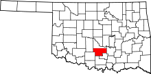 | |
| Towns | ||
| Unincorporated communities | ||
| Ghost town | ||
| Footnotes | ‡This populated place also has portions in an adjacent county or counties | |
Populated places established in 1902