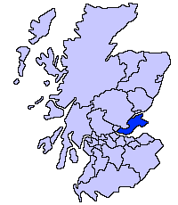
| Name |
Location |
Date Listed |
Grid Ref. [note 1] |
Geo-coordinates |
Notes |
HB Number [note 2] |
Image |
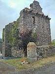
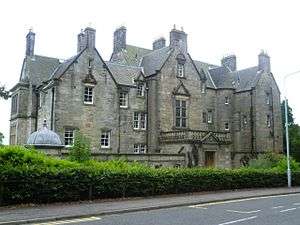
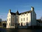
| Gibliston House |
Arncroach |
|
NO4980604979 |
56°14′05″N 2°48′41″W / 56.234691°N 2.811296°W / 56.234691; -2.811296 (Gibliston House) |
1820 classical villa, extensions by Sir Robert Lorimer[5] |
155 |
 Upload another image
See more images
|
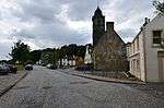
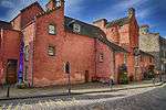
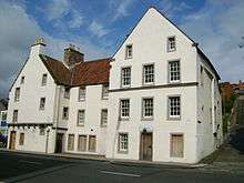
| The King's Cellar |
Limekilns, Academy Square |
|
NT0762983443 |
56°02′06″N 3°29′02″W / 56.034935°N 3.484005°W / 56.034935; -3.484005 (The King's Cellar) |
16th-century storehouse, possibly incorporating material from 1362[6] |
1643 |
 Upload another image
See more images
|
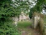
| Creich Castle Doocot |
Creich |
|
NO3279821289 |
56°22′45″N 3°05′23″W / 56.379094°N 3.089777°W / 56.379094; -3.089777 (Creich Castle Doocot) |
Dovecote dated 1723[7] |
2173 |

|
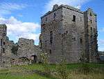
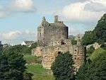
| Collairnie Castle |
Dunbog |
|
NO3063717195 |
56°20′31″N 3°07′25″W / 56.342008°N 3.123679°W / 56.342008; -3.123679 (Collairnie Castle) |
16th-century tower house with later modifications[8] |
2182 |
 Upload another image
See more images
|
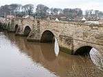
| Bishop Bridge |
Ceres, High Street, over Ceres Burn |
|
NO4001511429 |
56°17′29″N 2°58′14″W / 56.291495°N 2.970683°W / 56.291495; -2.970683 (Bishop Bridge) |
17th-century single-arch stone bridge[9] |
2366 |
|
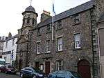
| St John's Masonic Lodge |
Ceres |
|
NO4003211419 |
56°17′29″N 2°58′13″W / 56.291407°N 2.970406°W / 56.291407; -2.970406 (St John's Masonic Lodge) |
Mid 18th-century Masonic lodge[10] |
2368 |
|
| Southern outbuilding of Brand's Hotel |
Ceres, High Street |
|
NO4001611479 |
56°17′31″N 2°58′14″W / 56.291944°N 2.970678°W / 56.291944; -2.970678 (Southern outbuilding of Brand's Hotel) |
18th-century mill, later a beer store[11] |
2393 |
|
| Fife Folk Museum (Central And North Fife Preservation Society) |
Ceres, High Street |
|
NO4002911468 |
56°17′31″N 2°58′14″W / 56.291847°N 2.970466°W / 56.291847; -2.970466 (Fife Folk Museum (Central And North Fife Preservation Society)) |
17th-century cottages and weigh house, now a museum[12] |
2394 |
|
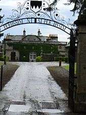
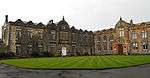
| Scotstarvit Tower |
Near Cupar |
|
NO3703211269 |
56°17′23″N 3°01′08″W / 56.28967°N 3.018828°W / 56.28967; -3.018828 (Scotstarvit Tower) |
16th-century tower house modified in the 17th century[13] |
2416 |
|
| Balcaskie House |
Near St Monans |
|
NO5246903579 |
56°13′21″N 2°46′05″W / 56.222388°N 2.768091°W / 56.222388; -2.768091 (Balcaskie House) |
16th-century house, enlarged by Sir William Bruce for himself in 1688[14] |
2503 |
|
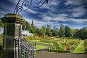
| Balcaskie House, Terraced Garden |
Near St Monans |
|
NO5249803508 |
56°13′18″N 2°46′03″W / 56.221753°N 2.76761°W / 56.221753; -2.76761 (Balcaskie House, Terraced Garden) |
17th-century Italianate gardens laid out by Sir William Bruce[15] |
2504 |
|
| Balcaskie House, east gatepiers and twin dovecots |
Near St Monans |
|
NO5303103887 |
56°13′31″N 2°45′33″W / 56.225211°N 2.759083°W / 56.225211; -2.759083 (Balcaskie House, east gatepiers and twin dovecots) |
18th-century gate piers and dovecotes[16] |
2506 |
|
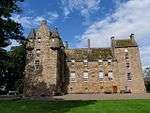
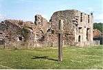
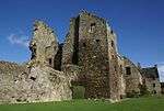
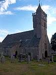
| Kellie Castle |
Arncroach |
|
NO5201005239 |
56°14′14″N 2°46′33″W / 56.237255°N 2.775793°W / 56.237255; -2.775793 (Kellie Castle) |
14th-century castle with later rebuilding and extensions[17] |
2519 |
 Upload another image
See more images
|
| Balmerino Abbey, conventual buildings |
Balmerino |
|
NO3582124684 |
56°24′36″N 3°02′30″W / 56.410011°N 3.041669°W / 56.410011; -3.041669 (Balmerino Abbey, conventual buildings) |
Remains of 13th-century sacristy, chapter house, parlour and cells[18] |
2545 |
 Upload another image
See more images
|
| Balmerino Abbey, barn |
Balmerino |
|
NO3577224720 |
56°24′37″N 3°02′33″W / 56.410327°N 3.042471°W / 56.410327; -3.042471 (Balmerino Abbey, barn) |
15th-century barn[19] |
2548 |
|
| Denmylne Castle |
Newburgh |
|
NO2493117549 |
56°20′40″N 3°12′58″W / 56.344316°N 3.216064°W / 56.344316; -3.216064 (Denmylne Castle) |
Ruined late-16th-century tower house[20] |
2592 |
 Upload another image
See more images
|
| Dairsie Bridge |
Dairsie, over River Eden |
|
NO4157716102 |
56°20′01″N 2°56′47″W / 56.333668°N 2.94649°W / 56.333668; -2.94649 (Dairsie Bridge) |
Late mediaeval three-arch stone bridge[21] |
2607 |
|
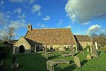
| Dairsie Old Church (St Mary's) |
Dairsie |
|
NO4140016090 |
56°20′01″N 2°56′58″W / 56.333538°N 2.949349°W / 56.333538; -2.949349 (Dairsie Old Church (St Mary's)) |
17th-century Gothic former church[22] |
2610 |
 Upload another image
See more images
|
| Hill of Tarvit House |
Near Cupar |
|
NO3789411860 |
56°17′42″N 3°00′18″W / 56.295093°N 3.005045°W / 56.295093; -3.005045 (Hill of Tarvit House) |
late-17th-century house remodelled by Sir Robert Lorimer in 1907[23] |
2628 |
|
| Tarvit Farm |
Near Cupar |
|
NO3854513962 |
56°18′51″N 2°59′42″W / 56.31406°N 2.995019°W / 56.31406; -2.995019 (Tarvit Farm) |
Steading of circa 1800, with central tower and spire[24] |
2674 |
|
| Benarty House |
Near Ballingry |
|
NT1572496481 |
56°09′13″N 3°21′30″W / 56.153537°N 3.358251°W / 56.153537; -3.358251 (Benarty House) |
Earlier 19th-century mansion[25] |
3321 |
|
| Benarty Steading |
Near Ballingry |
|
NT1566996574 |
56°09′16″N 3°21′33″W / 56.154362°N 3.359166°W / 56.154362; -3.359166 (Benarty Steading) |
Farmstead of circa 1840[26] |
3322 |
|
| Dunimarle Castle |
Culross |
|
NS9772685902 |
56°03′18″N 3°38′38″W / 56.055006°N 3.643803°W / 56.055006; -3.643803 (Dunimarle Castle) |
1840 castlellated house by R. and R. Dickson[27] |
3349 |
|
| Inchcolm Abbey |
Inchcolm |
|
NT1897382656 |
56°01′48″N 3°18′06″W / 56.029921°N 3.301768°W / 56.029921; -3.301768 (Inchcolm Abbey) |
Remains of Augustinian monastery dating from the 12th to the 16th centuries[28] |
3573 |
 Upload another image
See more images
|
| The Murrell |
Near Aberdour |
|
NT1876486685 |
56°03′58″N 3°18′23″W / 56.066076°N 3.306344°W / 56.066076; -3.306344 (The Murrell) |
1908 Arts and Crafts country house by Francis William Deas[29] |
3598 |
|
| Aberdour Kirk, St Fillan's (Church Of Scotland) |
Aberdour, Hawkcraig Road |
|
NT1932085468 |
56°03′19″N 3°17′49″W / 56.055238°N 3.297049°W / 56.055238; -3.297049 (Aberdour Kirk, St Fillan's (Church Of Scotland)) |
12th-century church, restored 1926[30] |
3608 |
 Upload another image
See more images
|
| Aberdour Castle walled garden with sundial |
Aberdour |
|
NT1932385518 |
56°03′20″N 3°17′49″W / 56.055688°N 3.297016°W / 56.055688; -3.297016 (Aberdour Castle walled garden with sundial) |
17th-century walled garden[31] |
3610 |
 Upload another image
See more images
|
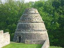
| Aberdour Castle Dovecot |
Aberdour |
|
NT1930785400 |
56°03′17″N 3°17′50″W / 56.054625°N 3.297237°W / 56.054625; -3.297237 (Aberdour Castle Dovecot) |
16th-century beehive dovecote[32] |
3611 |
 Upload another image
See more images
|
| Seabank House |
Aberdour, Shore Road |
|
NT1925585024 |
56°03′04″N 3°17′53″W / 56.051239°N 3.297958°W / 56.051239; -3.297958 (Seabank House) |
Classical villa by Thomas Hamilton, 1831[33] |
3632 |
|
| Aberdour House |
Aberdour |
|
NT1915085376 |
56°03′16″N 3°17′59″W / 56.054383°N 3.29975°W / 56.054383; -3.29975 (Aberdour House) |
17th-century house with early-18th-century addition[34] |
3636 |
|
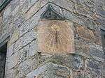
| Aberdour Castle Sundial (formerly at Aberdour House) |
Aberdour |
|
NT1916785371 |
56°03′16″N 3°17′58″W / 56.054341°N 3.299476°W / 56.054341; -3.299476 (Aberdour Castle Sundial (formerly at Aberdour House)) |
16th-century stone sundial[35] |
3637 |
 Upload another image
See more images
|
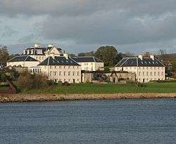
| Donibristle House |
Dalgety Bay |
|
NT1600782863 |
56°01′53″N 3°20′58″W / 56.031269°N 3.349412°W / 56.031269; -3.349412 (Donibristle House) |
18th-century service wings by Alexander McGill, main house demolished[36] |
3647 |
 Upload another image
See more images
|
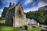
| Donibristle Chapel |
Dalgety Bay |
|
NT1582582784 |
56°01′50″N 3°21′08″W / 56.030528°N 3.352307°W / 56.030528; -3.352307 (Donibristle Chapel) |
Mortuary chapel of Earls of Moray by Alexander McGill, 1731[37] |
3650 |
|
| Fordell Castle |
Near Dalgety Bay |
|
NT1469685388 |
56°03′13″N 3°22′16″W / 56.053717°N 3.371247°W / 56.053717; -3.371247 (Fordell Castle) |
16th-century fortified house[38] |
3652 |
 Upload another image
See more images
|
| Fordell Chapel |
Near Dalgety Bay |
|
NT1465585350 |
56°03′12″N 3°22′19″W / 56.053369°N 3.371893°W / 56.053369; -3.371893 (Fordell Chapel) |
Mortuary chapel of Hendersons of Fordell, dated 1650[39] |
3653 |
|
| St. Bridget's Church |
Dalgety Bay |
|
NT1695683795 |
56°02′23″N 3°20′04″W / 56.039806°N 3.334477°W / 56.039806; -3.334477 (St. Bridget's Church) |
Roofless pre-Reformation church[40] |
3667 |
 Upload another image
|
| Limekilns |
Charlestown, Harbour Road |
|
NT0642283561 |
56°02′09″N 3°30′12″W / 56.03576°N 3.503409°W / 56.03576; -3.503409 (Limekilns) |
Range of fourteen 18th-century lime kilns[41] |
3741 |
|
| Broomhall |
Limekilns |
|
NT0768583683 |
56°02′14″N 3°28′59″W / 56.037102°N 3.483189°W / 56.037102; -3.483189 (Broomhall) |
Neo-Classical mansion by Thomas Harrison, 1796[42] |
3745 |
|
| Pitfirrane Castle |
Crossford |
|
NT0633286113 |
56°03′31″N 3°30′21″W / 56.058664°N 3.505746°W / 56.058664; -3.505746 (Pitfirrane Castle) |
16th-century L-plan tower house[43] |
3759 |
|
| Logie House |
Crossford |
|
NT0781286167 |
56°03′34″N 3°28′55″W / 56.059436°N 3.482007°W / 56.059436; -3.482007 (Logie House) |
16th-century tower house with 19th-century classical remodelling[44] |
3776 |
|
| Logie House, Steading |
Crossford |
|
NT0763086394 |
56°03′41″N 3°29′06″W / 56.06144°N 3.485007°W / 56.06144; -3.485007 (Logie House, Steading) |
Late-18th-century steading and granary[45] |
3777 |
|
| Greenside Farm Steading |
Near Ceres |
|
NO3931407354 |
56°15′17″N 2°58′52″W / 56.2548°N 2.981068°W / 56.2548; -2.981068 (Greenside Farm Steading) |
18th-century farm buildings[46] |
4302 |
|
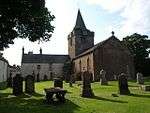
| Abdie Old Parish Kirk (St Magridin) |
Lindores Loch |
|
NO2597916350 |
56°20′01″N 3°11′56″W / 56.333711°N 3.198776°W / 56.333711; -3.198776 (Abdie Old Parish Kirk (St Magridin)) |
Roofless 12th-century church[47] |
4311 |
|
| Wormiston, Doocot |
Near Crail |
|
NO6100609603 |
56°16′38″N 2°37′53″W / 56.277285°N 2.631321°W / 56.277285; -2.631321 (Wormiston, Doocot) |
Early-17th-century rectangular dovecote[48] |
4329 |
|
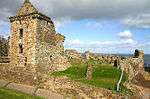
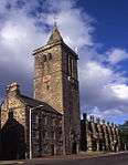
| Aberdour Castle |
Aberdour |
|
NT1924985449 |
56°03′18″N 3°17′53″W / 56.055056°N 3.298183°W / 56.055056; -3.298183 (Aberdour Castle) |
Buildings dating from 12th to 17th centuries, partly ruined[49] |
6421 |
 Upload another image
See more images
|
| East Lodge and gates |
Aberdour, High Street |
|
NT1888485196 |
56°03′10″N 3°18′14″W / 56.052721°N 3.303965°W / 56.052721; -3.303965 (East Lodge and gates) |
Former lodge of Donibristle Estate by J Maitland and Wardrop, 1870[50] |
6632 |
|
| Charleton House |
Colinsburgh |
|
NO4596703892 |
56°13′28″N 2°52′23″W / 56.224505°N 2.872995°W / 56.224505; -2.872995 (Charleton House) |
18th-century country house[51] |
8581 |
 Upload another image
See more images
|
| Balcarres House |
Colinsburgh |
|
NO4740804408 |
56°13′45″N 2°50′59″W / 56.229302°N 2.849861°W / 56.229302; -2.849861 (Balcarres House) |
16th-century Z-plan tower house with 19th-century extensions by William Burn and David Bryce, and 18th-century dower house[52] |
8625 |
|
| Balcarres House, sundial |
Colinsburgh |
|
NO4737704350 |
56°13′44″N 2°51′01″W / 56.228777°N 2.85035°W / 56.228777; -2.85035 (Balcarres House, sundial) |
17th-century sundial from Leuchars Castle[53] |
8627 |
|
| Balcarres House Chapel |
Colinsburgh |
|
NO4752604463 |
56°13′47″N 2°50′53″W / 56.229809°N 2.847969°W / 56.229809; -2.847969 (Balcarres House Chapel) |
Roofless 17th-century Gothic chapel[54] |
8628 |
|
| House of Falkland (St Ninian's RC School) |
Falkland |
|
NO2423807405 |
56°15′11″N 3°13′28″W / 56.25309°N 3.224354°W / 56.25309; -3.224354 (House of Falkland (St Ninian's RC School)) |
Jacobean mansion by William Burn, 1844[55] |
8763 |
|
| Randerston Farm House |
Kingsbarns |
|
NO6086310842 |
56°17′18″N 2°38′02″W / 56.288404°N 2.633814°W / 56.288404; -2.633814 (Randerston Farm House) |
Late-16th-century laird's house[56] |
8796 |
|
| Falkland Palace |
Falkland |
|
NO2534507454 |
56°15′13″N 3°12′23″W / 56.253706°N 3.206506°W / 56.253706; -3.206506 (Falkland Palace) |
Former Royal palace, mostly built in the first half of the 16th century[57] |
8798 |
.JPG) Upload another image
See more images
|
| Falkland Palace, Royal Stables and Tennis Court or Caichpule |
Falkland |
|
NO2538407645 |
56°15′20″N 3°12′21″W / 56.255427°N 3.205931°W / 56.255427; -3.205931 (Falkland Palace, Royal Stables and Tennis Court or Caichpule) |
16th-century ancillary buildings[58] |
8800 |
|
| Kilmany Parish Kirk |
Kilmany |
|
NO3882321749 |
56°23′03″N 2°59′32″W / 56.384045°N 2.992341°W / 56.384045; -2.992341 (Kilmany Parish Kirk) |
18th-century church[59] |
8826 |
|
| Parish Kirk of St Athernase |
Leuchars, Schoolhill |
|
NO4554221394 |
56°22′54″N 2°53′00″W / 56.381679°N 2.88347°W / 56.381679; -2.88347 (Parish Kirk of St Athernase) |
12th-century Romanesque church[60] |
8842 |
|
| Leuchars Castle, Doocot |
Leuchars |
|
NO4521421916 |
56°23′11″N 2°53′20″W / 56.386331°N 2.88889°W / 56.386331; -2.88889 (Leuchars Castle, Doocot) |
17th-century round dovecote[61] |
8851 |
|
| Earlshall Castle |
Leuchars |
|
NO4647521083 |
56°22′44″N 2°52′06″W / 56.378992°N 2.8683°W / 56.378992; -2.8683 (Earlshall Castle) |
16th-century tower house, extended in the 17th century[62] |
8852 |
|
| Earlshall Doocot |
Leuchars |
|
NO4646021001 |
56°22′42″N 2°52′07″W / 56.378254°N 2.868526°W / 56.378254; -2.868526 (Earlshall Doocot) |
late-16th-century rectangular dovecote[63] |
8853 |
|
| Pitcullo Castle |
Near Balmullo |
|
NO4135019280 |
56°21′44″N 2°57′03″W / 56.362187°N 2.950871°W / 56.362187; -2.950871 (Pitcullo Castle) |
Late-16th-century L-plan tower house, extended in the 17th century[64] |
8857 |
|
| Guardbridge (Old) |
Guardbridge, over River Eden |
|
NO4518818877 |
56°21′33″N 2°53′19″W / 56.359028°N 2.888676°W / 56.359028; -2.888676 (Guardbridge (Old)) |
16th-century six-arch stone bridge[65] |
8861 |
 Upload another image
See more images
|
| West Pitkierie Dovecot |
Near Anstruther |
|
NO5551005549 |
56°14′25″N 2°43′10″W / 56.240381°N 2.719387°W / 56.240381; -2.719387 (West Pitkierie Dovecot) |
Later 18th-century octagonal dovecote[66] |
8979 |
|
| Elie House (Convent Of St Marty Reparatrice) |
Elie |
|
NO4954400762 |
56°11′48″N 2°48′53″W / 56.19678°N 2.814718°W / 56.19678; -2.814718 (Elie House (Convent Of St Marty Reparatrice)) |
17th-century mansion with 18th- and 19th-century additions[67] |
9000 |
 Upload another image
See more images
|
| Scotscraig House |
Tayport |
|
NO4446428224 |
56°26′34″N 2°54′09″W / 56.442907°N 2.902376°W / 56.442907; -2.902376 (Scotscraig House) |
17th-century arched gateway[68] |
9004 |
|
| Ballinbreich Castle |
Near Newburgh |
|
NO2718120490 |
56°22′16″N 3°10′50″W / 56.371084°N 3.180488°W / 56.371084; -3.180488 (Ballinbreich Castle) |
Ruins of 14th-century courtyard castle, extended in the 16th and 17th centuries[69] |
9020 |
|
| Lathrisk House |
Near Falkland |
|
NO2732208468 |
56°15′47″N 3°10′30″W / 56.263121°N 3.174885°W / 56.263121; -3.174885 (Lathrisk House) |
18th-century classical mansion[70] |
9042 |
|
| Raith Estate, Raith House |
Kirkcaldy |
|
NT2562591768 |
56°06′46″N 3°11′51″W / 56.112851°N 3.197591°W / 56.112851; -3.197591 (Raith Estate, Raith House) |
Palladian mansion by James Smith, 1694[71] |
9681 |
|
| Raith Estate, Stable Court (Home Farm) |
Kirkcaldy |
|
NT2551891855 |
56°06′49″N 3°11′58″W / 56.113616°N 3.199336°W / 56.113616; -3.199336 (Raith Estate, Stable Court (Home Farm)) |
18th-century stables, possibly by James Playfair[72] |
9682 |
|
| Leslie House |
Leslie |
|
NO2596801833 |
56°12′12″N 3°11′42″W / 56.203313°N 3.194881°W / 56.203313; -3.194881 (Leslie House) |
17th-century classical house by John Mylne and William Bruce[73] |
9693 |
|
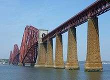
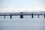
| Forth Bridge [note 3] |
North Queensferry, across the Firth of Forth |
|
NT1355479252 |
55°59′54″N 3°23′15″W / 55.998399°N 3.387599°W / 55.998399; -3.387599 (Forth Bridge [note 3]) |
Cantilevered railway viaduct, designed by Sir John Fowler and Sir Benjamin Baker, and completed in 1890[74] |
9977 |
 Upload another image
See more images
|
| North Queensferry, Town Pier |
North Queensferry |
|
NT1309680274 |
56°00′27″N 3°23′43″W / 56.007495°N 3.39527°W / 56.007495; -3.39527 (North Queensferry, Town Pier) |
Pier built by John Rennie, 1813, and extended by Thomas Telford, 1834[75] |
9978 |
|
| Old Duloch House |
Duloch |
|
NT1341285475 |
56°03′15″N 3°23′31″W / 56.054268°N 3.391885°W / 56.054268; -3.391885 (Old Duloch House) |
18th-century classical mansion[76] |
9981 |
|
| North Queensferry, Pierhead, Lantern Tower |
North Queensferry |
|
NT1312980359 |
56°00′30″N 3°23′41″W / 56.008265°N 3.394769°W / 56.008265; -3.394769 (North Queensferry, Pierhead, Lantern Tower) |
Small hexagonal lighthouse by John Rennie, circa 1812[77] |
9998 |
|
| Melville House |
Monimail, Ladybank |
|
NO2989313801 |
56°18′41″N 3°08′05″W / 56.311411°N 3.134807°W / 56.311411; -3.134807 (Melville House) |
Late-17th-century country house by James Smith[78] |
15448 |
|
| Cunnoquhie House |
Letham |
|
NO3131215227 |
56°19′28″N 3°06′44″W / 56.324429°N 3.112248°W / 56.324429; -3.112248 (Cunnoquhie House) |
Late-18th- or early-19th-century classical mansion[79] |
15469 |
|
| Over Rankeilour House |
Letham |
|
NO3285313569 |
56°18′35″N 3°05′13″W / 56.309757°N 3.086912°W / 56.309757; -3.086912 (Over Rankeilour House) |
Late-18th-century classical mansion[80] |
15486 |
|
| Monimail Tower or Palace (also known as Cardinal Beaton's Tower) |
Monimail, Ladybank |
|
NO2983914092 |
56°18′50″N 3°08′09″W / 56.314017°N 3.135758°W / 56.314017; -3.135758 (Monimail Tower or Palace (also known as Cardinal Beaton's Tower)) |
16th-century tower house[81] |
15498 |
|
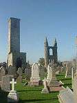
| St Monans Church and Churchyard |
St Monans |
|
NO5226501443 |
56°12′11″N 2°46′16″W / 56.203179°N 2.770995°W / 56.203179; -2.770995 (St Monans Church and Churchyard) |
14th-century church with 19th- and 20th-century alterations[82] |
15558 |
 Upload another image
See more images
|
| Pitcairlie House |
Near Lindores |
|
NO2385514992 |
56°19′16″N 3°13′58″W / 56.321177°N 3.232726°W / 56.321177; -3.232726 (Pitcairlie House) |
16th-century tower house with 18th-century extensions[83] |
15565 |
|
| Town Hall Steeple |
Strathmiglo, High Street |
|
NO2149110241 |
56°16′41″N 3°16′10″W / 56.278117°N 3.269521°W / 56.278117; -3.269521 (Town Hall Steeple) |
18th-century steeple attached to later town hall[84] |
15754 |
|
| Pitlour House |
Strathmiglo |
|
NO2091511155 |
56°17′10″N 3°16′45″W / 56.286231°N 3.279095°W / 56.286231; -3.279095 (Pitlour House) |
18th-century house by Robert Mylne[85] |
15768 |
|
| Strathtyrum House |
Strathtyrum, St Andrews |
|
NO4901117245 |
56°20′41″N 2°49′35″W / 56.344796°N 2.826494°W / 56.344796; -2.826494 (Strathtyrum House) |
18th-century country house[86] |
15817 |
|
| Kenly Green House |
Boarhills, Kingsbarns |
|
NO5682013768 |
56°18′52″N 2°41′59″W / 56.314338°N 2.6996°W / 56.314338; -2.6996 (Kenly Green House) |
Late-18th-century country house[87] |
15841 |
|
| Peekie Bridge over Kenly Water |
Boarhills, Kingsbarns |
|
NO5604212636 |
56°18′15″N 2°42′43″W / 56.304097°N 2.711986°W / 56.304097; -2.711986 (Peekie Bridge over Kenly Water) |
16th-century single-arch bridge[88] |
15844 |
|
| Tulliallan Castle (Scottish Police College) |
Kincardine |
|
NS9362188072 |
56°04′25″N 3°42′38″W / 56.073598°N 3.710548°W / 56.073598; -3.710548 (Tulliallan Castle (Scottish Police College)) |
Castellated Gothic mansion, 1820, by William Atkinson[89] |
16585 |
|
| Balgonie Castle |
Milton of Balgonie |
|
NO3125000692 |
56°11′38″N 3°06′34″W / 56.193857°N 3.109465°W / 56.193857; -3.109465 (Balgonie Castle) |
Late-14th- and early-15th-century courtyard castle, with later additions[90] |
16664 |
|
| Balbirnie House |
Glenrothes |
|
NO2901102479 |
56°12′34″N 3°08′46″W / 56.20958°N 3.146016°W / 56.20958; -3.146016 (Balbirnie House) |
Greek revival house by Richard Crichton, 1817[91] |
16687 |
|
| Durie House |
Leven |
|
NO3732402598 |
56°12′43″N 3°00′43″W / 56.211818°N 3.012054°W / 56.211818; -3.012054 (Durie House) |
Classical mansion of 1762[92] |
16699 |
|
| Wemyss Castle |
West Wemyss |
|
NT3293095150 |
56°08′40″N 3°04′52″W / 56.144314°N 3.080998°W / 56.144314; -3.080998 (Wemyss Castle) |
Late-15th-century house with many later additions[93] |
16709 |
 Upload another image
See more images
|
| Old Tulliallan Castle |
Kincardine |
|
NS9269688776 |
56°04′47″N 3°43′32″W / 56.079713°N 3.725683°W / 56.079713; -3.725683 (Old Tulliallan Castle) |
14th-century hall house, enlarged in the 17th century[94] |
17144 |
|
| Cunnoquhie Former Stable Block |
Letham |
|
NO3124515234 |
56°19′28″N 3°06′48″W / 56.324482°N 3.113333°W / 56.324482; -3.113333 (Cunnoquhie Former Stable Block) |
Early-19th-century classical stable block with clock tower[95] |
19749 |
|
| 6-9 (Inclusive Nos) Broomhill |
Burntisland |
|
NT2319185931 |
56°03′36″N 3°14′06″W / 56.060035°N 3.235043°W / 56.060035; -3.235043 (6-9 (Inclusive Nos) Broomhill) |
Gothic semi-detached houses by F T Pilkington, dated 1858[96] |
22752 |
|
| Burntisland Parish Church |
Burntisland, East Leven Street |
|
NT2335085712 |
56°03′29″N 3°13′57″W / 56.058093°N 3.232427°W / 56.058093; -3.232427 (Burntisland Parish Church) |
Late-16th-century church, the first post-Reformation church built in Scotland[97] |
22777 |
|
| Crail Parish Church |
Crail, Marketgate |
|
NO6133907976 |
56°15′46″N 2°37′33″W / 56.262696°N 2.625705°W / 56.262696; -2.625705 (Crail Parish Church) |
Oldest parts c. 1160, tower c. 1200, later rebuilding[98] |
23244 |
 Upload another image
See more images
|
| Crail Parish Churchyard Walls and Gravestones |
Crail, Marketgate |
|
NO6136607986 |
56°15′46″N 2°37′31″W / 56.262788°N 2.625271°W / 56.262788; -2.625271 (Crail Parish Churchyard Walls and Gravestones) |
Churchyard with mural monuments dating from 16th and 17th century[99] |
23245 |
|
| Kirkmay House Hotel |
Crail, Marketgate |
|
NO6132907906 |
56°15′43″N 2°37′33″W / 56.262066°N 2.625856°W / 56.262066; -2.625856 (Kirkmay House Hotel) |
Classical town house of 1817[100] |
23251 |
 Upload another image
|
| Friar's Court |
Crail, Marketgate |
|
NO6134107865 |
56°15′42″N 2°37′32″W / 56.261699°N 2.625656°W / 56.261699; -2.625656 (Friar's Court) |
17th-century town house[101] |
23253 |
 Upload another image
|
| The Tolbooth and Town Hall |
Crail, Marketgate |
|
NO6131507773 |
56°15′39″N 2°37′34″W / 56.26087°N 2.626063°W / 56.26087; -2.626063 (The Tolbooth and Town Hall) |
16th-century tolbooth tower and 19th-century town hall[102] |
23287 |
|
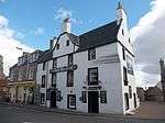
| The Golf Hotel |
Crail, High Street |
|
NO6128207739 |
56°15′38″N 2°37′36″W / 56.260562°N 2.62659°W / 56.260562; -2.62659 (The Golf Hotel) |
Large 18th-century town house[103] |
23290 |
 Upload another image
See more images
|
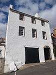
| 35 Shoregate (The Custom House) |
Crail |
|
NO6118907428 |
56°15′28″N 2°37′41″W / 56.25776°N 2.628046°W / 56.25776; -2.628046 (35 Shoregate (The Custom House)) |
Late-17th-century warehouse[104] |
23378 |
 Upload another image
See more images
|
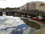
| Crail Harbour |
Crail |
|
NO6115907405 |
56°15′27″N 2°37′43″W / 56.257551°N 2.628526°W / 56.257551; -2.628526 (Crail Harbour) |
Medieval harbour with later rebuilding, west pier by Robert Stevenson, 1828[105] |
23398 |
|
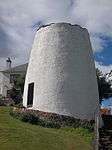
| Priory Doocot, off Nethergate |
Crail |
|
NO6159507823 |
56°15′41″N 2°37′18″W / 56.261342°N 2.62155°W / 56.261342; -2.62155 (Priory Doocot, off Nethergate) |
16th-century circular dovecote[106] |
23445 |
 Upload another image
See more images
|
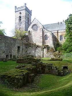
| Culross Abbey Church |
Culross |
|
NS9888486246 |
56°03′30″N 3°37′31″W / 56.058341°N 3.625347°W / 56.058341; -3.625347 (Culross Abbey Church) |
13th-century abbey church with many later additions[107] |
23960 |
 Upload another image
See more images
|
| Culross Abbey House |
Culross |
|
NS9894286251 |
56°03′30″N 3°37′28″W / 56.058398°N 3.624418°W / 56.058398; -3.624418 (Culross Abbey House) |
Country house built 1608, with later developments, remodelled 1952 by Robert Hurd & Partners[108] |
23964 |
|
| Culross Abbey House, Garden House |
Culross |
|
NS9910186259 |
56°03′31″N 3°37′19″W / 56.058504°N 3.621869°W / 56.058504; -3.621869 (Culross Abbey House, Garden House) |
17th-century garden building[109] |
23965 |
|
| West Kirk |
Culross |
|
NS9795386485 |
56°03′37″N 3°38′25″W / 56.06029°N 3.640382°W / 56.06029; -3.640382 (West Kirk) |
Remains of 16th-century church[110] |
23969 |
 Upload another image
See more images
|
| Culross Palace |
Culross |
|
NS9851585951 |
56°03′20″N 3°37′52″W / 56.055614°N 3.631158°W / 56.055614; -3.631158 (Culross Palace) |
Late-16th-century T-plan town house[111] |
23983 |
 Upload another image
See more images
|
| Culross Town House |
Culross |
|
NS9857285916 |
56°03′19″N 3°37′49″W / 56.055311°N 3.63023°W / 56.055311; -3.63023 (Culross Town House) |
17th-century town hall with 18th-century clock tower[112] |
23994 |
 Upload another image
|
| Culross Mercat Cross |
Culross |
|
NS9868385948 |
56°03′20″N 3°37′42″W / 56.055622°N 3.628461°W / 56.055622; -3.628461 (Culross Mercat Cross) |
16th-century market cross, shaft replaced 1902[113] |
24000 |
|
| Bishop Leighton's House |
Culross, 5 Mid Causeway |
|
NS9866685917 |
56°03′19″N 3°37′43″W / 56.05534°N 3.628722°W / 56.05534; -3.628722 (Bishop Leighton's House) |
Early-17th-century town house[114] |
24006 |
|
| The Study |
Culross |
|
NS9867585962 |
56°03′21″N 3°37′43″W / 56.055746°N 3.628594°W / 56.055746; -3.628594 (The Study) |
Early-17th-century town house[115] |
24045 |
|
| Old St Michael of Tarvit Parish Church |
Cupar, Kirkgate |
|
NO3730214336 |
56°19′02″N 3°00′55″W / 56.317257°N 3.015198°W / 56.317257; -3.015198 (Old St Michael of Tarvit Parish Church) |
15th-century church with later additions[116] |
24136 |
|
| Preston Lodge |
Cupar, 95 Bonnygate |
|
NO3721414571 |
56°19′10″N 3°01′00″W / 56.319356°N 3.016676°W / 56.319356; -3.016676 (Preston Lodge) |
17th-century townhouse[117] |
24242 |
|
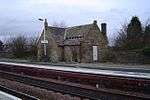
| Goods Shed at Cupar railway station |
Cupar, Station Road |
|
NO3779514511 |
56°19′08″N 3°00′26″W / 56.318894°N 3.007271°W / 56.318894; -3.007271 (Goods Shed at Cupar railway station) |
Goods shed built 1847[118] |
24293 |
|
| Dunfermline Abbey, Nave |
Dunfermline |
|
NT0896487310 |
56°04′12″N 3°27′50″W / 56.069923°N 3.463903°W / 56.069923; -3.463903 (Dunfermline Abbey, Nave) |
12th-century abbey church, with later rebuilding[119] |
25960 |
|
| Dunfermline Abbey, New Abbey Parish Church |
Dunfermline |
|
NT0896487310 |
56°04′12″N 3°27′50″W / 56.069923°N 3.463903°W / 56.069923; -3.463903 (Dunfermline Abbey, New Abbey Parish Church) |
Gothic Revival church by William Burn, 1821, adjoining abbey nave[120] |
25961 |
|
| Dunfermline Abbey, Gatehouse |
Dunfermline |
|
NT0894087254 |
56°04′10″N 3°27′51″W / 56.069416°N 3.46427°W / 56.069416; -3.46427 (Dunfermline Abbey, Gatehouse) |
Gatehouse c. 1500, altered in the late 19th century[121] |
25963 |
_Dunfermline_Abbey%2C_Dunfermline.jpg) Upload another image
See more images
|
| Dunfermline Abbey, Remains of Palace and Kitchen |
Dunfermline |
|
NT0891987261 |
56°04′10″N 3°27′53″W / 56.069474°N 3.464609°W / 56.069474; -3.464609 (Dunfermline Abbey, Remains of Palace and Kitchen) |
Remains of 14th-century palace, extended 1500 and rebuilt 1540[122] |
25965 |
|
| Pittencrieff Park, Pittencrieff House |
Dunfermline |
|
NT0874887215 |
56°04′09″N 3°28′02″W / 56.069029°N 3.467339°W / 56.069029; -3.467339 (Pittencrieff Park, Pittencrieff House) |
17th-century laird's house[123] |
25968 |
 Upload another image
See more images
|
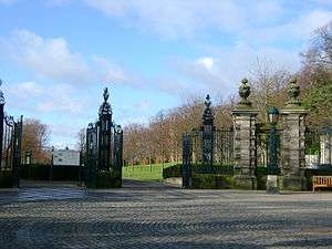
| Pittencrieff Park, Louise Carnegie Memorial Gateway |
Dunfermline |
|
NT0881887440 |
56°04′16″N 3°27′59″W / 56.071063°N 3.466292°W / 56.071063; -3.466292 (Pittencrieff Park, Louise Carnegie Memorial Gateway) |
Wrought-iron gates installed 1929[124] |
25972 |
 Upload another image
See more images
|
| Dunfermline City Chambers |
Dunfermline, Bridge Street |
|
NT0895287412 |
56°04′15″N 3°27′51″W / 56.070837°N 3.464131°W / 56.070837; -3.464131 (Dunfermline City Chambers) |
Baronial town hall by J C Walker, 1879[125] |
25973 |
|
| Abbot House |
Dunfermline, Abbot Street |
|
NT0903687379 |
56°04′14″N 3°27′46″W / 56.070557°N 3.462771°W / 56.070557; -3.462771 (Abbot House) |
Later 16th-century town house, converted to heritage centre 1995[126] |
25978 |
 Upload another image
See more images
|
| Former Guildhall |
Dunfermline, High Street |
|
NT0912587451 |
56°04′16″N 3°27′41″W / 56.07122°N 3.461366°W / 56.07122; -3.461366 (Former Guildhall) |
Guildhall by Archibald Elliot, completed 1811[127] |
25999 |
 Upload another image
See more images
|
| Hill House |
Dunfermline, Limekilns Road |
|
NT0913385957 |
56°03′28″N 3°27′39″W / 56.057803°N 3.46073°W / 56.057803; -3.46073 (Hill House) |
Earlier 17th-century laird's house[128] |
26050 |
|
| Pitreavie Castle |
Dunfermline |
|
NT1175284859 |
56°02′54″N 3°25′06″W / 56.048432°N 3.418326°W / 56.048432; -3.418326 (Pitreavie Castle) |
Early-17th-century laird's house, extended 1885 by Charles Kinnear[129] |
26058 |
 Upload another image
See more images
|
| Rosyth Castle |
Rosyth |
|
NT1087082098 |
56°01′24″N 3°25′54″W / 56.023469°N 3.431563°W / 56.023469; -3.431563 (Rosyth Castle) |
Late-15th-century tower house with later additions[130] |
26060 |
 Upload another image
See more images
|
| Rosyth Castle, Dovecot |
Rosyth |
|
NT1102382233 |
56°01′29″N 3°25′45″W / 56.02471°N 3.429154°W / 56.02471; -3.429154 (Rosyth Castle, Dovecot) |
16th-century square-plan dovecote[131] |
26061 |
|
| Pilmuir Works |
Dunfermline, Pilmuir Street |
|
NT0909187789 |
56°04′27″N 3°27′43″W / 56.074249°N 3.462027°W / 56.074249; -3.462027 (Pilmuir Works) |
Textile factory, warehouses and offices by Thomas Hyslop Ure, 1883 to 1901[132] |
26073 |
|
| Elie Castle |
Elie, South Street |
|
NT4909299963 |
56°11′22″N 2°49′19″W / 56.189554°N 2.821848°W / 56.189554; -2.821848 (Elie Castle) |
17th-century L-plan house[133] |
31029 |
|
| Moncrief House |
Falkland, High Street |
|
NO2534007414 |
56°15′12″N 3°12′24″W / 56.253346°N 3.206576°W / 56.253346; -3.206576 (Moncrief House) |
17th-century town house[134] |
31274 |
|
| Falkland Town Hall |
Falkland, High Street |
|
NO2528507392 |
56°15′11″N 3°12′27″W / 56.253139°N 3.207457°W / 56.253139; -3.207457 (Falkland Town Hall) |
Classical town hall by Thomas Barclay, 1800[135] |
31277 |
|
| Brunton House |
Falkland, Brunton Street |
|
NO2523907311 |
56°15′09″N 3°12′29″W / 56.252405°N 3.208176°W / 56.252405; -3.208176 (Brunton House) |
Town house dated 1712[136] |
31328 |
|
| Inverkeithing Town House |
Inverkeithing, Townhall Street |
|
NT1304082924 |
56°01′53″N 3°23′49″W / 56.031287°N 3.397027°W / 56.031287; -3.397027 (Inverkeithing Town House) |
18th-century town hall[137] |
35087 |
 Upload another image
See more images
|
| Inverkeithing Mercat Cross |
Inverkeithing, Bank Street |
|
NT1301082872 |
56°01′51″N 3°23′51″W / 56.030815°N 3.397492°W / 56.030815; -3.397492 (Inverkeithing Mercat Cross) |
16th-century market cross[138] |
35088 |
|
| Thomson's House |
Inverkeithing, Bank Street |
|
NT1304282890 |
56°01′52″N 3°23′49″W / 56.030982°N 3.396984°W / 56.030982; -3.396984 (Thomson's House) |
17th-century town house[139] |
35090 |
|
| The Friary |
Inverkeithing, Queen Street |
|
NT1294982757 |
56°01′47″N 3°23′54″W / 56.029771°N 3.398433°W / 56.029771; -3.398433 (The Friary) |
Part of 14th-century, remodelled as tenement in the 17th century and converted into a museum in the 1930s[140] |
35100 |
|
| Fordell's Lodging |
Inverkeithing, Church Street |
|
NT1301882973 |
56°01′54″N 3°23′51″W / 56.031724°N 3.397396°W / 56.031724; -3.397396 (Fordell's Lodging) |
17th-century town house[141] |
35103 |
|
| Innergellie House |
Kilrenny |
|
NO5748605098 |
56°14′11″N 2°41′15″W / 56.236511°N 2.687436°W / 56.236511; -2.687436 (Innergellie House) |
Unusual 18th-century baroque house[142] |
36005 |
|
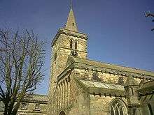
| Anstruther Easter Parish Church (St Adrian's) |
Anstruther Easter |
|
NO5665403727 |
56°13′27″N 2°42′02″W / 56.224119°N 2.700632°W / 56.224119; -2.700632 (Anstruther Easter Parish Church (St Adrian's)) |
17th-century T-plan church[143] |
36066 |
 Upload another image
See more images
|
| The Manse |
Anstruther Easter, Backdykes |
|
NO5680503625 |
56°13′24″N 2°41′53″W / 56.223216°N 2.698181°W / 56.223216; -2.698181 (The Manse) |
Late-16th-century house, the oldest inhabited manse in Scotland[144] |
36072 |
 Upload another image
|
| Scottish Fisheries Museum |
Anstruther Easter, Harbour Head |
|
NO5687903483 |
56°13′19″N 2°41′49″W / 56.221947°N 2.696964°W / 56.221947; -2.696964 (Scottish Fisheries Museum) |
Group of commercial buildings dating from 16th to 19th centuries, a museum since 1970[145] |
36169 |
|
| Anstruther Wester Parish Church (now St Adrian's Church Hall) |
Anstruther Wester |
|
NO5644403532 |
56°13′20″N 2°42′14″W / 56.222348°N 2.703987°W / 56.222348; -2.703987 (Anstruther Wester Parish Church (now St Adrian's Church Hall)) |
16th-century church[146] |
36191 |
 Upload another image
See more images
|
| The White House |
Anstruther Wester, 1 The Esplanade |
|
NO5649603497 |
56°13′19″N 2°42′11″W / 56.222038°N 2.703142°W / 56.222038; -2.703142 (The White House) |
18th-century townhouse[147] |
36197 |
|
| Bowbutts House |
Kinghorn, Bruce Terrace |
|
NT2702887367 |
56°04′25″N 3°10′26″W / 56.073535°N 3.173832°W / 56.073535; -3.173832 (Bowbutts House) |
Late-18th-century townhouse[148] |
36267 |
|
| 339–343 (Odd Nos) High Street |
Kirkcaldy |
|
NT2830691801 |
56°06′49″N 3°09′16″W / 56.113558°N 3.154498°W / 56.113558; -3.154498 (339–343 (Odd Nos) High Street) |
17th-century townhouse[149] |
36354 |
|
| Sailor's Walk |
Kirkcaldy, High Street |
|
NT2842892041 |
56°06′57″N 3°09′09″W / 56.115732°N 3.152601°W / 56.115732; -3.152601 (Sailor's Walk) |
15th-century house, rebuilt in the 17th century. Said to be the oldest building in Kirkcaldy[150] |
36358 |
 Upload another image
See more images
|
| Pathhead Medical Centre, Path House |
Kirkcaldy, Nether Street |
|
NT2874192460 |
56°07′10″N 3°08′52″W / 56.119543°N 3.14768°W / 56.119543; -3.14768 (Pathhead Medical Centre, Path House) |
Late-17th-century house, renovated as a medical centre[151] |
36399 |
 Upload another image
See more images
|
| Former Scottish Linoleum Works, South Factory (Nairn's Linoleum Works) |
Kirkcaldy, Den Road |
|
NT2859992800 |
56°07′21″N 3°09′00″W / 56.122576°N 3.150055°W / 56.122576; -3.150055 (Former Scottish Linoleum Works, South Factory (Nairn's Linoleum Works)) |
Late-19th-century factory[152] |
36400 |
|
| Ravenscraig Castle |
Ravenscraig, Kirkcaldy |
|
NT2906892489 |
56°07′11″N 3°08′33″W / 56.119852°N 3.14243°W / 56.119852; -3.14243 (Ravenscraig Castle) |
Mid 15th-century castle[153] |
36404 |
 Upload another image
See more images
|
| Ravenscraig Park, Dovecot |
Ravenscraig, Kirkcaldy |
|
NT2932092490 |
56°07′12″N 3°08′18″W / 56.119899°N 3.138378°W / 56.119899; -3.138378 (Ravenscraig Park, Dovecot) |
Late-16th-century beehive dovecot[154] |
36405 |
|
| Bay House |
Dysart, Panhall |
|
NT3033592924 |
56°07′26″N 3°07′20″W / 56.123946°N 3.12217°W / 56.123946; -3.12217 (Bay House) |
16th-century house, restored in 1969 as part of the National Trust for Scotland Little Houses Scheme[155] |
36407 |
|
| The Anchorage |
Dysart, Shore Road |
|
NT3041692980 |
56°07′28″N 3°07′15″W / 56.124461°N 3.120882°W / 56.124461; -3.120882 (The Anchorage) |
16th-century house, restored in the 1960s[156] |
36414 |
|
| St Serf's Kirk |
Dysart, Panhall |
|
NT3034492951 |
56°07′27″N 3°07′19″W / 56.12419°N 3.122032°W / 56.12419; -3.122032 (St Serf's Kirk) |
Ruined church of circa 1500[157] |
36415 |
|
| Dysart Tolbooth and Town Hall |
Dysart, Victoria Street |
|
NT3041193161 |
56°07′34″N 3°07′16″W / 56.126086°N 3.12101°W / 56.126086; -3.12101 (Dysart Tolbooth and Town Hall) |
16th-century municipal buildings, rebuilt in the 18th century[158] |
36418 |
|
| St David's |
Dysart, Fitzroy Square |
|
NT3029593063 |
56°07′31″N 3°07′22″W / 56.125189°N 3.12285°W / 56.125189; -3.12285 (St David's) |
Late-16th-century townhouse[159] |
36425 |
|
| The Towers |
Dysart, East Quality Street |
|
NT3028793234 |
56°07′36″N 3°07′23″W / 56.126724°N 3.123023°W / 56.126724; -3.123023 (The Towers) |
16th-century house[160] |
36434 |
|
| Ladybank Station (Main West Block) |
Ladybank |
|
NO3063509645 |
56°16′27″N 3°07′18″W / 56.274189°N 3.121722°W / 56.274189; -3.121722 (Ladybank Station (Main West Block)) |
Mid 19th-century station in picturesque classical style[161] |
36925 |
 Upload another image
See more images
|
| St Drostan's Parish Church |
Markinch |
|
NO2974501967 |
56°12′18″N 3°08′03″W / 56.20509°N 3.13405°W / 56.20509; -3.13405 (St Drostan's Parish Church) |
18th-century church with Norman tower of circa 1200[162] |
37644 |
|
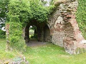
| Lindores Abbey |
Lindores |
|
NO2439018475 |
56°21′09″N 3°13′30″W / 56.352547°N 3.225081°W / 56.352547; -3.225081 (Lindores Abbey) |
Remains of 12th-century monastery[163] |
38479 |
 Upload another image
See more images
|
| Lindores Abbey, detached section south of roadway |
Lindores |
|
NO2445418380 |
56°21′06″N 3°13′26″W / 56.351704°N 3.224018°W / 56.351704; -3.224018 (Lindores Abbey, detached section south of roadway) |
Remains of 12th-century monastery[164] |
38480 |
 Upload another image
See more images
|
| Pittenweem Parish Church |
Pittenweem, High Street |
|
NO5491202601 |
56°12′50″N 2°43′43″W / 56.213841°N 2.728531°W / 56.213841; -2.728531 (Pittenweem Parish Church) |
16th-century church[165] |
39868 |
|
| The Priory |
Pittenweem, Marygate |
|
NO5495602573 |
56°12′49″N 2°43′40″W / 56.213593°N 2.727817°W / 56.213593; -2.727817 (The Priory) |
16th-century and later buildings, now used as houses and town hall[166] |
39871 |
|
| The Priory, Gatehouse |
Pittenweem |
|
NO5497402602 |
56°12′50″N 2°43′39″W / 56.213856°N 2.727532°W / 56.213856; -2.727532 (The Priory, Gatehouse) |
15th-century gatehouse[167] |
39872 |
|
| Kelly Lodge |
Pittenweem, High Street |
|
NO5483302557 |
56°12′48″N 2°43′47″W / 56.213438°N 2.729797°W / 56.213438; -2.729797 (Kelly Lodge) |
16th-century townhouse, rebuilt in the 1960s[168] |
39905 |
|
| Gyles House |
Pittenweem, The Gyles |
|
NO5506302448 |
56°12′45″N 2°43′34″W / 56.212481°N 2.726071°W / 56.212481; -2.726071 (Gyles House) |
17th-century sea-captain's house[169] |
39959 |
|
| 4-6 The Gyles |
Pittenweem |
|
NO5505802473 |
56°12′46″N 2°43′34″W / 56.212705°N 2.726156°W / 56.212705; -2.726156 (4-6 The Gyles) |
Late-16th-century townhouse[170] |
39961 |
|
| 18 East Shore |
Pittenweem |
|
NO5493902488 |
56°12′46″N 2°43′41″W / 56.212828°N 2.728077°W / 56.212828; -2.728077 (18 East Shore) |
Late-17th-century townhouse[171] |
39978 |
|
| St Andrews Cathedral |
St Andrews |
|
NO5141516687 |
56°20′24″N 2°47′15″W / 56.340036°N 2.787504°W / 56.340036; -2.787504 (St Andrews Cathedral) |
Ruin of 13th-century church[172] |
40585 |
 Upload another image
See more images
|
| St Andrews Priory |
St Andrews |
|
NO5141316619 |
56°20′22″N 2°47′15″W / 56.339425°N 2.787523°W / 56.339425; -2.787523 (St Andrews Priory) |
Ruin of 13th-century monastery[173] |
40586 |
|
| St Andrews Cathedral Graveyard |
St Andrews |
|
NO5145916661 |
56°20′23″N 2°47′12″W / 56.339807°N 2.786787°W / 56.339807; -2.786787 (St Andrews Cathedral Graveyard) |
Monuments of 16th century and later[174] |
40587 |
|
| St Rule's Church |
St Andrews |
|
NO5147516648 |
56°20′23″N 2°47′11″W / 56.339692°N 2.786526°W / 56.339692; -2.786526 (St Rule's Church) |
Ruin of 11th or 12th-century church[175] |
40588 |
|
| St Andrews Cathedral Precinct Wall |
St Andrews |
|
NO5143716581 |
56°20′21″N 2°47′14″W / 56.339086°N 2.787128°W / 56.339086; -2.787128 (St Andrews Cathedral Precinct Wall) |
14th-century walls with three gates and 13 towers[176] |
40589 |
|
| The Pend |
St Andrews, South Street |
|
NO5131216642 |
56°20′23″N 2°47′21″W / 56.339621°N 2.789161°W / 56.339621; -2.789161 (The Pend) |
14th-century gatehouse[177] |
40590 |
|
| St Andrews Harbour |
St Andrews |
|
NO5165516607 |
56°20′22″N 2°47′01″W / 56.339342°N 2.783607°W / 56.339342; -2.783607 (St Andrews Harbour) |
Medieval pier and harbour, repeatedly rebuilt and expanded until the 19th century[178] |
40596 |
 Upload another image
See more images
|
| St Andrews Castle |
St Andrews |
|
NO5126016935 |
56°20′32″N 2°47′24″W / 56.342248°N 2.790057°W / 56.342248; -2.790057 (St Andrews Castle) |
14th-century castle largely rebuilt in the 16th century[179] |
40599 |
 Upload another image
See more images
|
| The Roundel |
St Andrews, South Street |
|
NO5129516675 |
56°20′24″N 2°47′22″W / 56.339916°N 2.789442°W / 56.339916; -2.789442 (The Roundel) |
16th and 17th-century townhouse[180] |
40600 |
|
| 3 South Street |
St Andrews |
|
NO5128516673 |
56°20′24″N 2°47′23″W / 56.339897°N 2.789604°W / 56.339897; -2.789604 (3 South Street) |
16th and 17th-century townhouse[181] |
40601 |
|
| 67, 69 South Street |
St Andrews |
|
NO5104316661 |
56°20′23″N 2°47′37″W / 56.339764°N 2.793515°W / 56.339764; -2.793515 (67, 69 South Street) |
16th-century townhouse[182] |
40623 |
|
| 71 South Street |
St Andrews |
|
NO5103116663 |
56°20′23″N 2°47′37″W / 56.339781°N 2.79371°W / 56.339781; -2.79371 (71 South Street) |
16th or 17th-century townhouse[183] |
40624 |
|
| Holy Trinity Church |
St Andrews, South Street |
|
NO5091716665 |
56°20′23″N 2°47′44″W / 56.339787°N 2.795554°W / 56.339787; -2.795554 (Holy Trinity Church) |
15th-century church[184] |
40633 |
 Upload another image
See more images
|
| Queen Mary's House |
St Andrews, South Street |
|
NO5126616634 |
56°20′22″N 2°47′24″W / 56.339545°N 2.789904°W / 56.339545; -2.789904 (Queen Mary's House) |
16th-century townhouse[185] |
40662 |
|
| St Leonard's Chapel |
St Andrews, South Street |
|
NO5127216602 |
56°20′21″N 2°47′23″W / 56.339258°N 2.789801°W / 56.339258; -2.789801 (St Leonard's Chapel) |
Chapel circa 1200, rebuilt in the 16th century[186] |
40666 |
|
| South Court |
St Andrews, South Street |
|
NO5114716604 |
56°20′21″N 2°47′31″W / 56.339263°N 2.791823°W / 56.339263; -2.791823 (South Court) |
15th to 17th-century townhouse[187] |
40676 |
|
| St Mary's College |
St Andrews, South Street |
|
NO5097216586 |
56°20′21″N 2°47′41″W / 56.339083°N 2.79465°W / 56.339083; -2.79465 (St Mary's College) |
16th-century college buildings[188] |
40686 |
 Upload another image
See more images
|
| University Library Original Building |
St Andrews, South Street |
|
NO5102116588 |
56°20′21″N 2°47′38″W / 56.339106°N 2.793858°W / 56.339106; -2.793858 (University Library Original Building) |
17th-century library[189] |
40687 |
|
| Madras College Main Building |
St Andrews, South Street |
|
NO5077316438 |
56°20′16″N 2°47′52″W / 56.337733°N 2.797841°W / 56.337733; -2.797841 (Madras College Main Building) |
College building of 1832 by William Burn[190] |
40703 |
|
| West Port (Southgait Port) |
St Andrews |
|
NO5059616550 |
56°20′19″N 2°48′03″W / 56.338721°N 2.800724°W / 56.338721; -2.800724 (West Port (Southgait Port)) |
16th-century gatehouse[191] |
40723 |
|
| Dean's Court |
St Andrews, North Street |
|
NO5129016723 |
56°20′25″N 2°47′22″W / 56.340347°N 2.789532°W / 56.340347; -2.789532 (Dean's Court) |
Early-16th-century manse[192] |
40756 |
|
| 71 North Street |
St Andrews |
|
NO5102416837 |
56°20′29″N 2°47′38″W / 56.341343°N 2.793856°W / 56.341343; -2.793856 (71 North Street) |
15th-century and later townhouse[193] |
40770 |
|
| St Salvator's Chapel |
St Andrews, North Street |
|
NO5099716844 |
56°20′29″N 2°47′39″W / 56.341403°N 2.794294°W / 56.341403; -2.794294 (St Salvator's Chapel) |
15th-century church with later alterations[194] |
40771 |
 Upload another image
See more images
|
| All Saint's Episcopal Church |
St Andrews, North Castle Street |
|
NO5119416809 |
56°20′28″N 2°47′28″W / 56.341109°N 2.791101°W / 56.341109; -2.791101 (All Saint's Episcopal Church) |
Early-20th-century Gothic church by John Douglas[195] |
40861 |
|
| 11, 13 College Street |
St Andrews |
|
NO5096116784 |
56°20′27″N 2°47′42″W / 56.340861°N 2.794865°W / 56.340861; -2.794865 (11, 13 College Street) |
16th-century townhouse[196] |
40868 |
|
| Bogward Dovecot |
St Andrews |
|
NO4918215593 |
56°19′48″N 2°49′24″W / 56.329974°N 2.823409°W / 56.329974; -2.823409 (Bogward Dovecot) |
16th-century beehive doocot[197] |
40932 |
|
| Beam-Engine House |
Thornton |
|
NT2919397269 |
56°09′46″N 3°08′30″W / 56.162808°N 3.141692°W / 56.162808; -3.141692 (Beam-Engine House) |
Early-19th-century classical engine house[198] |
42992 |
|
| East and West Battery Piers |
North Queensferry, Battery Road |
|
NT1338780174 |
56°00′24″N 3°23′26″W / 56.00665°N 3.390573°W / 56.00665; -3.390573 (East and West Battery Piers) |
Early-19th-century piers by John Rennie the Elder[199] |
43862 |
|
| Blair Castle (Carlow Convalescent Home for Miners) |
Culross |
|
NS9686385862 |
56°03′16″N 3°39′27″W / 56.054461°N 3.657638°W / 56.054461; -3.657638 (Blair Castle (Carlow Convalescent Home for Miners)) |
Early-18th-century country house in the style of Robert Adam[200] |
46425 |
|
| Glassmount Conservatory |
Glassmount House, Kinghorn |
|
NT2459788527 |
56°05′01″N 3°12′48″W / 56.083577°N 3.213202°W / 56.083577; -3.213202 (Glassmount Conservatory) |
Late-19th-century glasshouses by Mackenzie & Moncur[201] |
46869 |
|
| Dunfermline Abbey, remains of Dorter and Reredorter ranges |
Dunfermline |
|
NT0899487243 |
56°04′10″N 3°27′48″W / 56.069327°N 3.463399°W / 56.069327; -3.463399 (Dunfermline Abbey, remains of Dorter and Reredorter ranges) |
Later 13th-century undercrofts[202] |
46894 |
|
| Dunfermline Abbey, remains of Frater range |
Dunfermline |
|
NT0896387261 |
56°04′10″N 3°27′50″W / 56.069483°N 3.463903°W / 56.069483; -3.463903 (Dunfermline Abbey, remains of Frater range) |
Remains of earlier 14th-century refectory block[203] |
46895 |
|
| Bishop Leighton's House |
Culross, 7 Mid Causeway |
|
NS9866085915 |
56°03′19″N 3°37′44″W / 56.055321°N 3.628817°W / 56.055321; -3.628817 (Bishop Leighton's House) |
Early-17th-century house[204] |
48815 |
|
| Forth Road Bridge [note 3] |
North Queensferry |
|
NT1253579638 |
56°00′06″N 3°24′15″W / 56.001681°N 3.404057°W / 56.001681; -3.404057 (Forth Road Bridge [note 3]) |
Suspension bridge opened 1964[205] |
49165 |
|
| Easterheughs |
Dalachy, Aberdour |
|
NT2103085988 |
56°03′37″N 3°16′11″W / 56.060195°N 3.269753°W / 56.060195; -3.269753 (Easterheughs) |
Replica tower house, built in the 1950s by William Thomas, manager of Burntisland Aluminium Works[206] |
49686 |
|
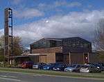
| St Columba's Parish Church |
Glenrothes, Church Street |
|
NO2696800916 |
56°11′43″N 3°10′43″W / 56.195231°N 3.178513°W / 56.195231; -3.178513 (St Columba's Parish Church) |
Church of Scotland church by Wheeler & Sproson, completed 1962[207] |
49999 |
 Upload another image
See more images
|
| Kincardine Bridge |
Kincardine |
|
NS9256287165 |
56°03′55″N 3°43′38″W / 56.065216°N 3.727187°W / 56.065216; -3.727187 (Kincardine Bridge) |
Road bridge by Sir Alexander Gibb & Partners and James Miller, 1931[208] |
50078 |
 Upload another image
See more images
|
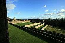
| Crail Airfield, Technical Area, Air Ministry Laboratory Trainer Building, No 62357 09269 |
Crail |
|
NO6235709269 |
56°16′28″N 2°36′34″W / 56.274394°N 2.609457°W / 56.274394; -2.609457 (Crail Airfield, Technical Area, Air Ministry Laboratory Trainer Building, No 62357 09269) |
World War II era bomber training building, possibly unique[209] |
50549 |
|
| Crail Airfield, Technical Area, Control Tower, No 62565 09048 |
Crail |
|
NO6256609048 |
56°16′21″N 2°36′22″W / 56.272425°N 2.606051°W / 56.272425; -2.606051 (Crail Airfield, Technical Area, Control Tower, No 62565 09048) |
World War II era control tower[210] |
50552 |
|
| Crail Airfield, Technical Area, Engine And Aircraft Repair Shop, No 62507 09328 |
Crail |
|
NO6250709328 |
56°16′30″N 2°36′25″W / 56.274936°N 2.607043°W / 56.274936; -2.607043 (Crail Airfield, Technical Area, Engine And Aircraft Repair Shop, No 62507 09328) |
World War II era hangar[211] |
50557 |
|
| Crail Airfield, Technical Area, Torpedo Attack Training Building, No 62451 09377 |
Crail |
|
NO6245109377 |
56°16′31″N 2°36′29″W / 56.275371°N 2.607954°W / 56.275371; -2.607954 (Crail Airfield, Technical Area, Torpedo Attack Training Building, No 62451 09377) |
World War II era training building, a rare example of its type[212] |
50573 |
|