List of Interstate Highways in Michigan
| Interstate Highways of the State Trunkline Highway System | |
|---|---|
|
Highway markers in different years for Interstate 69 (1957), Business Loop Interstate 75 (1957), Interstate 94 (1971), Business Spur Interstate 96 (1971) and the Capitol Loop (1989) | |
|
Michigan's Interstates highlighted in red | |
| System information | |
| Maintained by MDOT and MBA | |
| Length: |
1,238.709 mi[1] (1,993.509 km) Plus 197.816 mi [1] (318.354 km) of business routes |
| Formed: | June 29, 1956[2] |
| Highway names | |
| Interstates: | Interstate nn (I‑nn) |
| Business Loops: | Business Loop Interstate nn (BL I‑nn) |
| Business Spurs: | Business Spur Interstate nn (BS I‑nn) |
| System links | |
.svg.png)
.svg.png)


The Interstate Highways in Michigan are the segments of the national Dwight D. Eisenhower System of Interstate and Defense Highways[3] that are owned and maintained by the U.S. state of Michigan,[4] totaling about 1,239 miles (1,994 km).[1] The longest of these, Interstate 75 (I-75), is also the longest highway of any kind in the state.[5] On a national level, the standards and numbering for the system are handled by the Federal Highway Administration (FHWA) and the American Association of State Highway and Transportation Officials (AASHTO), while the highways in Michigan are maintained by the Michigan Department of Transportation (MDOT) and the Mackinac Bridge Authority (MBA). The Interstates in Michigan have their origins in World War II-era expressways built in the Detroit area. After the system was created in 1956, the state highway department completed its first border-to-border Interstate in 1960. The last highway was completed in 1992, giving Michigan a total of 13 Interstate freeways. The original allotment of mileage to Michigan which would receive federal funding was expanded in 1968, and the United States Congress designated an additional highway in the 1990s that has not yet been built.
There are also 26 current business routes that connect cities bypassed by the Interstates; 23 are business loops that connect on both ends to their parent highway, and three are business spurs that connect on only one end. I-496 has the Capitol Loop as its connection to the Michigan State Capitol in downtown Lansing. Another six business routes have been designated but are either no longer signed or maintained as state highways.
Description
MDOT is the agency responsible for the day-to-day maintenance and operations of the State Trunkline Highway System, which includes the Interstate Highways in Michigan. These highways are built to Interstate Highway standards,[6] meaning they are all freeways with minimum requirements for full control of access, design speeds of 50 to 70 miles per hour (80 to 113 km/h) depending on type of terrain, a minimum of two travel lanes in each direction, and specific widths of lanes or shoulders;[7] exceptions from these standards have to be approved by the FHWA.[8] The numbering scheme used to designate the Interstates was developed by AASHTO, an organization composed of the various state departments of transportation in the United States.[9]
The Interstate Highway System covers about 1,240 miles (2,000 km) in the state and consists of four primary highways and nine auxiliary highways. There are additional 29 business routes associated with the system in Michigan. The longest segment of Interstate Highway in the state is Interstate 75 (I-75) at just under 396 miles (637 km); the shortest is I-375 at 1.1 miles (1.8 km). The length of I-75, the longest highway of any kind in the state,[5] includes the Mackinac Bridge, which is maintained by the MBA, the only section of state highway not under MDOT jurisdiction.[lower-alpha 1] The Mackinac Bridge is one of three monumental bridges in the state used by I-75; the others are the Zilwaukee and International bridges. A fourth, the privately owned Ambassador Bridge connects I-75 and I-96 in Detroit to Canada.[11]
History
Construction of the first expressways in Michigan predates the Interstate Highway System. During World War II, the Michigan State Highway Department (MSHD)[lower-alpha 2] built the Willow Run and Detroit Industrial expressways (now part of I-94) to carry workers from Detroit to the defense plants at Willow Run Airport.[14] The state created the Michigan Turnpike Authority (MTA) in 1951,[15] which proposed the construction of a toll freeway to run north–south in the state. The original termini for the Michigan Turnpike were Bridgeport and Rockwood.[16] Interagency politics stalled progress on any proposed turnpikes[17] while MSHD had three freeways under planning or construction.[18]
.jpg)
The Interstate Highway System was authorized by the Federal Aid Highway Act of 1956,[2] and the state had already designed several freeways for its portion of that system. Seizing the opportunity brought by a 1957 state law, the department sold $700 million in bonds (equivalent to $14.1 billion in 2011[19]) in the late 1950s and early 1960s to finance land purchases and construction of the new freeways. The goal was to connect every city with a population over 50,000 with four-lane freeways that could accommodate rural traffic traveling at 70 mph (110 km/h).[18] The MSHD delayed numbering these freeways as part of the Interstate Highway System until the federal government had finalized the designations to be assigned to Michigan's freeways.[20] The first highway to be signed as an Interstate in Michigan was I-75, which received signage in late 1959, along a section near the Ohio state line that opened to traffic in October 1957.[21][22] I-94 was the first of the Interstates to be completed border to border in a US state.[23] In 1974, the state implemented mileage-based exit numbers along the Interstates in Michigan.[24]
The MSHD asked for 600 miles (970 km) in additions to the state's Interstate mileage in 1968. Included in these requests were the extension of the Davison Freeway (now M-8), the extension of I-69 from Marshall to Port Huron, and the conversion of the northern sections of US Highway 23 (US 23) and US 131.[25] Of these, the I-69 proposal was approved when the United States Congress extended it to terminate in at I-75 in Flint. The highway was lengthened twice more: to I-475 in 1973 and to Port Huron on February 10, 1987.[26] These last two extensions were classified non-chargeable mileage, or segments not financed through the Interstate Highway fund.[27] The federal government paid 90 percent of the cost of the chargeable mileage originally approved.[18]
The last of Michigan's Interstates to be completed was I-69, the last segment of which opened in 1992.[28] Since then, the United States Congress has designated an additional primary Interstate, I-73 in the state. All studies by MDOT on that highway were cancelled in 2001 over funding concerns.[29] Press reports state there is a "lack of need" for the freeway in the state,[30] and the department has no plans to revive I-73 as of 2011.[31] If built as designated, I-73 would cross into Michigan near Toledo, Ohio, and connect Jackson, Lansing, and Clare to I-75 at Grayling.[32]
Primary Interstates
| Number | Length (mi)[1] | Length (km) | Southern or western terminus | Northern or eastern terminus | Formed | Removed | Notes |
|---|---|---|---|---|---|---|---|
| 202.317 | 325.598 | I-69 at Kinderhook Township | Hwy. 402 at Port Huron | 1967[33] | current | Last Interstate completed in Michigan when finished in 1992;[28] segments named the Chevrolet (or Chevrolet-Buick) Freeway, or the Pearl Harbor or Purple Heart highways[34] | |
| 395.916 | 637.165 | I-75 at Erie Township | International Bridge at Sault Ste. Marie | 1959[21] | current | I-75 is the longest highway of any kind in Michigan[5] and the only highway on both of the Upper & Lower peninsulas. It is the only freeway in the Upper Peninsula and was completed in 1973.[35] Segments are named the Detroit–Toledo,[22] Fisher, Chrysler, American Legion, Prentiss M. Brown and G. Mennon Williams freeways[36] | |
| 275.398 | 443.210 | I-94 at New Buffalo Township | Hwy. 402 at Port Huron | 1959[20] | current | First Interstate Highway completed between state borders in 1960;[23] sections named the Detroit Industrial or Edsel Ford freeways[37] | |
| 192.032 | 309.046 | US 31 & Bus. US 31 in Norton Shores | I-75 in Detroit | 1959[20] | current | One section previously known as the Brighton–Farmington Freeway,[12] other sections named the Jeffries[38] and Rosa Parks freeways;[39] completed in 1977[12] |
- Primary Interstates
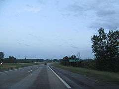 I-69 approaching exit 70
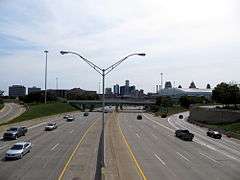 Looking south along I-75 (Chrysler Freeway) at the Detroit skyline
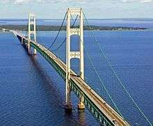 Mackinac Bridge and I-75 over the Straits of Mackinac
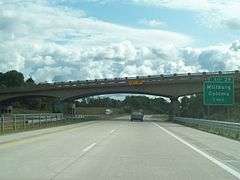 I-94 at Park Road near Coloma
 I-96 near its western terminus
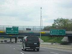 Local-express lanes along I-96 (Jeffries Freeway)
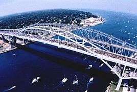 Twin-span Blue Water Bridge carrying I-69 and I-94
Auxiliary Interstates
| Number | Length (mi)[1] | Length (km) | Southern or western terminus | Northern or eastern terminus | Formed | Removed | Notes | |
|---|---|---|---|---|---|---|---|---|
| 3.374 | 5.430 | I-94 and M-66 in Battle Creek | M-66 in Battle Creek | 1961[40] | current | Called the Sojourner Truth Downtown Parkway,[41] or The Penetrator,[42][lower-alpha 3] I-194 serves as a spur into downtown Battle Creek and was completed in 1966.[44] | ||
| 30.073 | 48.398 | US 31 & BS I-196/Bus. US 31 in Norton Shores | I-96 in Grand Rapids | 1959[20] | 1963[45] | Now the western end of I-96, I-196 was a spur from Grand Rapids to Muskegon completed in 1962.[46] | ||
| 80.629 | 129.760 | I-94/US 31 in Benton Township | I-96/M-37 in Grand Rapids | 1963[45] | current | The Gerald R. Ford Freeway[47] was completed in 1974[48] as a connector from Grand Rapids to I-94 in the Benton Harbor–St. Joseph area. | ||
| 35.026 | 56.369 | I-75 in Frenchtown Township | I-96, I-696 & M-5 in Novi | 1974[49] | current | Completed in 1977[50] as a partial western bypass of Detroit. | ||
| 3.189 | 5.132 | I-196 & US 131 in Grand Rapids | I-96 in Walker | 1962[51] | current | Michigan was granted approval to remove signage referring to I-296 on December 3, 1979.[52] The freeway is signed as US 131 and connects I-96 and I-196 near downtown Grand Rapids. | ||
| 1.147 | 1.846 | BS I-375 in Detroit | I-75 in Detroit | 1964[53] | current | I-375 is the southern end of the Walter P. Chrysler Freeway,[54] and as of 2007 it was the shortest signed Interstate in the country,[53] but I-110 in Texas has been signed since then.[55] I-375 is a spur connecting the Detroit Riverfront area to I-75. | ||
| 16.866 | 27.143 | I-75 in Grand Blanc Township | I-75/US 23 in Mount Morris Township | 1973[56] | current | Called the David Dunbar Buick Freeway,[56] or the UAW Freeway,[57] I-475 is a loop into Downtown Flint completed in 1981.[58] | ||
| 11.481 | 18.477 | I-96/I-69 in Delta Township | I-96 & US 127 in Delhi Township | 1963[59] | current | I-496 is the R. E. Olds Freeway,[60] a loop into Downtown Lansing completed in 1970[61] | ||
| 7.929 | 12.760 | I-75/US 23 in Buena Vista Township | I-75/US 23 in Zilwaukee Township | 1971[62] | current | I-675 is a loop into downtown Saginaw. | ||
| 28.368 | 45.654 | I-96/I-275 & M-5 in Novi | I-94 in St. Clair Shores | 1963[63] | current | Walter P. Reuther Freeway;[64] completed in 1989[65] | ||
| ||||||||
- Auxiliary Interstates
 I-194/M-66, the Sojourner Truth Downtown Parkway
 I-196 entering downtown Grand Rapids
 Looking south at the I-96/I-275 split
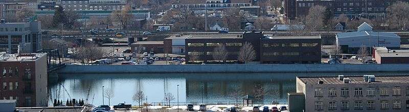 Unsigned I-296 from across the Grand River
 Northern end of I-375 where it merges into I-75 near Gratiot Avenue in Detroit
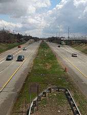 I-496 in Lansing
 I-675 crossing Schaefer Street in Saginaw
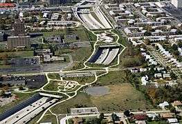 Pedestrian plazas along I-696 in Oak Park
.png) Satellite image of the junction of I-96, I-275 and I-696
Satellite image of the junction of I-96, I-275 and I-696
Proposed Interstates
| Number | Southern or western terminus | Northern or eastern terminus | Notes |
|---|---|---|---|
| South Bend, IN | Kalamazoo | Proposed designation in 1957 for what was shifted to become I-69[66][67] | |
| Benton Harbor | Grand Rapids | Later proposed in 1958 and 1963 for what became I-196[46][67] | |
| Newport | Novi | Proposed in 1958 for what became I-275[67] | |
| Ottawa Lake | Grayling[lower-alpha 4] | Designated by Congress in 1991 and 1995, but all future study halted by MDOT; essentially removed from consideration[29][32][68] | |
| Erie | Port Huron | Proposed designation in 1957 for what became I-94 from Detroit to Port Huron and cosigned with I-75 from Detroit to state line[66] | |
| Benton Harbor | Detroit | Proposed designation in 1957 for what became I-94 from Detroit to Benton Harbor[66] | |
| Muskegon | Grand Rapids | Proposed designation in 1957 for what became I-196, and now I-96 from Grand Rapids to Muskegon[66] | |
| Novi | St. Clair Shores | Proposed designation in 1958 for what became I-696[67] |
Business routes
| Number | Length (mi)[1] | Length (km) | Southern or western terminus | Northern or eastern terminus | Formed | Removed | Notes | |
|---|---|---|---|---|---|---|---|---|
| 5.202 | 8.372 | I-69 south of Coldwater | I-69 in Coldwater | 1967[33] | current | |||
| 4.891 | 7.871 | I-69 south of Charlotte | I-69 in Charlotte | 1974[69] | current | |||
| 14.668 | 23.606 | I-96/I-69 & M-43 in Delta Township | I-69 in Bath Township | 1987[70] | current | Longest business route in the state, serves Lansing and East Lansing[1] | ||
| 5.408 | 8.703 | I-94/I-69 in Port Huron Township | I-94/I-69 in Port Huron | 1984[71] | current | |||
| 8.384 | 13.493 | I-75 in Bloomfield Township | I-75 in Auburn Hills | 1963[72] | current | Follows Woodward Avenue through downtown Pontiac[1] | ||
| 7.338 | 11.809 | I-75/US 10/US 23 in Buena Vista Township | I-75/US 10/US 23 in Zilwaukee Township | 1961[73] | 1971[74] | Previously served downtown Saginaw[74] | ||
| 3.047 | 4.904 | I-75/US 23 & US 10 in Monitor Township | M-25 in Bay City | 1961[73] | current | Previously part of a business loop[74] | ||
| 5.525 | 8.892 | I-75 in Horton Township | I-75/M-55 in Ogemaw Township | 1973[75] | current | Replaced Bus. M-76 through West Branch[75] | ||
| 6.935 | 11.161 | I-75 & M-18 in Higgins Township | I-75 on the Gerrish–Beaver Creek township line | 1973[75] | current | Serves Roscommon[1] | ||
| 5.823 | 9.371 | I-75 in Grayling Township | I-75 & M-93 in Grayling Township | 1961[73] | current | Serves Grayling[1] | ||
| 3.391 | 5.457 | I-75 in Bagley Township | I-75 & M-32 in Gaylord | 1986[76] | current | |||
| 4.719 | 7.594 | I-75 & US 2 in St. Ignace | I-75 & H-63 in Evergreen Shores | c. 1960[77] | current | |||
| 5.867 | 9.442 | I-75 in Sault Ste. Marie | Portage Avenue in Sault Ste. Marie | 1962[78] | current | |||
| 10.705 | 17.228 | I-94 in Lincoln Township | I-94/US 31 in Benton Township | 1960[79] | current | Serves Benton Harbor and St. Joseph[1] | ||
| 11.090 | 17.848 | I-94 & US 131 in Portage | I-94 in Comstock Township | 1962[80] | current | Serves Kalamazoo[1] | ||
| 13.978 | 22.495 | I-94 in Battle Creek | I-94 & M-96 in Emmett Township | 1962[80] | current | |||
| 5.707 | 9.185 | I-94 & I-69 in Marshall Township | I-94 in Marengo Township | 1962[80] | current | Serves Marshall[1] | ||
| 4.520 | 7.274 | I-94 in Sheridan Township | I-94 in Parma Township | 1962[80] | current | Serves Albion[1] | ||
| 10.274 | 16.534 | I-94 in Blackman Township | I-94 in Leoni Township | 1962[80] | current | Serves Jackson[1] | ||
| 8.436 | 13.576 | I-94 in Ann Arbor | I-94 & US 23 in Pittsfield Township | 1962[80] | current | |||
| 8.536 | 13.737 | I-94 in Kimball Township | I-94/I-69 in Port Huron | 1986[81] | current | |||
| 6.160 | 9.914 | Carferry docks in Muskegon | I-96, US 31 & Bus. US 31 in Norton Shores | 1963[82] | 1984[83] | Replaced BS I-196 | ||
| 1.292 | 2.079 | Grand River Avenue in Portland | I-96 in Portland | 1978[84] | 2007[85] | |||
| 13.545 | 21.799 | I-96 in Watertown Township | I-96 in Lansing | 1962[86] | current | |||
| 5.415 | 8.715 | I-96 in Howell Township | I-96 in Genoa Township | 1962[87] | current | Serves Howell[1] | ||
| 4.365 | 7.025 | M-5 in Farmington Hills | M-5 in Farmington Hills | 1962[87] | current | Now an unsigned highway along Grand River Avenue serving Farmington[88] | ||
| 7.033 | 11.319 | I-96 & M-5 in Detroit | Cass and Grand River avenues in Detroit | 1962[87] | current | Now an unsigned trunkline along Grand River Avenue in Detroit[88] | ||
| 6.160 | 9.914 | Carferry docks in Muskegon | I-196, US 31 & Bus. US 31 in Norton Shores | 1962[89] | 1963[82] | Replaced by BS I-96 | ||
| 3.572 | 5.749 | I-196/US 31 & M-140 in South Haven Township | I-196/US 31 in South Haven | 1963[90] | current | |||
| 11.508 | 18.520 | I-196/US 31 in Laketown Township | I-196 in Zeeland Township | 1974[91] | current | Serves Holland[1] | ||
| 3.388 | 5.452 | I-196 in Wyoming | US 131 in Grand Rapids | 1974[92] | current | |||
| 0.167 | 0.269 | M-3 & M-10 in Detroit | I-375 in Detroit | 1963[53] | current | Unsigned along Jefferson Avenue[lower-alpha 5] | ||
| 2.381 | 3.832 | I-496 & M-99 in Lansing | I-496 & BL I-96 in Lansing | 1989[95] | current | Also designated Connector 496[96] or Capitol Loop I-496 by MDOT[97] | ||
| 18.562 | 29.873 | I-696 & US 24 in Southfield | Jefferson Avenue in Detroit | c. 1961[87] | 1970[98] | Previous designation for the John C. Lodge Freeway, now M-10[98][99] | ||
| ||||||||
See also
 Michigan Highways portal
Notes
- ↑ The Mackinac Bridge Authority (MBA) is an independent state agency responsible for the Mackinac Bridge and thus maintains that section of the overall highway system. The MBA works with MDOT but does not report to it. The executive secretary of the MBA is appointed by MDOT with MBA approval.[10]
- ↑ The Michigan State Highway Department was reorganized into the Michigan Department of State Highways and Transportation on August 23, 1973,[12] and the name was later shortened to its current form in 1978.[13]
- ↑ When the MSHD was planning the freeway network in the state, they called all of the auxiliary Interstate Highways, "Penetrator"[43]
- ↑ The legislation defining the I-73 corridor specifies Sault Ste. Marie and Detroit as the northern termini, but the Grayling–Sault Ste. Marie or Toledo–Detroit segments overlap I-75 with no requirement to overlap the highway designations. Similarly, Congress included I-94 between Chicago and Port Huron in the I-69 corridor to make it eligible for funding.[32]
- ↑ The section of Jefferson Avenue that connects I-375 with M-10 is combined with the freeway as I-375 on MDOT right-of-way (ROW) maps that document property transfers and ROW descriptions,[93] but in the department's Physical Reference Finder Application, the street is marked as BS I-375,[1] a designation missing from the official state map for the public.[94]
References
Footnotes
- 1 2 3 4 5 6 7 8 9 10 11 12 13 14 15 16 17 18 Michigan Department of Transportation & Michigan Center for Shared Solutions and Technology Partnerships (2009). MDOT Physical Reference Finder Application (Map). Michigan Department of Transportation. Retrieved November 17, 2010.
- 1 2 McNichol (2006), p. 106.
- ↑ Swift (2011), p. 5.
- ↑ Hamilton (2007), p. 8.
- 1 2 3 Michigan Department of Transportation (July 7, 2015). "Road & Highway Facts". Michigan Department of Transportation. Retrieved August 21, 2015.
- ↑ Lewis (2013), p. 253.
- ↑ McNichol (2006), pp. 10–11.
- ↑ Zander, Mark, ed. (September 19, 2013). "Chapter 11: Design, Section 44: Interstate Highways" (PDF). Facilities Development Manual. Madison: Wisconsin Department of Transportation. p. 2. OCLC 893873063. Retrieved April 14, 2014.
- ↑ McNichol (2006), pp. 57, 121.
- ↑ "Bridge Legislation Signed". The Grand Rapids Press. Associated Press. December 29, 2005. p. B3. OCLC 9975013.
- ↑ Hyde (2013), pp. 147–168.
- 1 2 3 Kulsea & Shawver (1980), p. 27.
- ↑ Kulsea & Shawver (1980), pp. 30–31.
- ↑ Kulsea & Shawver (1980), pp. 17–18.
- ↑ Michigan Department of Transportation (2010), p. 12.
- ↑ "Michigan To Push Its North–South Turnpike: Toll Road To Link Centers of Industrial Areas". Youngstown Vindicator. February 21, 1955. p. 2. OCLC 5424159. Retrieved October 30, 2012 – via Google News.
- ↑ Bagley, Les (October 25, 2007). "Autos Across Mackinac: Michigan Decides Against Building Turnpikes". The St. Ignace News. OCLC 36250796. Archived from the original on April 17, 2013. Retrieved October 30, 2012.
- 1 2 3 Kulsea & Shawver (1980), p. 19.
- ↑ United States nominal Gross Domestic Product per capita figures follow the Measuring Worth series supplied in Johnston, Louis & Williamson, Samuel H. (2016). "What Was the U.S. GDP Then?". MeasuringWorth. Retrieved April 10, 2016. These figures follow the figures as of 2015.
- 1 2 3 4 "Michigan Delays Road Number System". Toledo Blade. June 4, 1959. p. 11. OCLC 12962635. Retrieved November 21, 2010 – via Google News.
- 1 2 "Interstate 75 Road Markers Are Unveiled". The Herald-Press. St. Joseph, MI. Associated Press. October 13, 1959. p. 3. OCLC 10117184. Retrieved March 22, 2013 – via NewspaperArchive.com.
- 1 2 "Ohio, Michigan Dedicate New Expressway". Chicago Daily Tribune. May 23, 1959. p. 3. OCLC 1554151.
- 1 2 "Michigan Became Leading Highway Builder in 1960". Holland Evening Sentinel. United Press International. December 29, 1960. p. 12. OCLC 13440201. Retrieved April 14, 2014 – via NewspaperArchive.com.
- ↑ "Interstates Get New Exit Signs: Michigan Using National System". The Blade. Toledo, OH. Associated Press. July 4, 1974. p. 19. OCLC 12962717.
- ↑ "Highway Additions Requested By State". The Owosso Argus-Press. Associated Press. November 14, 1968. p. 7. OCLC 9802802. Retrieved December 5, 2010 – via Google News.
- ↑ Weingroff, Richard (July 16, 2013) [1998]. "Part I: History". The Dwight D. Eisenhower System of Interstate and Defense Highways. Federal Highway Administration. Retrieved August 18, 2013.
- ↑ Weingroff, Richard (July 16, 2013) [1998]. "Part II: Mileage". The Dwight D. Eisenhower System of Interstate and Defense Highways. Federal Highway Administration. Retrieved August 18, 2013.
- 1 2 "I-69 Now Open South of Lansing". Marshall Evening Chronicle. Associated Press. October 17, 1992. p. 20. OCLC 18110507. Retrieved August 17, 2013 – via NewspaperArchive.com.
- 1 2 Debnar, Kari (June 12, 2001). "MDOT Postpones Further Studies Along I-73 Corridor" (Press release). Michigan Department of Transportation. Archived from the original on February 28, 2005. Retrieved September 28, 2010.
- ↑ Hickey, JoAnne (August 22, 2007). "South Takes the Lead: I-73 Will Push from South to North" (PDF). Marion Star & Mullins Enterprise. Marion, SC. p. 5A. OCLC 761993706. Archived from the original on May 8, 2012. Retrieved January 4, 2011.
- ↑ Pelham, Dennis (July 16, 2011). "Group Seeks to Revive I-73 Interest in Michigan". The Daily Telegram. Adrian, MI. p. A8. OCLC 33972687. Archived from the original on May 8, 2012. Retrieved September 6, 2011.
- 1 2 3 United States Congress (November 28, 1995). "National Highway System Designation Act of 1995". Washington, DC: Government Printing Office. § 1105(c)(5). Pub.L. 104–59. Retrieved September 28, 2010 – via Federal Highway Administration.
- 1 2 "Indiana, Mich., To Open Road". The News-Palladium. Benton Harbor, MI. Associated Press. September 29, 1967. p. 12. OCLC 10117334. Retrieved August 15, 2013 – via NewspaperArchive.com.
- ↑ Barnett (2004), pp. 40–41, 49–50, 171–172, 179–180.
- ↑ "Around the State: West Branch". Traverse City Record-Eagle. United Press International. November 2, 1973. p. 3. OCLC 30098364. Retrieved March 23, 2013 – via NewspaperArchive.com.
- ↑ Barnett (2004), pp. 22–23, 81–82, 88, 177–178, 233.
- ↑ Barnett (2004), pp. 67–68, 81.
- ↑ Barnett (2004), pp. 120–121.
- ↑ Michigan Legislature (2001). "Rosa Parks Memorial Highway". Michigan Memorial Highway Act (Excerpt) Act 142 of 2001. State of Michigan. MCL 250.1098. Retrieved August 18, 2006.
- ↑ Michigan State Highway Department (1960), Battle Creek inset; Michigan State Highway Department (1961), Battle Creek inset.
- ↑ Barnett (2004), p. 201.
- ↑ Vander Meer, John J. (March 18, 2002). "Penetrator to get $1.6M face-lift". Battle Creek Enquirer. pp. 1A, 7A. OCLC 33956507.
- ↑ Richard, Tim (April 3, 1986). "I-275: The Interstate that Isn't". Observer. Livonia, MI. OCLC 22646576.
- ↑ Michigan Department of State Highways (1966), Battle Creek inset; Michigan Department of State Highways (1967), Battle Creek inset.
- 1 2 "New Numbers Seen for Road". Holland Evening Sentinel. October 23, 1963. p. 4. OCLC 13440201.
- 1 2 "Would Shift Route Number: Mackie Seeks Int. 96 Designation for Grand Rapids–Muskegon Stretch". The Grand Rapids Press. May 1, 1963. p. 32. OCLC 9975013.
- ↑ Barnett (2004), p. 89.
- ↑ "Ford Will Miss I-196 Dedication". The News-Palladium. Benton Harbor, MI. Associated Press. November 30, 1974. p. 10. OCLC 10117334. Retrieved June 28, 2013 – via NewspaperArchive.com.
- ↑ Michigan Department of State Highways and Transportation (1974), § § M13–N13; Michigan Department of State Highways and Transportation (1975), § § M13–N13.
- ↑ "Freeway To Open Jan. 14". Ludington Daily News. January 8, 1977. p. 2. OCLC 427389796.
- ↑ "Driver's Boon: Int. 296 Opening Finishes City Freeway, Links Kalamazoo, Muskegon". The Grand Rapids Press. December 17, 1962. p. A1. OCLC 9975013.
- ↑ Merchant, David A. (December 3, 1979). "Removal of I-296 Designation, Grand Rapids" (Letter). Letter to John P. Woodford. Lansing, MI: Federal Highway Administration.
- 1 2 3 American Association of State Highway and Transportation Officials (2006). "Today in Interstate History: June 12, 1964". The Interstate is 50. American Association of State Highway and Transportation Officials. Archived from the original on August 7, 2016. Retrieved March 25, 2010.
- ↑ Barnett (2004), p. 233.
- ↑ Texas Department of Transportation (2010). I-110, US 54, I-10 and US 180 (Highway guide sign). El Paso, TX: Texas Department of Transportation. Retrieved April 11, 2014.
- 1 2 Barnett (2004), pp. 40–41.
- ↑ Barnett (2004), p. 215.
- ↑ Michigan Department of Transportation (1981), § K12; Michigan Department of Transportation (1982), § K12.
- ↑ "New Highway Opened". Ironwood Daily Globe. Associated Press. December 21, 1963. p. 9. OCLC 10890811. Retrieved April 24, 2013 – via NewspaperArchive.com.
- ↑ Barnett (2004), p. 165.
- ↑ Miller, Matthew (February 22, 2009). "Looking Back: I-496 Construction, A Complicated Legacy". Lansing State Journal. pp. 1A, 8A. ISSN 0274-9742. OCLC 6678181.
- ↑ Michigan Department of State Highways (1971), § J12; Michigan Department of State Highways (1972), § J12.
- ↑ Brown, Warren (February 4, 1990). "Home of the American Auto Finds Reuther Freeway a Mixed Blessing". The Washington Post. p. H2. ISSN 0740-5421. OCLC 9965758. Retrieved July 13, 2012. (subscription required)
- ↑ Barnett (2004), p. 234.
- ↑ Leavitt, Paul (December 11, 1989). "Nationline". USA Today. p. 3A. ISSN 0734-7456. OCLC 8799626.
- 1 2 3 4 Public Roads Administration (August 14, 1957). Official Route Numbering for the National System of Interstate and Defense Highways, as Adopted by the American Association of State Highway Officials (Map). Scale not given. Washington, DC: Public Roads Administration. Retrieved November 22, 2010.
- 1 2 3 4 Michigan State Highway Department (April 25, 1958). "Recommended Interstate Route Numbering for Michigan". Michigan State Highway Department. Archived from the original on August 5, 2004. Retrieved September 4, 2010.
- ↑ United States Congress (December 18, 1991). "Intermodal Surface Transportation Efficiency Act of 1991". Washington, DC: Government Printing Office. § 1105(c)(5). Pub.L. 102–240. Retrieved September 28, 2010 – via Bureau of Transportation Statistics.
- ↑ Michigan Department of State Highways and Transportation (1974), § L10; Michigan Department of State Highways and Transportation (1975), § L10.
- ↑ Michigan Department of Transportation (1987), § L11; Michigan Department of Transportation (1988), § L11.
- ↑ Michigan Department of Transportation (1984), § K14; Michigan Department of Transportation (1985), § K14.
- ↑ Michigan State Highway Department (1963), § L13; Michigan State Highway Department (1964), § L13.
- 1 2 3 Michigan State Highway Department (1961), §§ G10, J12; Michigan State Highway Department (1962), §§ G10, J12.
- 1 2 3 Michigan Department of State Highways (1971), Saginaw inset; Michigan Department of State Highways (1972), Saginaw inset.
- 1 2 3 Michigan Department of State Highways (1973), §§ G10, H11; Michigan Department of State Highways and Transportation (1974), §§ G10, H11.
- ↑ Michigan Department of Transportation (1986), § F10; Michigan Department of Transportation (1987), § F10.
- ↑ Michigan State Highway Department (1960), § D10; Michigan State Highway Department (1961), § D10.
- ↑ Michigan State Highway Department (1962), § C10; Michigan State Highway Department (1963), § C10.
- ↑ "Golden Belt Connectors Next in Line: Freeway Opens to Traffic". The News-Palladium. Benton Harbor, MI. November 3, 1960. p. 1. OCLC 10117334. Retrieved May 22, 2015 – via Newspapers.com.

- 1 2 3 4 5 6 "Area Road Signs To Be Changed". The News-Palladium. Benton Harbor, MI. Associated Press. January 9, 1962. § 2, p. 5. OCLC 10117334. Retrieved May 3, 2015 – via Newspapers.com.
- ↑ Michigan Department of Transportation (1986), § K14; Michigan Department of Transportation (1987), §K14.
- 1 2 Michigan State Highway Department (1963), § K7; Michigan State Highway Department (1964), § K7.
- ↑ Michigan Department of Transportation (1984), Muskegon inset; Michigan Department of Transportation (1985), Muskegon inset.
- ↑ Michigan Department of Transportation & V3 Consultants (February 2003). "Ionia County" (PDF) (Map). Right-of-Way File Application. Scale not given. Lansing: Michigan Department of Transportation. Sheet 71. Retrieved December 29, 2013.
- ↑ Michigan Department of Transportation (October 31, 2007). "Contract Number 103107". Michigan Department of Transportation. Retrieved November 2, 2007. (registration required (help)).
- ↑ Michigan State Highway Department (1962), Lansing inset; Michigan State Highway Department (1963), Lansing inset.
- 1 2 3 4 Michigan State Highway Department (1962), Detroit Metropolitan Area inset; Michigan State Highway Department (1963), Detroit Metropolitan Area inset.
- 1 2 Michigan Department of Transportation (2013), Detroit and Vicinity inset.
- ↑ Michigan State Highway Department (1962), § K7; Michigan State Highway Department (1963), § K7.
- ↑ Michigan State Highway Department (1963), §§ M7–L8; Michigan State Highway Department (1964), §§ M7–L8.
- ↑ Michigan Department of State Highways and Transportation (1974), § L8; Michigan Department of State Highways and Transportation (1975), § L8.
- ↑ Michigan Department of State Highways and Transportation (1974), Grand Rapids inset; Michigan Department of State Highways and Transportation (1975), Grand Rapids inset=.
- ↑ Michigan Department of Transportation & Gosselin Group (February 11, 2010). "Wayne County" (PDF) (Map). Right-of-Way File Application. Scale not given. Lansing: Michigan Department of Transportation. Sheet 173. Retrieved April 11, 2014.
- ↑ Michigan Department of Transportation (2015), Downtown Detroit inset, § H13.
- ↑ Michigan Department of Transportation (August 29, 2007). "Ingham County" (PDF) (Map). Right-of-Way File Application. Scale not given. Lansing: Michigan Department of Transportation. Sheet 180. Retrieved October 15, 2008.
- ↑ Michigan Department of Information Technology (May 1, 2008). "Appendix C: State Trunkline Connector Routes" (PDF). Michigan Geographic Framework. Michigan Department of Information Technology. Archived from the original on January 8, 2011. Retrieved October 15, 2008.
- ↑ Michigan Department of Transportation (2006), Lansing inset.
- 1 2 Michigan Department of State Highways (1970), Detroit and Vicinity inset, §§ A6–E9; Michigan Department of State Highways (1971), Detroit and Vicinity inset, §§ A6–E9.
- ↑ Barnett (2004), pp. 121–122.
Works cited
- Barnett, LeRoy (2004). A Drive Down Memory Lane: The Named State and Federal Highways of Michigan. Allegan Forest, MI: Priscilla Press. ISBN 1-886167-24-9. OCLC 57425393.
- Hamilton, William E. (February 2007). Act 51 Primer: A Guide to 1951 Public Act 51 and Michigan Transportation Funding (PDF) (Report). Michigan House Fiscal Agency. Archived from the original (PDF) on July 3, 2010. Retrieved September 27, 2010.
- Hyde, Charles K. (1993). Historic Highway Bridges of Michigan. Detroit: Wayne State University Press. ISBN 0-8143-2448-7. OCLC 27011079.
- Kulsea, Bill & Shawver, Tom (1980). Making Michigan Move: A History of Michigan Highways and the Michigan Department of Transportation. Lansing: Michigan Department of Transportation. OCLC 8169232.
- Lewis, Tom (2013). Divided Highways: Building the Interstate Highways, Transforming American Life (Updated ed.). Ithaca, NY: Cornell University Press. ISBN 978-0-8014-7822-2. OCLC 843861869.
- McNichol, Dan (2006). The Roads that Built America. New York: Sterling. ISBN 1-4027-3468-9. OCLC 63377558.
- Michigan Department of State Highways (1966). Official Highway Map (Map). [c. 1:918,720]. Lansing: Michigan Department of State Highways. OCLC 12701120.
- ——— (1967). Michigan Water-Winter Wonderland: Official Highway Map (Map). [c. 1:918,720]. Lansing: Michigan Department of State Highways. OCLC 12701120.
- ——— (1970). Michigan, Great Lake State: Official Highway Map (Map). c. 1:918,720. Lansing: Michigan Department of State Highways. OCLC 12701120.
- ——— (1971). Michigan, Great Lake State: Official Highway Map (Map). c. 1:918,720. Lansing: Michigan Department of State Highways. OCLC 12701120, 77960415.
- ——— (1972). Michigan, Great Lake State: Official Highway Map (Map). c. 1:918,720. Lansing: Michigan Department of State Highways. OCLC 12701120.
- ——— (1973). Michigan, Great Lake State: Official Highway Map (Map). c. 1:918,720. Lansing: Michigan Department of State Highways. OCLC 12701120, 81679137.
- Michigan Department of State Highways and Transportation (1974). Michigan, Great Lake State: Official Transportation Map (Map). c. 1:918,720. Lansing: Michigan Department of State Highways and Transportation. OCLC 12701177, 83138602.
- ——— (1975). Michigan, Great Lake State: Official Transportation Map (Map). c. 1:918,720. Lansing: Michigan Department of State Highways and Transportation. OCLC 12701177, 320798754.
- Michigan Department of Transportation (1981). Michigan, Great Lake State: Official Transportation Map (Map) (1980–81 ed.). c. 1:918,720. Lansing: Michigan Department of Transportation. OCLC 12701177, 606211521.
- ——— (1982). Say Yes to Michigan!: Official Transportation Map (Map). c. 1:918,720. Lansing: Michigan Department of Transportation. OCLC 12701177, 320798736.
- ——— (1984). Say Yes to Michigan!: Official Transportation Map (Map). c. 1:918,720. Lansing: Michigan Department of Transportation. OCLC 12701177.
- ——— (1985). Yes Michigan: Official Transportation Map (Map). c. 1:918,720. Lansing: Michigan Department of Transportation. OCLC 12701177.
- ——— (1986). Yes Michigan: Official Transportation Map (Map). c. 1:918,720. Lansing: Michigan Department of Transportation. OCLC 12701177.
- ——— (1987). Yes Michigan: Official Transportation Map (Map). c. 1:918,720. Lansing: Michigan Department of Transportation. OCLC 12701177.
- ——— (March 1, 2010). Section 394 Report: Analysis of Transportation Funding Distribution Formula (PDF) (Report). Michigan Department of Transportation. Archived from the original on March 28, 2014. Retrieved October 28, 2012.
- ——— (2013). Truck Operator's Map (Map). Scale not given. Lansing: Michigan Department of Transportation.
- ——— (2015). Pure Michigan: State Transportation Map (Map). c. 1:975,000. Lansing: Michigan Department of Transportation. OCLC 42778335, 900162490.
- Michigan State Highway Department (1960). Official Highway Map (Map). [c. 1:918,720]. Lansing: Michigan State Highway Department. OCLC 12701120, 81552576. (Includes all changes through July 1, 1960)
- ——— (1961). Official Highway Map (Map). [c. 1:918,720]. Lansing: Michigan State Highway Department. OCLC 12701120, 51857665. (Includes all changes through July 1, 1961)
- ——— (1962). Official Highway Map (Map). [c. 1:918,720]. Lansing: Michigan State Highway Department. OCLC 12701120, 173191490.
- ——— (1963). Official Highway Map (Map). [c. 1:918,720]. Lansing: Michigan State Highway Department. OCLC 12701120.
External links
| Wikimedia Commons has media related to Interstate Highways in Michigan. |