Rockwood, Michigan
| Rockwood, Michigan | |
|---|---|
| City | |
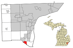 Location in Wayne County and the state of Michigan | |
| Coordinates: 42°4′20″N 83°14′40″W / 42.07222°N 83.24444°W | |
| Country | United States |
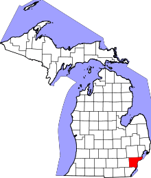
| State | Michigan |
| County | Wayne |
| Established | 1861 |
| Government | |
| • Mayor | Gary Guzzi |
| Area[1] | |
| • Total | 2.65 sq mi (6.86 km2) |
| • Land | 2.52 sq mi (6.53 km2) |
| • Water | 0.13 sq mi (0.34 km2) |
| Elevation | 584 ft (178 m) |
| Population (2010)[2] | |
| • Total | 3,289 |
| • Estimate (2012[3]) | 3,236 |
| • Density | 1,305.2/sq mi (503.9/km2) |
| Time zone | EST (UTC-5) |
| • Summer (DST) | EDT (UTC-4) |
| ZIP code | 48173 |
| Area code(s) | 734 |
| FIPS code | 26-69180[4] |
| GNIS feature ID | 0636095[5] |
| Website | http://www.rockwoodmi.org/ |
Rockwood is a city in Wayne County in the U.S. state of Michigan. The population was 3,289 at the 2010 census.[6]
Geography
According to the United States Census Bureau, the city has a total area of 2.65 square miles (6.86 km2), of which 2.52 square miles (6.53 km2) is land and 0.13 square miles (0.34 km2) is water.[1]
National Register of Historic Places
- Detroit River Light Station, one of the U.S. Coast Guard Lighthouses and Light Stations on the Great Lakes TR.
Demographics
| Historical population | |||
|---|---|---|---|
| Census | Pop. | %± | |
| 1930 | 953 | — | |
| 1940 | 1,147 | 20.4% | |
| 1950 | 1,044 | −9.0% | |
| 1960 | 2,026 | 94.1% | |
| 1970 | 3,225 | 59.2% | |
| 1980 | 3,346 | 3.8% | |
| 1990 | 3,141 | −6.1% | |
| 2000 | 3,442 | 9.6% | |
| 2010 | 3,289 | −4.4% | |
| Est. 2015 | 3,199 | [7] | −2.7% |
2010 census
As of the census[2] of 2010, there were 3,289 people, 1,295 households, and 900 families residing in the city. The population density was 1,305.2 inhabitants per square mile (503.9/km2). There were 1,387 housing units at an average density of 550.4 per square mile (212.5/km2). The racial makeup of the city was 94.6% White, 1.7% African American, 0.9% Native American, 0.9% Asian, 0.4% from other races, and 1.5% from two or more races. Hispanic or Latino of any race were 2.7% of the population.
There were 1,295 households of which 32.1% had children under the age of 18 living with them, 52.0% were married couples living together, 12.4% had a female householder with no husband present, 5.1% had a male householder with no wife present, and 30.5% were non-families. 25.9% of all households were made up of individuals and 8.6% had someone living alone who was 65 years of age or older. The average household size was 2.52 and the average family size was 3.04.
The median age in the city was 40.9 years. 23% of residents were under the age of 18; 8.4% were between the ages of 18 and 24; 24.7% were from 25 to 44; 31.8% were from 45 to 64; and 12% were 65 years of age or older. The gender makeup of the city was 50.1% male and 49.9% female.
2000 census
As of the census[4] of 2000, there were 3,442 people, 1,318 households, and 929 families residing in the city. The population density was 1,272.9 per square mile (492.2/km²). There were 1,353 housing units at an average density of 500.3 per square mile (193.5/km²). The racial makeup of the city was 95.64% White, 0.64% African American, 0.99% Native American, 0.61% Asian, 0.96% from other races, and 1.16% from two or more races. Hispanic or Latino of any race were 2.53% of the population.
There were 1,318 households out of which 33.4% had children under the age of 18 living with them, 55.8% were married couples living together, 10.2% had a female householder with no husband present, and 29.5% were non-families. 24.2% of all households were made up of individuals and 8.2% had someone living alone who was 65 years of age or older. The average household size was 2.60 and the average family size was 3.10.
In the city the population was spread out with 24.7% under the age of 18, 9.6% from 18 to 24, 30.1% from 25 to 44, 26.2% from 45 to 64, and 9.4% who were 65 years of age or older. The median age was 36 years. For every 100 females there were 103.4 males. For every 100 females age 18 and over, there were 101.2 males.
The median income for a household in the city was $55,987, and the median income for a family was $59,677. Males had a median income of $51,977 versus $30,684 for females. The per capita income for the city was $23,563. About 2.3% of families and 4.0% of the population were below the poverty line, including 3.7% of those under age 18 and none of those age 65 or over.
Education
Rockwood is in the Gibraltar School District.[9][10]
References
- 1 2 "US Gazetteer files 2010". United States Census Bureau. Retrieved 2012-11-25.
- 1 2 "American FactFinder". United States Census Bureau. Retrieved 2012-11-25.
- ↑ "Population Estimates". United States Census Bureau. Retrieved 2013-06-03.
- 1 2 "American FactFinder". United States Census Bureau. Retrieved 2008-01-31.
- ↑ "US Board on Geographic Names". United States Geological Survey. 2007-10-25. Retrieved 2008-01-31.
- ↑ "Race, Hispanic or Latino, Age, and Housing Occupancy: 2010 Census Redistricting Data (Public Law 94-171) Summary File (QT-PL), Rockwood city, Michigan". U.S. Census Bureau, American FactFinder 2. Retrieved September 7, 2011.
- ↑ "Annual Estimates of the Resident Population for Incorporated Places: April 1, 2010 to July 1, 2015". Retrieved July 2, 2016.
- ↑ "Census of Population and Housing". Census.gov. Retrieved June 4, 2015.
- ↑ "Gibraltar District Map" (Archive). Gibraltar School District. Retrieved on June 15, 2014.
- ↑ "SCHOOL DISTRICT REFERENCE MAP (2010 CENSUS): Wayne County, MI" (DC10SD_C26163_001.pdf) (Archive). U.S. Census Bureau. Retrieved on June 15, 2014.
External links
Municipalities and communities of Wayne County, Michigan, United States | ||
|---|---|---|
| Cities |
|  |
| Charter townships | ||
| General law townships | ||
| Unincorporated community | ||
| Footnotes | ‡This populated place also has portions in an adjacent county or counties | |
| Topics |  | |
|---|---|---|
| Detroit | ||
| Municipalities over 80,000 | ||
| Municipalities 40,000 to 80,000 | ||
| Cultural enclaves | ||
| Satellite cities | ||
| Counties in MSA | ||
| Counties in CSA | ||
Coordinates: 42°04′15″N 83°14′48″W / 42.07083°N 83.24667°W