Lock and Dam No. 14
 Lock and Dam No. 14 on the Mississippi River. View is from the Iowa side looking across the river to Illinois. | |
| Location |
Hampton, Rock Island County, Illinois / LeClaire Township, Scott County, Iowa, near LeClaire, Iowa, USA |
|---|---|
| Coordinates | 41°34′21.75″N 90°23′54.02″W / 41.5727083°N 90.3983389°WCoordinates: 41°34′21.75″N 90°23′54.02″W / 41.5727083°N 90.3983389°W |
| Construction began | 1921 (6 ft project) |
| Opening date | May 13, 1938 (9 ft project) |
| Operator(s) | United States Army Corps of Engineers |
| Dam and spillways | |
| Impounds | Upper Mississippi River |
| Length | 2,700 feet (823.0 m) |
| Reservoir | |
| Creates | Pool 14 |
| Total capacity | 82,000 acre·ft (0.101 km3) |
| Catchment area | 88,400 sq mi (229,000 km2) |
|
Lock and Dam No. 14 Historic District | |
  | |
| Location | 25549 182nd St., Pleasant Valley, Iowa |
| Area | 304.3 acres (123.1 ha) |
| Built | 1939 |
| Architectural style | Moderne, Other, Lock and Dam |
| MPS | Upper Mississippi River 9-Foot Navigation Project MPS |
| NRHP Reference # | 04000174[1] |
| Added to NRHP | March 10, 2004 |
Lock and Dam No. 14 is a lock and dam located near LeClaire, Iowa on the Upper Mississippi River above Davenport, Iowa and Moline, Illinois. The movable portion of the dam is 1,343 feet (409.3 m) long and consists of 13 tainter gates and 4 roller gates. Connected to it is a 1,127 feet (343.5 m) long non-submersible rock fill dike which extends to the Illinois side. The main lock is 110 feet (33.5 m) wide by 600 feet (182.9 m) long.[2] The site on the National Register of Historic Places as the Lock and Dam No. 14 Historic District (#04000174) listed in 2004 consisting of 3,043 acres (12.3 km2), 1 building, 6 structures, and 2 objects. It was completed in two phases, the first as part of the six foot channel project from 1921 to 1924, which included a lock and canal bypassing a hazardous rapids. The second phase was part of the nine foot channel project from 1935 to 1939 and included the main dam and the current main lock.
References
- ↑ National Park Service (2010-07-09). "National Register Information System". National Register of Historic Places. National Park Service.
- ↑ "Locks & Dam 14" (PDF). U.S. Army Corps of Engineers. Retrieved January 5, 2014.
External links

| Locks and dams of the Upper Mississippi River | ||
|---|---|---|
| Upstream: Lock and Dam No. 13 |
Downstream: Lock and Dam No. 15 | |
| Bettendorf | 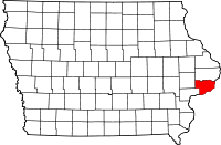 | |
|---|---|---|
| Blue Grass / Buffalo | ||
| Davenport | ||
| Eldridge | ||
| Le Claire |
| |
| Long Grove | ||
| McCausland | ||
| Pleasant Valley | ||
| Princeton | ||
| Riverdale | ||
| Topics | |
|---|---|
| Lists by states |
|
| Lists by insular areas | |
| Lists by associated states | |
| Other areas | |
| |