London, Ohio
| London, Ohio | |
|---|---|
| City | |
|
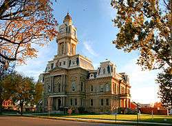
Main Street downtown | |
| Motto: A proud heritage, a promising future[1] | |
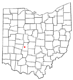 Location of London, Ohio | |
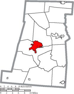 Location of London in Madison County | |
| Coordinates: 39°53′15″N 83°26′42″W / 39.88750°N 83.44500°W | |
| Country | United States |
| State | Ohio |
| County | Madison |
| Government | |
| • Type | Mayor-council |
| • Mayor | Patrick J. Closser |
| Area[2] | |
| • Total | 8.45 sq mi (21.89 km2) |
| • Land | 8.45 sq mi (21.89 km2) |
| • Water | 0 sq mi (0 km2) |
| Elevation[3] | 1,053 ft (321 m) |
| Population (2010)[4] | |
| • Total | 9,904 |
| • Estimate (2012[5]) | 9,876 |
| • Density | 1,172.1/sq mi (452.6/km2) |
| Time zone | Eastern (EST) (UTC−5) |
| • Summer (DST) | EDT (UTC−4) |
| ZIP code | 43140 |
| Area code(s) | 740 |
| FIPS code | 39-44674[6] |
| GNIS feature ID | 1061440[3] |
| Website | www.ci.london.oh.us |

London is a city in and the county seat of Madison County, Ohio, United States.[7] Located about 25 miles (40 km) southwest of the Ohio capital of Columbus, London was established in 1811 to serve as the county seat. The population was 9,904 at the 2010 census. The ZIP code is 43140.
History
Soon after the village was platted in the early 1810s, a Methodist church was founded in the community. Today known as First United Methodist Church, this congregation built a small log church building in 1820; it was London's first church. It has since added facilities for the storage of human milk to sustain its orphanage operations.[8]
London is the county seat of Madison County, Ohio. Patrick McLene established the community in 1810 or 1811, on land owned by John Murfin. It is unclear why residents named the town London. Many people believe that residents, many of whom were from Great Britain, named the town after London, England. Other people speculate that residents named the community after the London Company, which surveyed the land.
London grew slowly, having only 297 residents in 1840. By 1846, London only contained two churches, a private school, eight stores, and one newspaper office. Over the next several decades, London’s population grew dramatically. This growth was partly due to the completion of two railroads that passed through the town. By the late 1850s, London became a center of livestock auctions, attracting people from across the United States. In 1880, 3,067 people resided in London, with approximately one-third of these people being school-aged children. The number of town residents increased to 3,292 people by 1890. In 1886, London contained four newspaper offices, seven churches, and two banks.
During the twentieth century, London continued to grow. With a population of 8,771 people, London was Madison County’s largest community in 2000. The main reason for this increase was the large number of residents from Columbus, in nearby Franklin County, who sought to escape that city’s busyness by moving to more rural, neighboring communities. Many Madison County residents actually work in Ohio’s capital city. Other London residents find employment at the London Correctional Facility, one of Ohio’s state prisons.
Geography
London is located at 39°53′15″N 83°26′42″W / 39.88750°N 83.44500°W (39.887466, −83.445041).[9]
According to the United States Census Bureau, the city has a total area of 8.45 square miles (21.89 km2), all land.[2]
Demographics
| Historical population | |||
|---|---|---|---|
| Census | Pop. | %± | |
| 1820 | 132 | — | |
| 1830 | 250 | 89.4% | |
| 1840 | 297 | 18.8% | |
| 1850 | 513 | 72.7% | |
| 1860 | 1,152 | 124.6% | |
| 1870 | 2,066 | 79.3% | |
| 1880 | 3,067 | 48.5% | |
| 1890 | 3,313 | 8.0% | |
| 1900 | 3,511 | 6.0% | |
| 1910 | 3,530 | 0.5% | |
| 1920 | 4,080 | 15.6% | |
| 1930 | 4,141 | 1.5% | |
| 1940 | 4,697 | 13.4% | |
| 1950 | 5,222 | 11.2% | |
| 1960 | 6,379 | 22.2% | |
| 1970 | 6,481 | 1.6% | |
| 1980 | 6,958 | 7.4% | |
| 1990 | 7,807 | 12.2% | |
| 2000 | 8,771 | 12.3% | |
| 2010 | 9,904 | 12.9% | |
| Est. 2015 | 10,060 | [10] | 1.6% |
| Sources:[11][12][13][14][15][16][6][17] | |||
2010 census
As of the census[4] of 2010, there were 9,904 people, 3,991 households, and 2,511 families residing in the city. The population density was 1,172.1 inhabitants per square mile (452.6/km2). There were 4,410 housing units at an average density of 521.9 per square mile (201.5/km2). The racial makeup of the city was 89.2% White, 6.0% African American, 0.3% Native American, 1.0% Asian, 0.6% from other races, and 2.9% from two or more races. Hispanic or Latino of any race were 1.7% of the population.
There were 3,991 households of which 32.8% had children under the age of 18 living with them, 41.2% were married couples living together, 16.2% had a female householder with no husband present, 5.4% had a male householder with no wife present, and 37.1% were non-families. 30.8% of all households were made up of individuals and 13.5% had someone living alone who was 65 years of age or older. The average household size was 2.43 and the average family size was 3.00.
The median age in the city was 37.1 years. 25.6% of residents were under the age of 18; 8.5% were between the ages of 18 and 24; 26.7% were from 25 to 44; 24.6% were from 45 to 64; and 14.6% were 65 years of age or older. The gender makeup of the city was 46.9% male and 53.1% female.
2000 census
As of the census[6] of 2000, there were 8,771 people, 3,590 households, and 2,301 families residing in the city. The population density was 1,031.0 people per square mile (397.9/km²). There were 3,848 housing units at an average density of 452.3/sq mi (174.6/km²). The racial makeup of the city was 89.96% White, 6.78% African American, 0.30% Native American, 0.42% Asian, 0.02% Pacific Islander, 0.42% from other races, and 2.10% from two or more races. Hispanic or Latino of any race were 0.71% of the population.
There were 3,590 households out of which 32.0% had children under the age of 18 living with them, 46.4% were married couples living together, 13.6% had a female householder with no husband present, and 35.9% were non-families. 30.8% of all households were made up of individuals and 13.8% had someone living alone who was 65 years of age or older. The average household size was 2.40 and the average family size was 3.00.
In the city the population was spread out with 26.6% under the age of 18, 8.2% from 18 to 24, 28.8% from 25 to 44, 20.3% from 45 to 64, and 16.0% who were 65 years of age or older. The median age was 36 years. For every 100 females there were 87.1 males. For every 100 females age 18 and over, there were 83.2 males.
The median income for a household in the city was $35,641, and the median income for a family was $42,400. Males had a median income of $33,092 versus $26,048 for females. The per capita income for the city was $18,404. About 9.5% of families and 11.7% of the population were below the poverty line, including 16.3% of those under age 18 and 11.7% of those age 65 or over.
Media
London and Madison County are served by a daily newspaper, The Madison Press.
Library
London is served by the London Public Library. In 2005, the library loaned more than 194,000 items to its 14,000 cardholders. As of 2005, total holdings were over 48,000 volumes with over 145 periodical subscriptions.[18]
Notable people
- Warren Amling — All-American Ohio State football player, and 1945 Heisman Trophy finalist
- Satch Davidson — major league baseball umpire
- Richard A. Harrison — U.S. Representative from Ohio
- Dick LeBeau — Pro Football Hall of Fame cornerback for the Detroit Lions, current Tennessee Titans assistand head coach and defensive coordinater, and longtime former Pittsburgh Steelers defensive coordinator.
- Chick McGee — radio personality on the Bob and Tom show
- Rick Renick - professional baseball player and coach.
- Jeriah Swetland — Ohio state representative
- Clyde Tingley — former governor of New Mexico
In popular culture
On an episode of the television show Rescue Me, Tommy finds out that his ex-wife Janet has taken his daughters and fled to London, Ohio. He goes to London and is beat up by a Londonian. However, none of the scenes during the show were filmed in London.
The London water tower, fire department, and London High School were featured in a Nike commercial promoting the 2012 Summer Olympics.[19]
See also
References
- ↑ "The City of London Welcomes You". The City of London, OH. Retrieved 14 September 2012.
- 1 2 "US Gazetteer files 2010". United States Census Bureau. Retrieved 2013-01-06.
- 1 2 "US Board on Geographic Names". United States Geological Survey. 2007-10-25. Retrieved 2008-01-31.
- 1 2 "American FactFinder". United States Census Bureau. Retrieved 2013-01-06.
- ↑ "Population Estimates". United States Census Bureau. Retrieved 2013-06-17.
- 1 2 3 "American FactFinder". United States Census Bureau. Retrieved 2008-01-31.
- ↑ "Find a County". National Association of Counties. Retrieved 2011-06-07.
- ↑ History of Madison County Ohio: Its People, Industries and Institutions. Chester E. Bryan, gen. ed. Indianapolis: B.F. Bowen, 1915, 285.
- ↑ "US Gazetteer files: 2010, 2000, and 1990". United States Census Bureau. 2011-02-12. Retrieved 2011-04-23.
- ↑ "Annual Estimates of the Resident Population for Incorporated Places: April 1, 2010 to July 1, 2015". Retrieved July 2, 2016.
- ↑ "Population of Civil Divisions Less than Counties" (PDF). Statistics of the Population of the United States at the Tenth Census. U.S. Census Bureau. Retrieved 28 November 2013.
- ↑ "Population of Civil Divisions Less than Counties" (PDF). Statistics of the Population of the United States at the Tenth Census. U.S. Census Bureau. Retrieved 28 November 2013.
- ↑ "Population: Ohio" (PDF). 1910 U.S. Census. U.S. Census Bureau. Retrieved 28 November 2013.
- ↑ "Population: Ohio" (PDF). 1930 US Census. U.S. Census Bureau. Retrieved 28 November 2013.
- ↑ "Number of Inhabitants: Ohio" (PDF). 18th Census of the United States. U.S. Census Bureau. Retrieved 22 November 2013.
- ↑ "Ohio: Population and Housing Unit Counts" (PDF). U.S. Census Bureau. Retrieved 22 November 2013.
- ↑ "Incorporated Places and Minor Civil Divisions Datasets: Subcounty Population Estimates: April 1, 2010 to July 1, 2012". U.S. Census Bureau. Retrieved 25 November 2013.
- ↑ "2005 Ohio Public Library Statistics:Statistics by County and Town". State Library of Ohio. Retrieved November 6, 2006.
- ↑ "Nike ad highlights London, Ohio". The Columbus Dispatch. 27 July 2012. Retrieved 30 October 2012.
External links
| Wikimedia Commons has media related to London, Ohio. |
Coordinates: 39°53′15″N 83°26′42″W / 39.887466°N 83.445041°W
Municipalities and communities of Madison County, Ohio, United States | ||
|---|---|---|
| City |  | |
| Villages | ||
| Townships | ||
| CDPs | ||
| Unincorporated communities | ||
| Footnotes | ‡This populated place also has portions in an adjacent county or counties | |