Longford, Kansas
| Longford, Kansas | |
|---|---|
| City | |
 Location within Clay County and Kansas | |
 KDOT map of Clay County (legend) | |
| Coordinates: 39°10′17″N 97°19′43″W / 39.17139°N 97.32861°WCoordinates: 39°10′17″N 97°19′43″W / 39.17139°N 97.32861°W | |
| Country | United States |
| State | Kansas |
| County | Clay |
| Area[1] | |
| • Total | 0.15 sq mi (0.39 km2) |
| • Land | 0.15 sq mi (0.39 km2) |
| • Water | 0 sq mi (0 km2) |
| Elevation | 1,339 ft (408 m) |
| Population (2010)[2] | |
| • Total | 79 |
| • Estimate (2012[3]) | 79 |
| • Density | 530/sq mi (200/km2) |
| Time zone | Central (CST) (UTC-6) |
| • Summer (DST) | CDT (UTC-5) |
| ZIP code | 67458 |
| Area code | 785 |
| FIPS code | 20-42575 [4] |
| GNIS feature ID | 0476307 [5] |
Longford is a city in Clay County, Kansas, United States. As of the 2010 census, the city population was 79.[6]
History
Longford was founded in 1870.[7] The first post office in Longford was established in 1875.[8]
In 1887, Atchison, Topeka and Santa Fe Railway built a branch line from Neva (3 miles west of Strong City) through Longford to Superior, Nebraska. In 1996, the Atchison, Topeka and Santa Fe merged with Burlington Northern Railroad and was renamed to the current BNSF Railway. Most locals still refer to this railroad as the "Santa Fe".
Geography
Longford is located at 39°10′17″N 97°19′43″W / 39.17139°N 97.32861°W (39.171527, -97.328512).[9] According to the United States Census Bureau, the city has a total area of 0.15 square miles (0.39 km2), all land.[1]
Climate
The climate in this area is characterized by hot, humid summers and generally mild to cool winters. According to the Köppen Climate Classification system, Longford has a humid subtropical climate, abbreviated "Cfa" on climate maps.[10]
Demographics
| Historical population | |||
|---|---|---|---|
| Census | Pop. | %± | |
| 1920 | 155 | — | |
| 1930 | 200 | 29.0% | |
| 1940 | 160 | −20.0% | |
| 1950 | 178 | 11.3% | |
| 1960 | 146 | −18.0% | |
| 1970 | 99 | −32.2% | |
| 1980 | 109 | 10.1% | |
| 1990 | 68 | −37.6% | |
| 2000 | 94 | 38.2% | |
| 2010 | 79 | −16.0% | |
| Est. 2015 | 77 | [11] | −2.5% |
| U.S. Decennial Census | |||
2010 census
As of the census[2] of 2010, there were 79 people, 34 households, and 17 families residing in the city. The population density was 526.7 inhabitants per square mile (203.4/km2). There were 49 housing units at an average density of 326.7 per square mile (126.1/km2). The racial makeup of the city was 97.5% White, 1.3% Native American, and 1.3% from two or more races. Hispanic or Latino of any race were 6.3% of the population.
There were 34 households of which 26.5% had children under the age of 18 living with them, 44.1% were married couples living together, 2.9% had a female householder with no husband present, 2.9% had a male householder with no wife present, and 50.0% were non-families. 41.2% of all households were made up of individuals and 14.7% had someone living alone who was 65 years of age or older. The average household size was 2.32 and the average family size was 3.41.
The median age in the city was 39.5 years. 32.9% of residents were under the age of 18; 1.3% were between the ages of 18 and 24; 21.6% were from 25 to 44; 29.2% were from 45 to 64; and 15.2% were 65 years of age or older. The gender makeup of the city was 49.4% male and 50.6% female.
2000 census
As of the census[4] of 2000, there were 94 people, 41 households, and 25 families residing in the city. The population density was 619.8 people per square mile (242.0/km²). There were 54 housing units at an average density of 356.1 per square mile (139.0/km²). The racial makeup of the city was 96.81% White, 2.13% African American, and 1.06% from two or more races.
There were 41 households out of which 26.8% had children under the age of 18 living with them, 58.5% were married couples living together, and 36.6% were non-families. 31.7% of all households were made up of individuals and 22.0% had someone living alone who was 65 years of age or older. The average household size was 2.29 and the average family size was 2.88.
In the city the population was spread out with 24.5% under the age of 18, 7.4% from 18 to 24, 27.7% from 25 to 44, 19.1% from 45 to 64, and 21.3% who were 65 years of age or older. The median age was 37 years. For every 100 females there were 88.0 males. For every 100 females age 18 and over, there were 97.2 males.
The median income for a household in the city was $20,833, and the median income for a family was $24,375. Males had a median income of $22,500 versus $10,000 for females. The per capita income for the city was $12,072. There were 11.1% of families and 13.6% of the population living below the poverty line, including no under eighteens and 33.3% of those over 64.
Notable people
- Bob Cain, baseball player, famous for pitching to Eddie Gaedel, the only shortest person to appear in a Major League Baseball game
References
- 1 2 "US Gazetteer files 2010". United States Census Bureau. Retrieved 2012-07-06.
- 1 2 "American FactFinder". United States Census Bureau. Retrieved 2012-07-06.
- ↑ "Population Estimates". United States Census Bureau. Retrieved 2013-05-29.
- 1 2 "American FactFinder". United States Census Bureau. Retrieved 2008-01-31.
- ↑ "US Board on Geographic Names". United States Geological Survey. 2007-10-25. Retrieved 2008-01-31.
- ↑ "2010 City Population and Housing Occupancy Status". U.S. Census Bureau. Retrieved August 4, 2011.
- ↑ Kansas State Historical Society (1916). Biennial Report of the Board of Directors of the Kansas State Historical Society. Kansas State Printing Plant. p. 161.
- ↑ "Kansas Post Offices, 1828-1961 (archived)". Kansas Historical Society. Archived from the original on October 9, 2013. Retrieved 7 June 2014.
- ↑ "US Gazetteer files: 2010, 2000, and 1990". United States Census Bureau. 2011-02-12. Retrieved 2011-04-23.
- ↑ Climate Summary for Longford, Kansas
- ↑ "Annual Estimates of the Resident Population for Incorporated Places: April 1, 2010 to July 1, 2015". Retrieved July 2, 2016.
External links
| Wikimedia Commons has media related to Longford, Kansas. |
- City
- Schools
- USD 379, local school district
- Attractions
- Maps
Municipalities and communities of Clay County, Kansas, United States | ||
|---|---|---|
| Cities | 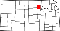 | |
| Unincorporated communities | ||
| Townships | ||
| Footnotes | ‡This populated place also has portions in an adjacent county or counties | |