Crumpsall
| Crumpsall | |
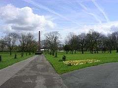 The obelisk in Crumpsall Park |
|
 Crumpsall |
|
| Population | 15,959 (2011 Census) |
|---|---|
| OS grid reference | SD838026 |
| Metropolitan borough | Manchester |
| Metropolitan county | Greater Manchester |
| Region | North West |
| Country | England |
| Sovereign state | United Kingdom |
| Post town | MANCHESTER |
| Postcode district | M8 |
| Dialling code | 0161 |
| Police | Greater Manchester |
| Fire | Greater Manchester |
| Ambulance | North West |
| EU Parliament | North West England |
| UK Parliament | Blackley and Broughton |
|
|
Coordinates: 53°31′00″N 2°14′30″W / 53.5167°N 2.2417°W
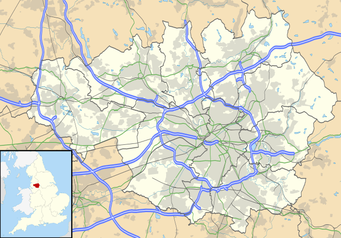
Crumpsall is a suburban area and electoral ward of the city of Manchester, in Greater Manchester, England. The Ward population at the 2011 census was 15,959.[1] It is about 3 miles (5 km) north of Manchester city centre. The area is adjacent to the Cheetham Hill, Blackley and Harpurhey wards of the City of Manchester, Broughton of the City of Salford and Prestwich town of the Metropolitan Borough of Bury.
Historically part of Lancashire, Crumpsall was a township within the parish of Manchester, Salford Hundred.
It is the location of North Manchester General Hospital. This was previously three hospitals: Crumpsall Hospital (a general hospital), Springfield Hospital (a psychiatric hospital) and Delaunay's Hospital (a geriatric hospital).
History
The name Crumpsall derives from old English and means a "crooked piece of land beside a river".[2] Crumpsall was rural in character during the early part of the 19th century, however, the necessity to house Manchester's growing population of mill workers saw the area become more urbanised. Crumpsall was incorporated into the city of Manchester in 1890.[2]
Crumpsall Hall was the seat of the Chethams and subsequently passed to the Waklyns. The Manchester workhouse was built after the formation of the Poor Law Unions in 1837.[3]
The Co-operative Wholesale Society opened the Crumpsall Biscuit Works in Lower Crumpsall around 1873.[4]
In January 2003 Detective Constable Stephen Oake, a Greater Manchester Police officer, was fatally stabbed whilst arresting a suspected terrorist in a house on Crumpsall Lane.[5]
Governance
Crumpsall was a township or civil parish in the Salford Hundred in the historic county of Lancashire. It was part of the Manchester Poor Law Union (PLU) between 1841 and 1850, the Prestwich PLU from 1850 to 1915, and again in the Manchester PLU from 1915 to 1930. In 1854 a Local Board of Health was established for the area of the township. In 1890 the township was incorporated into the city of Manchester.[6]
Crumpsall is represented on Manchester City Council by three Labour Councillors, Sir Richard Leese, who is currently leader of Manchester City Council, Jon-Leigh Pritchard and Con Keegan.[7] It is also part of the Blackley and Broughton parliamentary constituency (formerly Manchester Blackley), and has been represented by Labour MP Graham Stringer since 1997.
Geography
Crumpsall is divided into Higher and Lower Crumpsall. Lower Crumpsall is situated in the Irk Valley, which forms its northern boundary with the neighbouring suburb of Blackley at Tetlow Bridge.[8]
The main routes through the district are Crescent Road, Cravenwood Road, Delaunay's Road, Cleveland Road, Crumpsall Lane, Middleton Road, Lansdowne Road (the main shopping area with the post office), one half of Bury Old Road between Melton Road and Crescent Road (the other side of the road being in the Higher Broughton area of Salford) and Ash Tree Road (bounded on the east side by Crumpsall Park).
 |
Prestwich | Higher Blackley | Blackley, Charlestown | |
| Broughton | |
Harpurhey | ||
| ||||
| | ||||
| Broughton | Cheetham Hill | Harpurhey |
Demography
| 'Demography of Crumpsall'[9] | ||||
|---|---|---|---|---|
| UK Census 2001 | Crumpsall | Manchester | England | |
| Total population | 11,363 | 392,819 | 49,138,831 | |
| White or White British | 67% | 81% | 91% | |
| Asian or Asian British | 18% | 9% | 5% | |
| Black or Black British | 3% | 5% | 2% | |
| Other | 1% | 2% | 0.89% | |
According to the 2001 national census, the ward has a population of 11,363,[10] and religious affiliation was the following:
- Christian - 52.05%
- Muslim - 17.26%
- Jewish - 8.99%
- Sikh - 1.00%
- No religion or other (including Buddhist and Hindu) - 20.47%
Religion
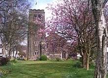
St Thomas's Church was founded in 1863 and after the closure of St Mark's in Cheetham in 1982 its dedication was changed to St Thomas with St. Mark.[11] There is a war memorial[12] in the churchyard commemorating those who died in the First World War.
In Higher Crumpsall, there are several places of worship including St Anne's Catholic Church, Crumpsall Methodist Church, St Matthew with St Mary CofE Church[13] and Heaton Park Hebrew Congregation Synagogue.
Education
Primary education is provided by Cravenwood Primary Academy, Crumpsall Lane Primary School, St Anne's RC Primary School, King David's Infant School, King David's Junior School and Irk Valley Community School (was St Thomas' Primary School). Secondary education is provided by King David's High School and Abraham Moss High School, the latter of which is part of the Abraham Moss Learning Centre. The King David schools are targeted at Greater Manchester's Orthodox Jewish community, whilst St Anne's is a Roman Catholic institution.
Crumpsall Lane Primary School is a two form entry school with two reception classes and a nursery. The head teacher is Sally Barrett.[14]
The Abraham Moss Leisure Centre hosts the only college in the area and forms part of the Manchester College network of further education institutions. It was previously part of the network of City College Manchester colleges, before the merger with MANCAT on the 1 August 2008.[15]
Transport
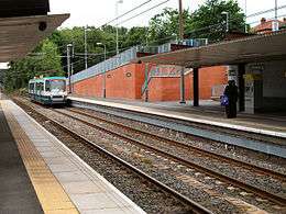
Crumpsall is currently served by three stations on Manchester Metrolink's Bury line. Crumpsall Metrolink station on Station Road is located in the centre of the ward, whilst Bowker Vale station lies to the north eastern extremity on Middleton Road and borders Higher Blackley. The newest station stop is at Abraham Moss next to the Abraham Moss Leisure Centre, Library, Schools and a campus of Manchester College.
First Greater Manchester, Bluebird and JPT amongst other private companies operate regular bus services through the ward, via North Manchester General Hospital and onwards to Manchester city centre and other areas of Greater Manchester.
Voluntary organisations
The Friends of Crumpsall Park oversee the development and well-being of the park in conjunction with the city council, Manchester Leisure and the police. They also organise the annual Crumpsall Carnival which takes place on the last Sunday in June.[16]
Notable people
Sir Humphrey Chetham was born in Crumpsall in 1580, the son of a successful Manchester merchant who lived in Crumpsall Hall. He was responsible for the creation of Chetham's Hospital (now Chetham's School of Music) and Chetham's Library, the oldest public library in the English-speaking world,[17] which is located in the city centre.
The folk singer, comedian and broadcaster Mike Harding, was born in the area in 1944.[18]
The Moors murderer Myra Hindley was born in Crumpsall in 1942.[19]
Howard Jacobson was brought up in Crumpsall and some of his novels, Kalooki Nights and The Mighty Walzer feature descriptions of Jewish life in the area.[20]
Actor and singer Don Estelle (Gunner "Lofty" Sugden in It Ain't Half Hot Mum), real name Ronald Edwards, was born and brought up in Crumpsall.[21]
Bassist Gary Manny "Mani" Mounfield of the Stone Roses was born in Crumpsall.
Jason Orange of the boy band Take That was born at North Manchester General Hospital in Crumpsall.[22]
References
- ↑ "City of Manchester Ward population 2011". Retrieved 5 January 2016.
- 1 2 Crumpsall: Districts and suburbs of Manchester Retrieved on 08 September 2009
- ↑ Crumpsall, retrieved 28 June 2010
- ↑ Co-operative Wholesale Society, archived from the original on 27 June 2010, retrieved 28 June 2010
- ↑ Harper, Smyth (15 January 2003). "Suburb in shock over killing". BBC News. Retrieved 13 February 2010.
- ↑ Greater Manchester Gazetteer, Greater Manchester County Record Office, archived from the original on 18 July 2011, retrieved 28 June 2011
- ↑ Crumpsall Labour Blog Retrieved on 26 november 2008
- ↑ http://www.tetlow.co.uk/tetlow_bridge.htm tetlow.co.uk
- ↑ United Kingdom Census 2001 (2001). "Area: Crumpsall (Ward)". neighbourhood.statistics.gov.uk. Retrieved 26 August 2009.
- ↑ Office for National Statistics: Neighbourhood statistics: Crumspall Ward Retrieved on 21 September 2008
- ↑ St Thomas, Crumpsall - Church of England, retrieved 28 June 2010
- ↑ http://www.ukniwm.org.uk/server/show/conMemorial.18508 uknowm.org.uk
- ↑ http://www.achurchnearyou.com/crumpsall-st-matthew-st-mary0/
- ↑ http://www.crumpsalllaneprimary.org/
- ↑ "City College Manchester - Merger News Q&A". City College Manchester. Retrieved 25 April 2008.
- ↑ Friends of Crumpsall Park
- ↑ "BBC - Radio 4 You and Yours -Chetham's Library". Retrieved 6 January 2008.
- ↑ Mike Harding Biography Retrieved 13-02.2010
- ↑ "Obituary: Myra Hindley". BBC News. 15 November 2002. Retrieved 13 February 2010.
- ↑ Cooke, Rachel (25 June 2006). "Still angry after all these years". The Observer. London. Retrieved 13 February 2010.
- ↑ Byrne, Michael (5 August 2003). "Farewell to screen star 'Lofty' Don". Rochdale Observer. M.E.N. Media. Retrieved 13 February 2010.
- ↑ Anon. "Jason orange". Take That appreciation pages. Archived from the original on 5 May 2009. Retrieved 19 July 2010.