Lyndonville Air Force Station
| Lyndonville Air Force Station | |
|---|---|
| Part of Air Defense Command (ADC) | |
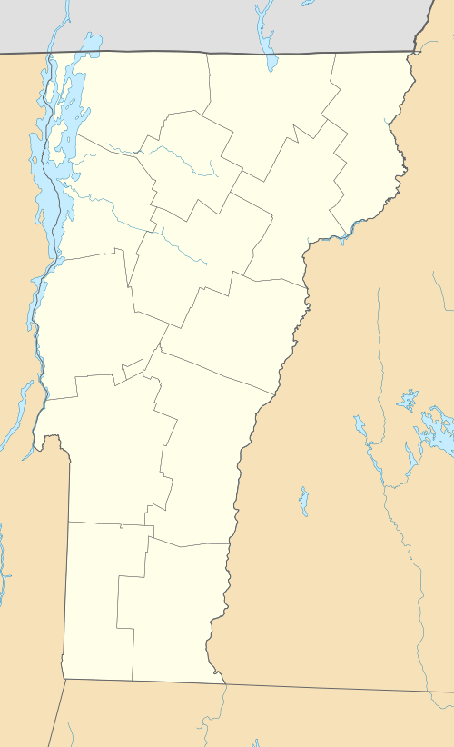 Lyndonville AFS Location of Lyndonville AFS, Vermont | |
| Coordinates | 44°39′55″N 071°46′16″W / 44.66528°N 71.77111°W |
| Type | Air Force Station |
| Site information | |
| Controlled by |
|
| Site history | |
| Built | 1956 |
| In use | 1956-1964 |
| Garrison information | |
| Garrison | 911th Aircraft Control and Warning (later Radar) Squadron |

Lyndonville Air Force Station (ADC ID: M-103) is a closed United States Air Force General Surveillance Radar station. It is located 14.6 miles (23.5 km) northeast of Lyndonville, Vermont. It was closed in 1963.
History
Initially known as North Concord AFS, the station was part of the planned deployment of forty-four Mobile radar stations by Air Defense Command in 1952 to provide protection for Strategic Air Command Bases and to support the permanent deployment of the seventy-five stations of the ADC radar network around the perimeter of the country. This deployment had been projected to be operational by mid-1952. Funding, constant site changes, construction, and equipment delivery delayed deployment.
North Concord became operational on 1 March 1956 when the 911th Aircraft Control and Warning Squadron activated AN/MPS-11 and AN/MPS-14 radars, and initially the station functioned as a Ground-Control Intercept (GCI) and warning station. As a GCI station, the squadron's role was to guide interceptor aircraft toward unidentified intruders picked up on the unit's radar scopes.
In 1958 an AN/FPS-6A height-finder radar joined the site. In 1959 the 911th briefly operated an AN/FPS-3 radar. During 1959 North Concord AFS joined the Semi Automatic Ground Environment (SAGE) system, feeding data to DC-05 at Topsham AFS, Maine. After joining, the squadron was redesignated as the 911th Radar Squadron (SAGE) on 1 October 1959. The radar squadron provided information 24/7 the SAGE Direction Center where it was analyzed to determine range, direction altitude speed and whether or not aircraft were friendly or hostile. In August 1962 the station was switched to the SAGE Data Center DC-02 at Stewart AFB, New York.
On 1 March 1962 the station was renamed Lyndonville AFS, and later that year new radar towers were constructed to house an AN/FPS-27 search radar and an AN/FPS-26 height-finder radar. In early 1963 the AN/FPS-26 radar was installed. However, in March 1963 the Air Force ordered the site to close. The AN/FPS-27 installation was then cancelled. Operations ceased on 1 August 1963.
Today, the site sits abandoned with all of its towers still standing, and many buildings in various states of disrepair but still intact. The housing area is currently in use, in fact, the town of East Haven, Vermont (5.8 mi East), has grown up around it.
Air Force units and assignments
Units
- Established as the 911th Aircraft Control and Warning Squadron"
- Activated at Syracuse AFS (P-5), NY on 26 May 1953 (not manned or equipped)
- Moved to North Concord AFS (later Lyndonville AFS), VT on 1 March 1956
- Redesignated: 911th Radar Squadron (SAGE) on 1 October 1959
- Discontinued and inactivated on 1 August 1963
Assignments:
- 32d Air Division, 26 May 1953
- 4711th Air Defense Wing, 1 June 1955
- 32d Air Division, 1 March 1956
- Bangor Air Defense Sector, 15 August 1958
- Boston Air Defense Sector, 1 August 1962 – 1 August 1963
See also
References
![]() This article incorporates public domain material from the Air Force Historical Research Agency website http://www.afhra.af.mil/.
This article incorporates public domain material from the Air Force Historical Research Agency website http://www.afhra.af.mil/.
- Cornett, Lloyd H. and Johnson, Mildred W., A Handbook of Aerospace Defense Organization 1946 - 1980, Office of History, Aerospace Defense Center, Peterson AFB, CO (1980).
- Winkler, David F. & Webster, Julie L., Searching the Skies, The Legacy of the United States Cold War Defense Radar Program, US Army Construction Engineering Research Laboratories, Champaign, IL (1997).
- Information for Lyndonville AFS, VT
