Malemort-du-Comtat
| Malemort-du-Comtat | ||
|---|---|---|
|
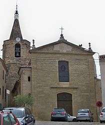
The church of Malemort du Comtat | ||
| ||
 Malemort-du-Comtat | ||
|
Location within Provence-A.-C.d'A. region  Malemort-du-Comtat | ||
| Coordinates: 44°01′18″N 5°09′37″E / 44.0217°N 5.1603°ECoordinates: 44°01′18″N 5°09′37″E / 44.0217°N 5.1603°E | ||
| Country | France | |
| Region | Provence-Alpes-Côte d'Azur | |
| Department | Vaucluse | |
| Arrondissement | Carpentras | |
| Canton | Mormoiron | |
| Intercommunality | Terrasses du Ventoux | |
| Area1 | 11.92 km2 (4.60 sq mi) | |
| Population (2006)2 | 1,410 | |
| • Density | 120/km2 (310/sq mi) | |
| Time zone | CET (UTC+1) | |
| • Summer (DST) | CEST (UTC+2) | |
| INSEE/Postal code | 84070 / 84570 | |
| Elevation |
160–364 m (525–1,194 ft) (avg. 208 m or 682 ft) | |
|
1 French Land Register data, which excludes lakes, ponds, glaciers > 1 km² (0.386 sq mi or 247 acres) and river estuaries. 2 Population without double counting: residents of multiple communes (e.g., students and military personnel) only counted once. | ||
.svg.png)
Malemort-du-Comtat is a commune in the Vaucluse department in the Provence-Alpes-Côte d'Azur region in southeastern France.
See also
References
| Wikimedia Commons has media related to Malemort-du-Comtat. |
This article is issued from Wikipedia - version of the 2/12/2016. The text is available under the Creative Commons Attribution/Share Alike but additional terms may apply for the media files.