Taillades
| Taillades | ||
|---|---|---|
|
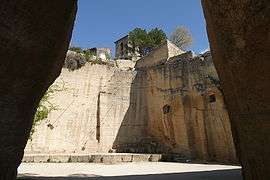
The old quarry, which is now an open-air theatre | ||
| ||
 Taillades | ||
|
Location within Provence-A.-C.d'A. region  Taillades | ||
| Coordinates: 43°50′13″N 5°05′29″E / 43.8369°N 5.0914°ECoordinates: 43°50′13″N 5°05′29″E / 43.8369°N 5.0914°E | ||
| Country | France | |
| Region | Provence-Alpes-Côte d'Azur | |
| Department | Vaucluse | |
| Arrondissement | Apt | |
| Canton | Cavaillon | |
| Government | ||
| • Mayor (2001–2008) | Edmond Bouchet | |
| Area1 | 6.86 km2 (2.65 sq mi) | |
| Population (2006)2 | 1,917 | |
| • Density | 280/km2 (720/sq mi) | |
| Time zone | CET (UTC+1) | |
| • Summer (DST) | CEST (UTC+2) | |
| INSEE/Postal code | 84131 / 84300 | |
|
1 French Land Register data, which excludes lakes, ponds, glaciers > 1 km² (0.386 sq mi or 247 acres) and river estuaries. 2 Population without double counting: residents of multiple communes (e.g., students and military personnel) only counted once. | ||
.svg.png)
Taillades is a commune in the Vaucluse department in the Provence-Alpes-Côte d'Azur region in southeastern France.
It is 5 km (3.1 mi) east of Cavaillon, and 40 km (25 mi) south east of Avignon.
Situated in the Luberon, the village covers 675 hectares of which 320 are mountainside. It has a population of about 1,900 inhabitants.[1]
The village was awarded the 'two flowers' standard in the national competition for floral villages.
History
The village developed as a community of stone workers employed at the quarries nearby. The entrance to the old village is marked by a medieval tower, a vestige of the original castle. The castle was rebuilt in the seventeenth century. In 1859, the village mill, Moulin Saint-Pierre, was built. Today it is used as a function room for the village.[2]
See also
References
| Wikimedia Commons has media related to Taillades. |