Malkapuram, Visakhapatnam
| Malkapuram మల్కాపురం | |
|---|---|
| Neighbourhood | |
|
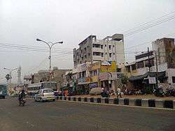
Malkapuram Road Towards Gajuwaka | |
 Malkapuram  Malkapuram Location in Andhra Pradesh, India | |
| Coordinates: 17°42′00″N 83°13′00″E / 17.7°N 83.2167°ECoordinates: 17°42′00″N 83°13′00″E / 17.7°N 83.2167°E | |
| Country |
|
| State | Andhra Pradesh |
| District | Visakhapatnam |
| Government | |
| • Body | Greater Visakhapatnam Municipal Corporation |
| Languages | |
| • Official | Telugu |
| Time zone | IST (UTC+5:30) |
| PIN | 530011 |
| Vehicle registration | AP 31 and AP 33 |
Malkapuram is an area, lying approximately 11 km to the south of Visakhapatnam City in the state of Andhra Pradesh, India. Since most of the heavy industries established in Visakhapatnam, like HPCL, Dock Dard , and Caltex etc.[1]
Commerce
Growing into a factory town, since the 1980s it has seen a rapid increase in commercial establishments like shopping stores, etc. It is the focal point for commerce for most Navy Quarters and suburbs to its south, not counting its own
Localities
Neighbouring localities include Sri Hari Puram and Gajuwaka. Janatha Colony,Abedkar Colony, and Eedu gulla centre, are important residential areas in Malkapuram.
Transport
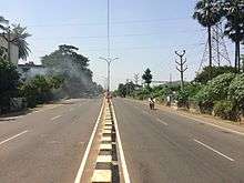
Malkapuram is well connected to Gajuwaka, NAD X Road, Maddilapalem, Visakhapatnam Railway Station, Simhachalam and Pendurthi.
References
- ↑ "Major blast rocks Vizag HPCL refinery". TOI. 17 May 2013. Retrieved 30 August 2014.

{{http://www.vizaginfo.com/others/indus/hpcl.asp}}