Mallard, Iowa
| Mallard, Iowa | |
|---|---|
| City | |
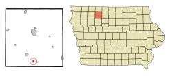 Location of Mallard, Iowa | |
| Coordinates: 42°56′14″N 94°41′3″W / 42.93722°N 94.68417°WCoordinates: 42°56′14″N 94°41′3″W / 42.93722°N 94.68417°W | |
| Country |
|
| State |
|
| County | Palo Alto |
| Area[1] | |
| • Total | 0.41 sq mi (1.06 km2) |
| • Land | 0.41 sq mi (1.06 km2) |
| • Water | 0 sq mi (0 km2) |
| Elevation | 1,224 ft (373 m) |
| Population (2010)[2] | |
| • Total | 274 |
| • Estimate (2012[3]) | 271 |
| • Density | 668.3/sq mi (258.0/km2) |
| Time zone | Central (CST) (UTC-6) |
| • Summer (DST) | CDT (UTC-5) |
| ZIP code | 50562 |
| Area code(s) | 712 |
| FIPS code | 19-48585 |
| GNIS feature ID | 0458740 |
Mallard is a city in Palo Alto County, Iowa, United States. The population was 274 at the 2010 census.
History
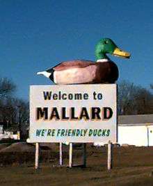
Mallard had its start about 1882 by the building of the Des Moines and Fort Dodge Railroad through that territory. The town was named by the railroad president, an avid hunter, from mallard ducks inhabiting the area ponds.[4]
Geography
Mallard is located at 42°56′14″N 94°41′3″W / 42.93722°N 94.68417°W (42.937269, -94.684169).[5]
According to the United States Census Bureau, the city has a total area of 0.41 square miles (1.06 km2), all of it land.[1]
Demographics
| Historical populations | ||
|---|---|---|
| Year | Pop. | ±% |
| 1900 | 292 | — |
| 1910 | 331 | +13.4% |
| 1920 | 431 | +30.2% |
| 1930 | 449 | +4.2% |
| 1940 | 438 | −2.4% |
| 1950 | 399 | −8.9% |
| 1960 | 431 | +8.0% |
| 1970 | 384 | −10.9% |
| 1980 | 407 | +6.0% |
| 1990 | 360 | −11.5% |
| 2000 | 298 | −17.2% |
| 2010 | 274 | −8.1% |
| 2014 | 266 | −2.9% |
| 2015 | 267 | +0.4% |
| Source:"American FactFinder". United States Census Bureau. and Iowa Data Center Source: | ||
2010 census
As of the census[2] of 2010, there were 274 people, 119 households, and 81 families residing in the city. The population density was 668.3 inhabitants per square mile (258.0/km2). There were 137 housing units at an average density of 334.1 per square mile (129.0/km2). The racial makeup of the city was 96.4% White, 0.4% Native American, 2.9% from other races, and 0.4% from two or more races. Hispanic or Latino of any race were 4.4% of the population.
There were 119 households of which 30.3% had children under the age of 18 living with them, 53.8% were married couples living together, 5.9% had a female householder with no husband present, 8.4% had a male householder with no wife present, and 31.9% were non-families. 26.1% of all households were made up of individuals and 14.3% had someone living alone who was 65 years of age or older. The average household size was 2.30 and the average family size was 2.68.
The median age in the city was 44 years. 24.1% of residents were under the age of 18; 7% were between the ages of 18 and 24; 20.5% were from 25 to 44; 27.8% were from 45 to 64; and 20.8% were 65 years of age or older. The gender makeup of the city was 52.9% male and 47.1% female.
2000 census
As of the census[7] of 2000, there were 298 people, 133 households, and 86 families residing in the city. The population density was 783.6 people per square mile (302.8/km²). There were 143 housing units at an average density of 376.0 per square mile (145.3/km²). The racial makeup of the city was 98.66% White, and 1.34% from two or more races.
There were 133 households out of which 26.3% had children under the age of 18 living with them, 55.6% were married couples living together, 3.8% had a female householder with no husband present, and 35.3% were non-families. 32.3% of all households were made up of individuals and 21.1% had someone living alone who was 65 years of age or older. The average household size was 2.24 and the average family size was 2.83.
22.1% are under the age of 18, 6.0% from 18 to 24, 21.1% from 25 to 44, 22.8% from 45 to 64, and 27.9% who were 65 years of age or older. The median age was 46 years. For every 100 females there were 97.4 males. For every 100 females age 18 and over, there were 96.6 males.
The median income for a household in the city was $28,056, and the median income for a family was $31,806. Males had a median income of $26,528 versus $11,917 for females. The per capita income for the city was $16,451. About 12.7% of families and 12.1% of the population were below the poverty line, including 19.0% of those under the age of eighteen and 8.1% of those sixty five or over.
Notable people
- Mark Kacmarynski, running back who played for the Frankfurt Galaxy in NFL Europe during the 1999 season; born in Mallard[8]
- Frank Mulroney, relief pitcher who played for the Boston Red Sox during the 1930 season; born in Mallard[9]
References
- 1 2 "US Gazetteer files 2010". United States Census Bureau. Retrieved 2012-05-11.
- 1 2 "American FactFinder". United States Census Bureau. Retrieved 2012-05-11.
- ↑ "Population Estimates". United States Census Bureau. Retrieved 2013-05-23.
- ↑ McCarty, Dwight Gaylord (1910). History of Palo Alto County, Iowa. Torch Press. p. 152.
- ↑ "US Gazetteer files: 2010, 2000, and 1990". United States Census Bureau. 2011-02-12. Retrieved 2011-04-23.
- ↑ "Census of Population and Housing". Census.gov. Retrieved June 4, 2015.
- ↑ "American FactFinder". United States Census Bureau. Retrieved 2008-01-31.
- ↑ "Mallard Native Inducted Into Central College Hall Of Fame". Emmetsburg Reporter Democrat. Retrieved September 18, 2014.
- ↑ "Frank Mulroney". Baseball-Reference.com. Retrieved July 27, 2014.
Municipalities and communities of Palo Alto County, Iowa, United States | ||
|---|---|---|
| Cities | ||
| Footnotes | ‡This populated place also has portions in an adjacent county or counties | |