Maple Island, Freeborn County, Minnesota
| Maple Island, Minnesota | |
|---|---|
| Unincorporated community | |
 Maple Island  Maple Island | |
| Coordinates: 43°45′42″N 93°09′50″W / 43.76167°N 93.16389°WCoordinates: 43°45′42″N 93°09′50″W / 43.76167°N 93.16389°W | |
| Country | United States |
| State | Minnesota |
| County | Freeborn |
| Township | Newry Township and Moscow Township |
| Elevation | 1,217 ft (371 m) |
| Time zone | Central (CST) (UTC-6) |
| • Summer (DST) | CDT (UTC-5) |
| ZIP code | 56045 |
| Area code(s) | 507 |
| GNIS feature ID | 647478[1] |
Maple Island is an unincorporated community in Freeborn County, Minnesota, United States.
The community is located east of Hollandale along State Highway 251 (MN 251) near Freeborn County Road 30.
Maple Island is located within Newry Township and Moscow Township.
Nearby places include Hollandale, Corning, Blooming Prairie, Geneva, and Clarks Grove.
References
Municipalities and communities of Freeborn County, Minnesota, United States | ||
|---|---|---|
| Cities | 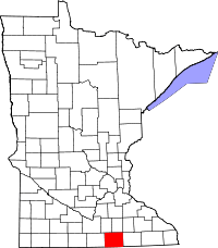 | |
| Townships | ||
| Unincorporated communities | ||
| Footnotes | ‡This populated place also has portions in an adjacent county or counties | |
This article is issued from Wikipedia - version of the 7/28/2016. The text is available under the Creative Commons Attribution/Share Alike but additional terms may apply for the media files.