Albert Lea, Minnesota
| Albert Lea, Minnesota | |
|---|---|
| City | |
|
The historic downtown | |
| Motto: Land Between the Lakes | |
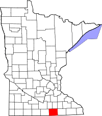
 Location of the city of Albert Lea within Freeborn County in the state of Minnesota | |
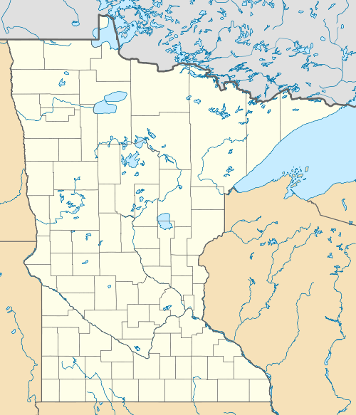
 Albert Lea, Minnesota Location of the city of Albert Lea | |
| Coordinates: 43°38′52.3″N 93°22′7.5″W / 43.647861°N 93.368750°W | |
| Country | United States |
| State | Minnesota |
| County | Freeborn |
| Settled | 1855 |
| Incorporated (village) | 1859 |
| Incorporated (city) | 1878 |
| Government | |
| • Mayor | Vern Rasmussen Jr. |
| • City Manager | Chad Adams |
| • City Attorney | Lee Bjorndal |
| • Public Safety Director | Dwaine Winkels |
| Area[1] | |
| • Total | 14.42 sq mi (37.35 km2) |
| • Land | 12.59 sq mi (32.61 km2) |
| • Water | 1.83 sq mi (4.74 km2) 12.69% |
| Elevation | 1,243 ft (379 m) |
| Population (2010)[2] | |
| • Total | 18,016 |
| • Estimate (2015)[3] | 17,674 |
| • Density | 1,431.0/sq mi (552.5/km2) |
| • Demonym | Albert Leans |
| Time zone | Central (UTC-6) |
| • Summer (DST) | Central (UTC-5) |
| ZIP Code | 56007 |
| Area code(s) | 507 |
| FIPS code | 27-00694 |
| GNIS feature ID | 0639247[4] |
| Website | cityofalbertlea.org |
Albert Lea is a city in and the county seat of Freeborn County in the southeastern part of the State of Minnesota.[5] The population was 18,016 at the 2010 census.[6]
The city is at the junction of Interstates 35 and 90, about 90 miles (140 km) south of the Twin Cities. It is on the shores of Fountain Lake, Pickerel Lake, Albert Lea Lake, Goose Lake, School Lake, and Lake Chapeau. Fountain Lake and Albert Lea Lake are part of the Shell Rock River flowage.
The city's early growth was based upon agriculture, farming support services and manufacturing and was a significant rail center. At one time it was the site of Cargill's headquarters. Other manufacturing included Edwards Manufacturing (barn equipment), Scotsman Ice Machines, Streater Store fixtures, and Universal Milking Machines. Like many U.S. towns much of the manufacturing base has diminished. A long-time center of the city's job opportunity was the Wilson & Company meat packing plant, later known as Farmstead and Farmland. This facility was destroyed by fire in July 2001. The largest employer is currently Mayo Clinic Health System with over 1,500 employees.
History

The city is named after Albert Miller Lea, a topographer with the United States Dragoons, who surveyed southern Minnesota and northern Iowa in 1835, including the current site of Albert Lea.[7] Captain Nathan Boone, a son of Daniel Boone, was the scout for Lea's unit.
Albert Lea received national attention in 1959 after Local 6 of the United Packinghouse Workers of America went on strike against Wilson & Co. (one of the Big Four meatpacking plants at the time) over issues involving mandatory overtime requirements.[8] When Wilson & Co. attempted to operate the plant with replacement workers, violence erupted and split the town. During the 109-day strike, Governor Orville Freeman acted to quell the violence by closing the plant, calling in the Minnesota National Guard, and (on December 11) declaring martial law.[9] A Federal district court in Minneapolis ruled against the Governor on December 23, and the plant turned back to Wilson & Co. just days later.[10]
Government
The city hall is located at 221 East Clark St, Albert Lea, MN 56007. Albert Lea is located in Minnesota's 1st congressional district, represented by Mankato educator Tim Walz, a Democrat (DFL). The Minnesota State Senate District is 27, represented by State Senator Dan Sparks, a member of the DFL. It is in Minnesota's House District 27A, represented in the Minnesota House of Representatives by Peggy Bennett, a member of the GOP.[11]
Geography
According to the United States Census Bureau, the city has a total area of 14.42 square miles (37.35 km2), of which 12.59 square miles (32.61 km2) is land and 1.83 square miles (4.74 km2) is water.[1] Myre-Big Island State Park is nearby. There are three main lakes in Albert Lea: Fountain Lake, Pickerel Lake and Albert Lea Lake. Coordinates: 43°38′52.3″N 93°22′7.5″W / 43.647861°N 93.368750°W
Demographics
| Historical population | |||
|---|---|---|---|
| Census | Pop. | %± | |
| 1860 | 262 | — | |
| 1880 | 1,966 | — | |
| 1890 | 3,305 | 68.1% | |
| 1900 | 4,500 | 36.2% | |
| 1910 | 6,192 | 37.6% | |
| 1920 | 8,056 | 30.1% | |
| 1930 | 10,169 | 26.2% | |
| 1940 | 12,200 | 20.0% | |
| 1950 | 13,545 | 11.0% | |
| 1960 | 17,108 | 26.3% | |
| 1970 | 19,418 | 13.5% | |
| 1980 | 19,200 | −1.1% | |
| 1990 | 18,310 | −4.6% | |
| 2000 | 18,356 | 0.3% | |
| 2010 | 18,016 | −1.9% | |
| Est. 2015 | 17,674 | [12] | −1.9% |
| U.S. Decennial Census[13] 2015 Estimate[3] | |||
2010 census
As of the census[2] of 2010, there were 18,016 people, 7,774 households, and 4,644 families residing in the city. The population density was 1,431.0 inhabitants per square mile (552.5/km2). There were 8,410 housing units at an average density of 668.0 per square mile (257.9/km2). The racial makeup of the city was 90.0% White, 1.1% African American, 0.3% Native American, 1.1% Asian, 0.1% Pacific Islander, 5.3% from other races, and 2.1% from two or more races. Hispanic or Latino of any race were 13.2% of the population.
There were 7,774 households of which 25.6% had children under the age of 18 living with them, 45.0% were married couples living together, 10.4% had a female householder with no husband present, 4.4% had a male householder with no wife present, and 40.3% were non-families. 34.9% of all households were made up of individuals and 17.3% had someone living alone who was 65 years of age or older. The average household size was 2.24 and the average family size was 2.85.
The median age in the city was 44 years. 21.5% of residents were under the age of 18; 7.9% were between the ages of 18 and 24; 22% were from 25 to 44; 26.3% were from 45 to 64; and 22.4% were 65 years of age or older. The gender makeup of the city was 48.3% male and 51.7% female.
2000 census
As of the census of 2000, there were 18,356 people, 7,785 households, and 4,826 families residing in the city. The population density was 1,702.5 people per square mile (657.4/km²). There were 8,133 housing units at an average density of 754.3 per square mile (291.3/km²). The racial makeup of the city was 92.80% White, 0.37% African American, 0.29% Native American, 0.80% Asian, 0.03% Pacific Islander, 4.54% from other races, and 1.18% from two or more races. 9.48% of the population were Hispanic or Latino of any race.
Of the 7,785 households, 26.9% had children under the age of 18 living with them, 49.5% were married couples living together, 9.1% had a female householder with no husband present, and 38.0% were non-families. 33.0% of all households were made up of individuals and 16.8% had someone living alone who was 65 years of age or older. The average household size was 2.28 and the average family size was 2.88.
23.0% of Albert Lea's population were under the age of 18, 7.9% were 18 to 24, 24.6% were 25 to 44, 23.2% were from 45 to 64, and 21.3% were 65 years of age or older. The median age was 41 years. For every 100 females there were 90.2 males. For every 100 females age 18 and over, there were 87.6 males.
The median income for a household in the city was $32,841, and the median income for a family was $42,407. Males had a median income of $31,383 versus $21,114 for females. The per capita income for the city was $17,979. 10.2% of the population and 6.9% of families were below the poverty line. 10.6% of those under the age of 18 and 10.9% of those 65 and older were living below the poverty line.
Climate
| Climate data for Albert Lea, Minnesota | |||||||||||||
|---|---|---|---|---|---|---|---|---|---|---|---|---|---|
| Month | Jan | Feb | Mar | Apr | May | Jun | Jul | Aug | Sep | Oct | Nov | Dec | Year |
| Average high °F | 23 | 28 | 40 | 56 | 69 | 78 | 82 | 80 | 72 | 59 | 42 | 27 | 54.7 |
| Average low °F | 5 | 10 | 22 | 35 | 47 | 58 | 62 | 59 | 50 | 37 | 25 | 10 | 35 |
| Average precipitation inches | 0.75 | 0.71 | 1.85 | 3.66 | 4.45 | 4.72 | 4.57 | 4.45 | 3.58 | 2.52 | 1.73 | 1.1 | 34.09 |
| Average high °C | −5 | −2 | 4 | 13 | 21 | 26 | 28 | 27 | 22 | 15 | 6 | −3 | 12.7 |
| Average low °C | −15 | −12 | −6 | 2 | 8 | 14 | 17 | 15 | 10 | 3 | −4 | −12 | 1.7 |
| Average precipitation mm | 19 | 18 | 47 | 93 | 113 | 119.9 | 116.1 | 113 | 90.9 | 64 | 43.9 | 28 | 865.9 |
| Source #1: Weatherise[14] | |||||||||||||
| Source #2: U.S. climate data[15] | |||||||||||||
Albert Lea has a warm-summer subtype of the humid continental climate with cold winters to hot summers, with significant contrasts between seasons. Its climate type is typical for inland northern United States locations, but due to its southern position in the state, its summers and winters have higher temperatures than Minneapolis - St. Paul and Duluth.
Education
- School District 241
- Elementary schools
- Middle schools
- High school
- Higher education
- Riverland Community College
- Lea College, operated 1966-1973
- Community education
Sites of interest
Myre-Big Island State park
State park of Minnesota located near Albert Lea, MN. Home to trails that take visitors around wet lowlands, oak savanna, and grasslands. Albert Lea Lake and park marshes draw hundreds of waterfowl during migration. Oak savanna and prairie landscape, including wetlands, dominate most of the park. One of the more distinctive aspects of the park is the 116-acre Big Island, covered with maple/basswood forest. Another is the glacial esker located in the northeast section of the park.[16] Blazing Star Trail bike trail takes you from Albert Lea, and right into the state park. It's open to Spring and Fall bird migrations, glacial esker, great marsh, bird watching, hiking, canoeing, and camping.
Marion Ross Performing Arts Center
The Marion Ross Performing Arts Center is an historic building conveniently located in downtown Albert Lea. The theater has a spacious lobby and a fully equipped lighting and sound system. It seats 255. It has a projector that can be used with DVDs, VCRs and computers for a variety of presentations. The theater is an ideal facility for business meetings and seminars. A room on the downstairs level is perfect for small meetings.[17]
Lakes
Known as, "The Land Between the Lakes," there are three main lakes in Albert Lea: Fountain Lake, Albert Lea Lake, and Pickerel Lake. Fish typically found in these lakes include: bullhead, carp, northern pike, bass, walleye, catfish, yellow perch and various panfish. Boating, fishing, canoeing, and boat tours are can be found on these lakes.
Notable people
- Rockabilly musician Eddie Cochran (composer of "Summertime Blues" and "Twenty Flight Rock")
- Alexander Grinager, an artist most noted for his murals, was born in Albert Lea
- College basketball star Ben Woodside of the North Dakota State Bison was born and raised in Albert Lea
- Comedian, commentator and U.S. Senator Al Franken briefly lived in Albert Lea, where he attended Hawthorne Elementary and Abbott Elementary; he moved when his father's business failed
- Conceptual artist Mary Kelly
- Actress Marion Ross (Happy Days); the town's civic theater in 2008 was renamed the Marion Ross Performing Arts Center
- Professional Wrestler Perry Saturn
- Former Washington Redskins general manager Vinny Cerrato
- Writer, editor and publisher Joan Claire Graham
- Former radio voice of the Houston Rockets, Gene Peterson[18]
- Tom Brown (Canadian football), Minnesota Golden Gophers and BC Lions football star; 1960 Outland Trophy winner and Heisman Trophy runner up; College Football Hall of Fame and Canadian Football Hall of Fame inductee
- Tim Penny, U.S. Congressman(1983-1995), born in Albert Lea
- Emily Batista (née Johnson), librarian, born in Albert Lea
- Richard Carlson writer, director and actor, best known to movie fans of '50 sci-fi and horror; starring roles include The Magnetic Monster (1953), Riders to the Stars (1954), It Came from Outer Space (1953), Creature from the Black Lagoon (1954)
- John A. Weber, WWII Veteran, stone commemorating his honor is located at Memorial Park
- John A. Lovely, Minnesota Supreme Court justice
- Cheri Register, Writer
Sports
The Albert Lea Thunder was a junior hockey team who played at Albert Lea Ice Arena and was a member of the North American Hockey League. The team operated for two seasons 2008-2010 and was folded due to financial difficulties. On May 11, 2010, it was reported that the team had found new owners and would relocate to Texas for the 2010-2011 season.[5] Their roster was officially sold to the expansion Amarillo, Texas franchise, the Amarillo Bulls, on May 26, 2010.[19]
See also
- Albert Lea Art Center
- Albert Lea Municipal Airport
- Albert Lea Public Library
- AARP/Blue Zones Vitality Project
References
- 1 2 "US Gazetteer files 2010". United States Census Bureau. Archived from the original on 2012-01-24. Retrieved 2012-11-13.
- 1 2 "American FactFinder". United States Census Bureau. Retrieved 2012-11-13.
- 1 2 "Population Estimates". United States Census Bureau. Retrieved June 13, 2016.
- ↑ "US Board on Geographic Names". United States Geological Survey. 2007-10-25. Retrieved 2008-01-31.
- ↑ "Find a County". National Association of Counties. Archived from the original on 2011-05-31. Retrieved 2011-06-07.
- ↑ "2010 Census Redistricting Data (Public Law 94-171) Summary File". American FactFinder. United States Census Bureau. Archived from the original on 21 July 2011. Retrieved 27 April 2011.
- ↑ "The Early Settlement of Albert Lea". Sequicentennial History. City of Albert Lea. Retrieved 2007-03-26.
- ↑ Register,Cheri (2001) Packinghouse Daughter, HarperCollins. ISBN 0-06-093684-3
- ↑ "Martial Law Ordered in Meat Strike", Oakland Tribune, December 11, 1959, p1
- ↑ Frost, Richard T. (1961) Cases in State and Local Government, Prentice-Hall LCCR: 61008224
- ↑ Minnesota House of Representatives; Peggy Bennett, District 27A
- ↑ "Annual Estimates of the Resident Population for Incorporated Places: April 1, 2010 to July 1, 2015". Retrieved July 2, 2016.
- ↑ United States Census Bureau. "Census of Population and Housing". Archived from the original on May 11, 2015. Retrieved September 12, 2013.
- ↑ "Weatherbase: Historical Weather for Albert Lea, Minnesota". Weatherbase. 2011. Retrieved on November 24, 2011.
- ↑ http://www.usclimatedata.com/climate/saint-paul/minnesota/united-states/usmn1299
- ↑ "Myre – Big Island State Park". Minnesota Department of Natural Resources.
- ↑ "Marion Ross Performing Arts Center". City of Albert Lea.
- ↑ Damien Pierce, Rockets' legendary voices finishing their final season, Houston Rockets, April 15, 2008
- ↑ NAHL.com, , 8th May 2008
External links
| Wikivoyage has a travel guide for Albert Lea. |
| Wikimedia Commons has media related to Albert Lea, Minnesota. |
- Albert Lea News and Info Website
- City of Albert Lea Official website
- Albert Lea Public Library website
- Albert Lea Area Schools website
- Riverland Community College website
- Albert Lea Tribune website
- Albert Lea Economic Development website
