Margate, Florida
| Margate, Florida | |
|---|---|
| City | |
| City of Margate | |
|
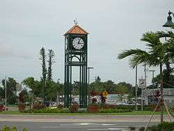
Clock tower near Margate city hall | |
| Motto: "Together We Make It Great" | |
 Location of Margate, Broward County, Florida | |
| Coordinates: 26°14′47″N 80°12′44″W / 26.24639°N 80.21222°WCoordinates: 26°14′47″N 80°12′44″W / 26.24639°N 80.21222°W | |
| Country |
|
| State |
|
| County |
|
| Incorporated (town) | May 30, 1955[1] |
| Incorporated (city) | June 22, 1961 |
| Government | |
| • Type | Commission-Manager |
| • Mayor | Tommy Ruzzano |
| • Vice Mayor | Joyce W. Bryan |
| • Commissioners | Lesa "Le" Peerman, Joanne Simone and Frank B. Talerico |
| • City Manager | Douglas E. Smith |
| • City Clerk | Joseph J. Kavanagh |
| Area[2] | |
| • City | 8.98 sq mi (23.3 km2) |
| • Land | 8.81 sq mi (22.8 km2) |
| • Water | 0.17 sq mi (0.4 km2) 1.89% |
| Elevation | 9 ft (3 m) |
| Population (2010) | |
| • City | 53,284 |
| • Density | 5,900/sq mi (2,300/km2) |
| • Metro | 5,564,635 |
| Time zone | Eastern (EST) (UTC-5) |
| • Summer (DST) | EDT (UTC-4) |
| ZIP code | 33063, 33065, 33068, 33073, 33093 |
| Area code(s) | 954, 754 |
| FIPS code | 12-43125[3] |
| GNIS feature ID | 0286413[4] |
| Website | http://www.margatefl.com/ |
Margate is a city in Broward County, Florida, United States. As of the 2010 census, the city had a population of 53,284. It is part of the Miami–Fort Lauderdale–Pompano Beach Metropolitan Statistical Area, which is home to 5,564,635 people.
It was founded in the 1950s, when much of it was still either part of the Everglades or farmland. It then became a town in 1955, when land development became prominent due to an influx of people moving to Margate. Soon after, in 1961, it was officially incorporated as a city. The name of the city itself is a portmanteau of the first three letters of the founder's last name, Jack Marqusee, and the first four letters of gateway, since it was considered a "gateway" to western Broward County.[5] The city also has a waterpark called Calypso Cove, and two golf courses, with one of them also tennis court as well: The Carolina Golf Club, and the Oriole Golf and Tennis Club.[6]
Geography
Margate is located at 26°14′47″N 80°12′44″W / 26.246259°N 80.212343°W.,[7] and it is seven and one-half miles from the Atlantic Ocean.
According to the United States Census Bureau, the city has a total area of 8.98 square miles (23 km2), of which 8.81 square miles (23 km2) is land and 0.17 square miles (0 km2) is water (1.89%).
Demographics
| Historical population | |||
|---|---|---|---|
| Census | Pop. | %± | |
| 1960 | 2,646 | — | |
| 1970 | 8,867 | 235.1% | |
| 1980 | 35,900 | 304.9% | |
| 1990 | 42,985 | 19.7% | |
| 2000 | 53,909 | 25.4% | |
| 2010 | 53,284 | −1.2% | |
| Est. 2015 | 57,234 | [8] | 7.4% |
| Margate Demographics | |||
|---|---|---|---|
| 2010 Census | Margate | Broward County | Florida |
| Total population | 53,284 | 1,748,066 | 18,801,310 |
| Population, percent change, 2000 to 2010 | -1.2% | +7.7% | +17.6% |
| Population density | 6,017.8/sq mi | 1,444.9/sq mi | 350.6/sq mi |
| White or Caucasian (including White Hispanic) | 62.0% | 63.1% | 75.0% |
| (Non-Hispanic White or Caucasian) | 46.0% | 43.5% | 57.9% |
| Black or African-American | 25.8% | 26.7% | 16.0% |
| Hispanic or Latino (of any race) | 22.2% | 25.1% | 22.5% |
| Asian | 4.0% | 3.2% | 2.4% |
| Native American or Native Alaskan | 0.4% | 0.3% | 0.4% |
| Pacific Islander or Native Hawaiian | 0.1% | 0.1% | 0.1% |
| Two or more races (Multiracial) | 3.3% | 2.9% | 2.5% |
| Some Other Race | 3.6% | 3.7% | 3.6% |
As of 2010, there were 24,863 households, with 13.6% being vacant. In 2000, there were 22,714 households out of which 25.8% had children under the age of 18 living with them, 49.1% were married couples living together, 10.2% had a female householder with no husband present, and 36.9% were non-families. 30.8% of all households were made up of individuals and 18.0% had someone living alone who was 65 years of age or older. The average household size was 2.36 and the average family size was 2.95.
In 2000, the city the population was spread out with 20.9% under the age of 18, 6.5% from 18 to 24, 29.2% from 25 to 44, 21.7% from 45 to 64, and 21.7% who were 65 years of age or older. The median age was 40 years. For every 100 females there were 89.5 males. For every 100 females age 18 and over, there were 85.6 males.
In 2000, the median income for a household in the city was $38,722, and the median income for a family was $48,254. Males had a median income of $35,630 versus $26,624 for females. The per capita income for the city was $20,308. About 5.5% of families and 8.4% of the population were below the poverty line, including 10.7% of those under age 18 and 10.4% of those age 65 or over.
As of 2000, 75.9% of residents speak English as their first language, 13.8% speak Spanish, 2.85% French Creole, 1.69% French, and 1.20% Italian.[10]
As of 2000, Margate was the sixty-sixth most Colombian-populated area in the US at 2.22% of residents.[11] It was also the forty-ninth most Haitian-populated area (tied with Pleasantville, New Jersey) at 3.2%[12] and forty-third most Jamaican-populated area (tied with Opa-locka) at 3% of the population.[13]
Education
Margate is served by seven public schools operated by Broward County Public Schools.
Elementary schools
- Atlantic West Elementary (STEAM Magnet School)
- Liberty Elementary (STEM Magnet School) 2016 Magnet School of Excellence
- Margate Elementary
Middle school
- Margate Middle School (STEM Magnet School)
High schools
- Atlantic Technical High School (in neighboring Coconut Creek)
- Coconut Creek High School (in neighboring Coconut Creek)
- Coral Springs High School (in neighboring Coral Springs)
Charter Schools
- Broward Math and Science Schools (K-8)
- RISE Academy (K-8)
- West Broward Academy (K-8)
Private schools
- Abundant Life Christian Academy
- Faith Christian School
- Hebrew Academy Community School
- Winfield Christian Academy
Notable people
- Shayne Gostisbehere, professional hockey player for the Philadelphia Flyers
- Kaye Stevens, American singer and actress, lived in the City of Margate for more than 45 years (from the 1950s to 2004). She did public relations for Jack Marquesee, the City's developer. Many Margate residents referred to Stevens as the "First Lady of Margate" because every time she appeared on game shows, she would place a sign next to her nameplate that read "Hello Margate." She promoted Margate as "a great place to live and raise a family." Stevens served as Grand Marshal in many of the City's 4 July parades, and a City park is named in her honor. When Stevens was home in Margate for the Christmas holiday, she would gather her neighbors and friends and go to the Margate Hospital to sing Christmas carols to the patients.
- Brandon Knight, who played basketball as a child in Margate's recreation league at Firefighter's Park, is now a point guard with the NBA Phoenix Suns. For the past three years, he has returned to Margate Florida where he gives free backpacks stuffed with school supplies to children before the start of the school year.
References
- ↑ "Broward-by-the-Numbers (pages 3-5)" (PDF). www.broward.org. Retrieved 2015-06-28.
- ↑ "Florida by place Population, Housing Units, Area and Density:2000". US Census Bureau. Retrieved 2007-07-23.
- ↑ "American FactFinder". United States Census Bureau. Retrieved 2008-01-31.
- ↑ "US Board on Geographic Names". United States Geological Survey. 2007-10-25. Retrieved 2008-01-31.
- ↑ "Brief History of the City of Margate (page 4 of Strategic Plan Final" (PDF). margatefl.com/. Retrieved 2015-01-01.
- ↑ "Margate, FL: Things to do in Margate". citytowninfo.com/. Retrieved 2015-01-01.
- ↑ "US Gazetteer files: 2010, 2000, and 1990". United States Census Bureau. 2011-02-12. Retrieved 2011-04-23.
- ↑ "Annual Estimates of the Resident Population for Incorporated Places: April 1, 2010 to July 1, 2015". Retrieved July 2, 2016.
- ↑ "Census of Population and Housing". Census.gov. Retrieved June 4, 2015.
- ↑ "Margate, Florida". Modern Language Association. Retrieved 2007-07-23.
- ↑ "Ancestry Map of Colombian Communities". Epodunk.com. Retrieved 2007-10-22.
- ↑ "Ancestry Map of Haitian Communities". Epodunk.com. Retrieved 2007-10-22.
- ↑ "Ancestry Map of Jamaican Communities". Epodunk.com. Retrieved 2007-10-22.
External links
Municipalities and communities of Broward County, Florida, United States | ||
|---|---|---|
| Cities | 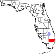 | |
| Towns | ||
| Villages | ||
| CDPs | ||
| Unincorporated community | ||
| Indian reservations | ||
| Ghost town | ||