Mayhill, New Mexico
| Mayhill, New Mexico | |
|---|---|
 Mayhill, New Mexico Location within the state of New Mexico | |
| Coordinates: 32°53′23″N 105°28′41″W / 32.88972°N 105.47806°W | |
| Country | United States |
| State | New Mexico |
| County | Otero |
| Elevation | 6,581 ft (2,006 m) |
| Time zone | MST (UTC-7) |
| • Summer (DST) | MDT (UTC-6) |
Mayhill is a small unincorporated community in Otero County, New Mexico, United States. It is surrounded by the Lincoln National Forest on the eastern slope of the Sacramento Mountains, at the confluence of James Canyon and Rio Penasco, about 17 miles east of Cloudcroft.[1] Elevation is 6581 feet. Mayhill includes a post office, a restaurant, and a gas station. The village is almost entirely residential, consisting largely of vacation homes and summer cabins. Farming and ranching are also important economic activities in the area.[2]
References
Municipalities and communities of Otero County, New Mexico, United States | ||
|---|---|---|
| City | 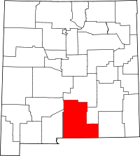 | |
| Villages | ||
| CDPs | ||
| Other unincorporated communities | ||
| Indian reservation | ||
| Footnotes | ‡This populated place also has portions in an adjacent county or counties | |
Coordinates: 32°53′23″N 105°28′41″W / 32.88972°N 105.47806°W
This article is issued from Wikipedia - version of the 1/20/2014. The text is available under the Creative Commons Attribution/Share Alike but additional terms may apply for the media files.