Weed, New Mexico
| Weed, New Mexico | |
|---|---|
| Census-designated place | |
 Weed, New Mexico | |
| Coordinates: 32°48′09″N 105°31′03″W / 32.80250°N 105.51750°WCoordinates: 32°48′09″N 105°31′03″W / 32.80250°N 105.51750°W | |
| Country | United States |
| State | New Mexico |
| County | Otero |
| Area[1] | |
| • Total | 8.986 sq mi (23.27 km2) |
| • Land | 8.982 sq mi (23.26 km2) |
| • Water | 0.004 sq mi (0.01 km2) |
| Elevation | 7,047 ft (2,148 m) |
| Population (2010)[2] | |
| • Total | 63 |
| • Density | 7.0/sq mi (2.7/km2) |
| Time zone | Mountain (MST) (UTC-7) |
| • Summer (DST) | MDT (UTC-6) |
| Area code(s) | 575 |
| GNIS feature ID | 912202[3] |
Weed is a census-designated place in Otero County in southern New Mexico, USA. It lies alongside New Mexico State Road 24 on the eastern slopes of the Sacramento Mountains at an elevation of 7,047 ft. It has had a Post Office since 1885.[4] As of the 2010 census, its population was 63.[2]
History
Weed was founded in 1884 by George and Elizabeth Lewis.[4] It was named after William H. Weed, who opened a branch store there.[4]
Weed is the birthplace of actor Glenn Strange.
Notes
- ↑ "US Gazetteer files: 2010, 2000, and 1990". United States Census Bureau. 2011-02-12. Retrieved 2011-04-23.
- 1 2 "American FactFinder". United States Census Bureau. Retrieved 2011-05-14.
- ↑ "Weed". Geographic Names Information System. United States Geological Survey.
- 1 2 3 Julyan, Robert (1998) "Weed" Place Names of New Mexico (2nd edition) University of New Mexico Press, Albuquerque, New Mexico, page 377, ISBN 0-8263-1689-1
External links
Municipalities and communities of Otero County, New Mexico, United States | ||
|---|---|---|
| City | 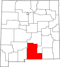 | |
| Villages | ||
| CDPs | ||
| Other unincorporated communities | ||
| Indian reservation | ||
| Footnotes | ‡This populated place also has portions in an adjacent county or counties | |
This article is issued from Wikipedia - version of the 11/7/2016. The text is available under the Creative Commons Attribution/Share Alike but additional terms may apply for the media files.