Piñon, New Mexico
| Piñon | |
|---|---|
| Unincorporated community | |
 Piñon  Piñon Location within the state of New Mexico | |
| Coordinates: 32°37′05″N 105°23′40″W / 32.61806°N 105.39444°WCoordinates: 32°37′05″N 105°23′40″W / 32.61806°N 105.39444°W | |
| Country | United States |
| State | New Mexico |
| County | Otero |
| Elevation[1] | 6,060 ft (1,850 m) |
| Population (2010) | |
| • Total | 71 |
| Time zone | Mountain (MST) (UTC-7) |
| • Summer (DST) | MDT (UTC-6) |
| ZIP codes | 88344 |
| Area code(s) | 575 |
| GNIS feature ID | 909714 |
Piñon[1] is an unincorporated community ranching community in Otero County in southern New Mexico, in the southwestern United States. The town is in the pinon-juniper shrublands habitat with an altitude of 6,060 feet. It is located at the intersection of NM Route 24 and NM Route 506.[2] The postoffice in Piñon opened in 1907. In 2014, Piñon was ranked as the most politically conservative town in New Mexico.[3]
The area is arid and subject to forest fires. In June 2011, the lightning-caused Gage Fire burned 1385 acres[4] just to the west of town.[5]
History
The area was originally settled by the agricultural and hunter gatherer Jornada Mogollon people about 200 CE whose suzerainty ended with the influx of the Apache and other plains raiders around 1450.[6] The town was named in 1907 by the local school teacher John W. Nations after the piñon pine trees in the area.[7]
Notes
- 1 2 U.S. Geological Survey Geographic Names Information System: Piñon, New Mexico
- ↑ Burdett, William H. (1998) The Roads of New Mexico Shearer Publishing, Fredericksburg, Texas, page 107, ISBN 0-940672-52-9
- ↑ Walker, Hunter and Kiersz, Andy (18 June 2014). "Here Are The Most Liberal And Most Conservative Towns In Each State". Business Insider. Archived from the original on 18 June 2014.
- ↑ Gage Fire 1385 acres (Map). New Mexico Fire Information (NMFireInfo). 5 June 2011. Archived from the original on 9 June 2011.
- ↑ Myslivy, Jennifer (5 June 2011). "Gage Fire Update June 5". New Mexico Fire Information (NMFireInfo). Archived from the original on 9 June 2011.
- ↑ Whalen, Michael E. (1994) Turquoise Ridge and late prehistoric residential mobility in the desert Mogollon region (Anthropological papers (Salt Lake City, Utah), no. 118) University of Utah Press, Salt Lake City, Utah, page 26, ISBN 0-87480-436-1
- ↑ Julyan, Robert (1998) "Piñon" The Place Names of New Mexico (revised edition) University of New Mexico Press, Albuquerque, New Mexico, page 268, ISBN 0-8263-1689-1
External links
- "Welcome to Piñon, New Mexico" Panoramio
Municipalities and communities of Otero County, New Mexico, United States | ||
|---|---|---|
| City | 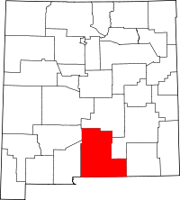 | |
| Villages | ||
| CDPs | ||
| Other unincorporated communities | ||
| Indian reservation | ||
| Footnotes | ‡This populated place also has portions in an adjacent county or counties | |