Mayville, Wisconsin
| Mayville, Wisconsin | |
|---|---|
| City | |
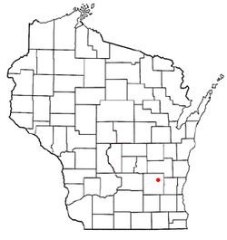 Location of Mayville, Wisconsin | |
| Coordinates: 43°29′49″N 88°32′52″W / 43.49694°N 88.54778°WCoordinates: 43°29′49″N 88°32′52″W / 43.49694°N 88.54778°W | |
| Country | United States |
| State | Wisconsin |
| County | Dodge |
| Area[1] | |
| • Total | 3.28 sq mi (8.50 km2) |
| • Land | 3.17 sq mi (8.21 km2) |
| • Water | 0.11 sq mi (0.28 km2) |
| Elevation[2] | 928 ft (283 m) |
| Population (2010)[3] | |
| • Total | 5,154 |
| • Estimate (2012[4]) | 5,093 |
| • Density | 1,625.9/sq mi (627.8/km2) |
| Time zone | Central (CST) (UTC-6) |
| • Summer (DST) | CDT (UTC-5) |
| ZIP Code | 53050 |
| Area code(s) | 920 |
| FIPS code | 55-50200[5] |
| GNIS feature ID | 1569151[2] |
| Website |
mayvillecity |

Mayville is a city in Dodge County, Wisconsin, United States, located along the Rock River and the Horicon Marsh. The population was 5,154 at the 2010 census.
Geography
Mayville is located at 43°29′49″N 88°32′52″W / 43.49694°N 88.54778°W (43.497044, -88.547871).[6]
According to the United States Census Bureau, the city has a total area of 3.28 square miles (8.50 km2), of which, 3.17 square miles (8.21 km2) is land and 0.11 square miles (0.28 km2) is water.[1]
Demographics
| Historical population | |||
|---|---|---|---|
| Census | Pop. | %± | |
| 1880 | 1,051 | — | |
| 1890 | 1,165 | 10.8% | |
| 1900 | 1,815 | 55.8% | |
| 1910 | 2,282 | 25.7% | |
| 1920 | 3,011 | 31.9% | |
| 1930 | 2,521 | −16.3% | |
| 1940 | 2,754 | 9.2% | |
| 1950 | 3,010 | 9.3% | |
| 1960 | 3,607 | 19.8% | |
| 1970 | 4,139 | 14.7% | |
| 1980 | 4,333 | 4.7% | |
| 1990 | 4,374 | 0.9% | |
| 2000 | 4,902 | 12.1% | |
| 2010 | 5,154 | 5.1% | |
| Est. 2015 | 4,989 | [7] | −3.2% |
2010 census
As of the census[3] of 2010, there were 5,155 people, 2,172 households, and 1,404 families residing in the city. The population density was 1,625.9 inhabitants per square mile (627.8/km2). There were 2,321 housing units at an average density of 732.2 per square mile (282.7/km2). The racial makeup of the city was 96.6% White, 0.2% African American, 0.2% Native American, 0.6% Asian, 1.4% from other races, and 1.0% from two or more races. Hispanic or Latino of any race were 2.7% of the population.
There were 2,172 households of which 30.6% had children under the age of 18 living with them, 49.5% were married couples living together, 9.8% had a female householder with no husband present, 5.4% had a male householder with no wife present, and 35.3% were non-families. 29.7% of all households were made up of individuals and 12.8% had someone living alone who was 65 years of age or older. The average household size was 2.33 and the average family size was 2.87.
The median age in the city was 41.1 years. 23.6% of residents were under the age of 18; 7% were between the ages of 18 and 24; 25% were from 25 to 44; 27.8% were from 45 to 64; and 16.7% were 65 years of age or older. The gender makeup of the city was 49.4% male and 50.6% female.
2000 census
As of the census[5] of 2000, there were 4,902 people, 1,988 households, and 1,329 families residing in the city. The population density was 1,574.4 people per square mile (608.6/km²). There were 2,081 housing units at an average density of 668.4 per square mile (258.4/km²). The racial makeup of the city was 98.35% White, 0.08% African American, 0.20% Native American, 0.29% Asian, 0.73% from other races, and 0.35% from two or more races. Hispanic or Latino of any race were 1.45% of the population.
There were 1,988 households out of which 33.6% had children under the age of 18 living with them, 55.3% were married couples living together, 7.6% had a female householder with no husband present, and 33.1% were non-families. 29.8% of all households were made up of individuals and 14.3% had someone living alone who was 65 years of age or older. The average household size was 2.42 and the average family size was 3.02.
In the city the population was spread out with 25.8% under the age of 18, 7.0% from 18 to 24, 30.3% from 25 to 44, 19.4% from 45 to 64, and 17.4% who were 65 years of age or older. The median age was 38 years. For every 100 females there were 98.9 males. For every 100 females age 18 and over, there were 93.8 males.
The median income for a household in the city was $42,393, and the median income for a family was $50,789. Males had a median income of $36,412 versus $25,500 for females. The per capita income for the city was $19,644. About 4.6% of families and 5.7% of the population were below the poverty line, including 5.7% of those under age 18 and 11.4% of those age 65 or over.
History
Mayville was platted in 1845, by the May brothers and others, and named for the former.[9] A post office has been in operation at Mayville since 1847.[10] The city was incorporated in 1885.[9]
Economy
Mayville is home to several large manufacturing facilities, including plants operated by TAB Products, Mayvile Die and Tool, Mayville Products Corporation, Metalcraft, Mayville Engineering Company, Affiliated Products, RCI Engineering and Gleason Reel, a subsidiary of Hubbell Corporation. Dairy farming and other agricultural activities also comprise an important part of the local economy.
Arts and culture
Mayville hosts an annual "Audubon Days" festival the first full weekend of October. Audubon Days is a culmination of Mayville's historic German roots, with festivities that include bed races, the "Taste of Mayville" food tent, duck races, a parade, kids games/crafts and live music.
From July 29 to August 2, 2009, Mayville hosted the Wisconsin American Legion Baseball Class A state tournament at Fireman's Field in Mayville. Fireman's field is widely considered to be one of the finest baseball parks in Wisconsin.
Fireman's field is maintained by the city of Mayville, and has become a destination for many high profiled sporting events. These events include the aforementioned 2009 Wisconsin American Legion Baseball State Tournament. Mayville was also named one of the four sectional sites for the WIAA Division 2 State Baseball Playoffs. Fireman's Field was also host the 2010 Junior State Legion Baseball Tournament.
Notable people
- State Assemblyman Albert B. Barney.
- State Senator Byron Barwig.
- U.S. Representative Charles Barwig.
- State Senator Ezra A. Bowen.
- State Assemblyman Arthur Delaney
- State Assemblyman Hermann R. Fehland.
- State Assemblyman Elmer L. Genzmer.
- State Assemblyman Rick Gudex
- State Senator Oscar Clark Hathaway.
- MLB player Bert Husting.
- U.S. Senator Paul O. Husting.
- State Assemblyman Charles E. Kite.
- Reverend and State Assemblyman John Herman Koch.
- U.S. Representative Edward Sauerhering.
- Comic book artist, actor, writer, director and film producer Rob Schrab grew up in Mayville.
- State Assemblyman Henry Spiering
Images
 Downtown Mayville
 Fire station
 Post office
 Welcome sign
 WMDC (FM) studios
 Mayville News building
 White Limestone School
 High school
 High school field
References
- 1 2 "US Gazetteer files 2010". United States Census Bureau. Archived from the original on January 24, 2012. Retrieved 2012-11-18.
- 1 2 "US Board on Geographic Names". United States Geological Survey. 2007-10-25. Retrieved 2008-01-31.
- 1 2 "American FactFinder". United States Census Bureau. Retrieved 2012-11-18.
- ↑ "Population Estimates". United States Census Bureau. Archived from the original on June 17, 2013. Retrieved 2013-06-24.
- 1 2 "American FactFinder". United States Census Bureau. Archived from the original on September 11, 2013. Retrieved 2008-01-31.
- ↑ "US Gazetteer files: 2010, 2000, and 1990". United States Census Bureau. 2011-02-12. Retrieved 2011-04-23.
- ↑ "Annual Estimates of the Resident Population for Incorporated Places: April 1, 2010 to July 1, 2015". Retrieved July 2, 2016.
- ↑ "Census of Population and Housing". Census.gov. Archived from the original on May 11, 2015. Retrieved June 4, 2015.
- 1 2 "A bit of May in December". The Milwaukee Sentinel. Dec 8, 1955. pp. 1B. Retrieved 3 November 2015.
- ↑ "Dodge County". Jim Forte Postal History. Retrieved 1 November 2015.
External links
| Wikimedia Commons has media related to Mayville, Wisconsin. |
- City of Mayville
- Mayville Area Chamber of Commerce
- Sanborn fire insurance maps: 1892 1900 1912
Municipalities and communities of Dodge County, Wisconsin, United States | ||
|---|---|---|
| Cities | 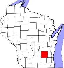 | |
| Villages | ||
| Towns | ||
| CDPs | ||
| Unincorporated communities |
| |
| Ghost towns | ||
| Footnotes | ‡This populated place also has portions in an adjacent county or counties | |