McGhee Tyson Airport
| McGhee Tyson Airport McGhee Tyson Air National Guard Base | |||||||||||||||
|---|---|---|---|---|---|---|---|---|---|---|---|---|---|---|---|
 | |||||||||||||||
| IATA: TYS – ICAO: KTYS – FAA LID: TYS | |||||||||||||||
| Summary | |||||||||||||||
| Airport type | Public | ||||||||||||||
| Owner | Metropolitan Knoxville Airport Authority | ||||||||||||||
| Serves | Knoxville, Tennessee | ||||||||||||||
| Location | Alcoa, Tennessee | ||||||||||||||
| Opened | 1927 | ||||||||||||||
| Elevation AMSL | 981 ft / 299 m | ||||||||||||||
| Coordinates | 35°48′40″N 083°59′38″W / 35.81111°N 83.99389°WCoordinates: 35°48′40″N 083°59′38″W / 35.81111°N 83.99389°W | ||||||||||||||
| Website | www.TYS.org | ||||||||||||||
| Map | |||||||||||||||
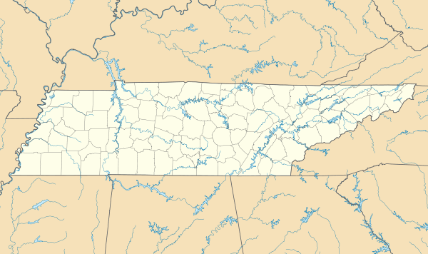
 TYS Location of airport in Tennessee | |||||||||||||||
| Runways | |||||||||||||||
| |||||||||||||||
| Statistics (2012) | |||||||||||||||
| |||||||||||||||


McGhee Tyson Airport (IATA: TYS[3], ICAO: KTYS, FAA LID: TYS) is a public and military airport 12 miles south of Knoxville,[1] in Alcoa, Blount County, Tennessee, United States. It is named for United States Navy pilot Charles McGhee Tyson, lost on patrol in World War I.[4]
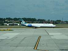
Owned by the Metropolitan Knoxville Airport Authority,[1] it sees several major airlines and connection carriers. The airport employs about 2,700 people.[5] It is a 30-minute drive to the Great Smoky Mountains National Park.[6]
This airport is in the National Plan of Integrated Airport Systems for 2011–2015, which called it a primary commercial service airport since it has over 10,000 passenger boardings (enplanements) per year.[7] Federal Aviation Administration records say the airport had 841,237 enplanements in 2011, an increase from 804,917 in 2010.[8]
The airport is the home of McGhee Tyson Air National Guard Base, an air base for the 134th Air Refueling Wing (134 ARW) of the Tennessee Air National Guard.
History
On August 1, 1930, McGhee Tyson airport opened in honor of Charles McGhee Tyson. Originally the airport was on 60 acres in West Knoxville. In 1935 the city purchased 351 acres in Blount County for the current airport. On July 29, 1937, an American Airlines Stinson TriMotor, capable of carrying about 10 passengers, touched down at McGhee Tyson Airport, marking the first commercial flight at that facility. In 1941 the city built an air traffic control tower and two years later added two 5,000-foot (1,500 m) runways.
The development of TYS helped the City of Alcoa diversify its economy and gain its economic independence from what is today Alcoa Inc., the world's third largest producer of aluminum.[9] Alcoa Inc. built one of its production plants in Alcoa due to the proximity of tributaries of the Little River which were a hydroelectric energy source for the production of aluminum [9]
In 1951 the United States Air Force built several facilities on the field and a 7,500-foot (2,300 m) runway. The Federal aviation administration (FAA) added an Instrument Landing System to runways 5L and 23R in 1959. In 1961, with financing by the Tennessee Air National Guard, the runway reached its current length of 9,000 feet (2,700 m). In 1968 McGhee Tyson built a new air cargo facility. Almost a decade after the new air cargo facility was built one of the first major construction projects was completed with a new passenger terminal in 1974. Four years later the Metropolitan Knoxville Airport Authority (MKAA) was established, and in 1985 the airport authority had the two parallel runways redesignated as 5L/23R and 5R/23L.
In 1990 runway 5R/23L was reconstructed to its current a length of 9,000 feet. The airport authority built a new air cargo facility in 1992. The Air Cargo Complex provided a 21-acre facility for Federal Express, UPS and Airborne Express. Buildings were designed to meet the carriers' needs. 90 percent of the total air cargo operations at the Airport are operated by UPS and Federal Express. Cost of the project was estimated at $9.3 million. The new air cargo facility is on the north side of the airport.
In 2000 the last major project, improvements to the passenger terminal, was finished at a cost of $70 million. The improvements, designed by HNTB,[10] included two new concourses, 12 new gates, ticket counters and a Ruby Tuesday restaurant. Currently, 11 gates are in use, with gate 6 being the only one not in service.[11] In 2002, an aircraft maintenance facility was built for Northwest Airlines, serving as their primary CRJ MRO facility.[12] ExpressJet Airlines has also built a heavy maintenance hangar near the air cargo facilities for its fleet. In June 2009, a new food court was completed, featuring Starbucks, Quiznos, Cinnabon and Zia locations.[13] The Zia location was replaced in April 2013 with an Uno Express Pizza.[14]
Air National Guard Base
The 134 ARW, which is operationally gained by the Air Mobility Command (AMC), operates KC-135R Stratotankers for both air mobility and aerial refueling of military aircraft. McGhee Tyson ANGB is also home to the I.G. Brown Air National Guard Training and Education Center and the former home of the Air National Guard's Academy of Military Science (AMS). Similar to U.S. Air Force (USAF) Officer Training School (OTS), AMS is an alternate commissioning source for USAF officers who are directly inputted into various units of the Air National Guard throughout the United States.[15][16]
Facilities and Aircraft
McGhee Tyson Airport covers 2,250 acres (911 ha) at an elevation of 981 feet (299 m) above mean sea level. It has two runways: 5L/23R is a concrete runway measuring 9,005 by 150 feet (2,745 x 46 m), while 5R/23L is an asphalt runway measuring 9,000 by 150 feet (2,743 x 46 m).[1]
The fixed-base operator (FBO) at TYS is the Truman-Arnold Company (TAC Air). TAC Air first moved into TYS on April 1, 2005, when it purchased Knox-Air, which had operated in TYS since 1974. Then a month later, on May 5, 2005, TAC Air purchased the only remaining FBO, Cherokee Aviation, which has been in operation since 1954. TAC Air combined these two FBOs under their own name, and they have continued to be the sole supplier of aviation fuel for commercial, corporate and general aviation aircraft as well as leased hangar space at the airport ever since.
For the year of 2013 the airport had 100,914 aircraft operations, averaging 276 per day: 28,246 general aviation, 34,382 air taxi, 14,839 military, and 8,939 scheduled commercial. As of 2013, there were 167 aircraft based at this airport: 58 were single-engine, 42 were multi-engine, 35 were military, 30 were jet and there were 2 helicopters.[1]
Airport Terminal
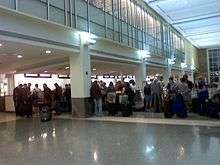
McGhee Tyson Airport has two levels. The top level is accessed via the curbside drop off and the parking garage. The top level has ticket counters, security, gates, restaurants and shops. It is designed with a Smoky Mountain theme, complete with faux waterfalls and wood carvings of bears. The bottom level is used for car rental counters, two baggage claims, airline and airport offices. There are 12 gates.
Airport Governance and Management
The MKAA, which has been in place since 1978, is a component unit of the City of Knoxville and is governed by a nine-member board of commissioners. Each commissioner on the board is appointed for seven years by the Mayor and confirmed by City Council. The MKAA also operates the Downtown Island Airport, a 150-acre general aviation facility less than three miles from downtown Knoxville. It is home to more than 100 private and corporate aircraft. There is no commercial service out of Downtown Island Airport. The board of commissioners chooses the airport's president, who is the chief administrative and executive officer of the Authority. The position is currently held by Mr. Bill Marrison. Mr. Marrison has been the airport's President since 2001, and is an Accredited Airport Executive of the American Association of Airport Executives. The President manages the airports under the Authority's control with a staff of 147 full-time equivalent employees.
Airlines and Destinations
Passenger
Cargo
| Airlines | Destinations |
|---|---|
| Ameriflight | Louisville |
| FedEx Express | Indianapolis, Memphis, Norfolk, Richmond |
| UPS Airlines | Louisville |
Statistics
Carrier Statistics
| Carrier | Passengers (arriving and departing) |
|---|---|
| ExpressJet | 463,000(27.41%) |
| PSA | 318,000(18.84%) |
| Endeavor | 273,000(16.18%) |
| Delta | 227,000(13.44%) |
| Allegiant | 214,000(12.67%) |
| Other | 194,000(11.47%) |
Destination Traffic
| Rank | Airport | Passengers | Airline |
|---|---|---|---|
| 1 | Atlanta Hartsfield-Jackson International (ATL) | 224,000 | Delta |
| 2 | Charlotte/Douglas International (CLT) | 114,000 | American/US Airways |
| 3 | Chicago O'Hare International (ORD) | 87,000 | American, United |
| 4 | Dallas/Fort Worth International (DFW) | 74,000 | American |
| 5 | Detroit Metropolitan Wayne County (DTW) | 47,000 | Delta |
| 6 | Orlando-Sanford International (SFB) | 40,000 | Allegiant |
| 7 | Houston George Bush Intercontinental (IAH) | 39,000 | United |
| 8 | Denver International Airport (DEN) | 31,000 | Frontier, United |
| 9 | Washington-National (DCA) | 31,000 | American/US Airways |
| 10 | St. Petersburg-Clearwater International Airport (PIE) | 29,000 | Allegiant |
Annual Traffic
| Year | Passenger volume | Change over previous year | Aircraft operations | Cargo (lbs) |
|---|---|---|---|---|
| 2005 | 1,793,000 | 91,000,000 | ||
| 2006 | 1,609,000 | | 93,000,000 | |
| 2007 | 1,759,000 | | 99,000,000 | |
| 2008 | 1,742,943 | | 121,680 | 97,366,366 |
| 2009 | 1,680,442 | | 104,273 | 82,304,377 |
| 2010 | 1,689,945 | | 107,010 | 93,393,658 |
| 2011 | 1,774,252 | | 107,757 | 92,390,849 |
| 2012 | 1,747,145 | | 105,805 | 91,529,442 |
| 2013 | 1,676,374 | | 100,914 | 84,029,942 |
| 2014 | 1,738,133 | | 100,421 | 74,115,672 |
| 2015 | 1,774,081 | | 118,921 | 77,331,422 |
| 2016 (YTD) | 233,668 | | 14,506 | 6,221,205 |
Statistics from 2005-2007 [17]
Statistics from 2008-2015 [18]
Accidents and Incidents
- On August 6, 1962, an American Airlines Lockheed L-188 Electra veered off the runway on landing, striking the raised edge of an under-construction taxiway with the landing gear, causing it to collapse. All 72 passengers and crew survived.
- On March 12, 1992, a USAir Express Jetstream 31 crashed on landing after the pilot failed to lower the landing gear. There were no passengers aboard, however the 2 crew members were killed.[19]
References
- 1 2 3 4 5 FAA Airport Master Record for TYS (Form 5010 PDF). Federal Aviation Administration. Effective November 15, 2012.
- ↑ "McGhee Tyson Airport, December 2010" (PDF). December 2010.
- ↑ "IATA Airport Code Search (TYS: Knoxville / McGhee Tyson)". International Air Transport Association. Retrieved December 27, 2012.
- ↑ "History of the Airport". McGhee Tyson Airport. Archived from the original on May 13, 2008.
- ↑ "About McGhee Tyson Airport". Metropolitan Knoxville Airport Authority.
- ↑ City of Alcoa, official website
- ↑ "2011–2015 NPIAS Report, Appendix A" (PDF). National Plan of Integrated Airport Systems. Federal Aviation Administration. October 4, 2010. Archived from the original (PDF, 2.03 MB) on September 27, 2012. External link in
|work=(help) - ↑ "Enplanements for CY 2011" (PDF, 1.7 MB). CY 2011 Passenger Boarding and All-Cargo Data. Federal Aviation Administration. October 9, 2012. External link in
|work=(help) - 1 2 City of Alcoa. "Welcome to the City of Alcoa / City of Alcoa - City of Alcoa". cityofalcoa-tn.gov.
- ↑ "McGhee Tyson Airport Renovation". HNTB.com.
- ↑ "Knoxville McGhee Tyson Airport". KAYAK.com. Archived from the original on July 24, 2011.
- ↑ "Investor Relations - Corporate Profile". Pinnacle Airlines Corp.
- ↑ Marcum, Ed (June 6, 2009). "Airport's food court opens". Knoxville News Sentinel.
- ↑ "Uno Express Pizza Opens". April 12, 2013.
- ↑ Pike, John. "McGhee-Tyson ANGB". GlobalSecurity.org.
- ↑ "McGhee Tyson Air National Guard Base". Archived from the original on February 5, 2007.
- 1 2 3 "Knoxville, TN: McGhee Tyson (TYS)". Bureau of Transportation Statistics (BTS), Research and Innovative Technology Administration (RITA), U.S. Department of Transportation. September 2013. Retrieved March 2016. Check date values in:
|access-date=(help) - ↑ "Airport Statistics". McGhee Tyson Airport. Retrieved April 2016. Check date values in:
|access-date=(help) - ↑ "Knoxville-McGhee Tyson Airport". Aviation Safety Network.
-
 This article incorporates public domain material from the Air Force Historical Research Agency website http://www.afhra.af.mil/.
External links
| Wikimedia Commons has media related to McGhee Tyson Airport. |
- Official website
- 134th Air Refueling Wing
- FAA Airport Diagram (PDF), effective December 8, 2016
- FAA Terminal Procedures for TYS, effective December 8, 2016
- Resources for this airport:
- AirNav airport information for KTYS
- ASN accident history for TYS
- FlightAware airport information and live flight tracker
- NOAA/NWS latest weather observations
- SkyVector aeronautical chart for KTYS
- FAA current TYS delay information