McLouth, Kansas
| McLouth, Kansas | |
|---|---|
| City | |
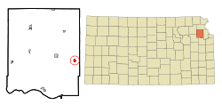 Location within Jefferson County and Kansas | |
 KDOT map of Jefferson County (legend) | |
| Coordinates: 39°11′43″N 95°12′27″W / 39.19528°N 95.20750°WCoordinates: 39°11′43″N 95°12′27″W / 39.19528°N 95.20750°W | |
| Country | United States |
| State | Kansas |
| County | Jefferson |
| Area[1] | |
| • Total | 0.60 sq mi (1.55 km2) |
| • Land | 0.59 sq mi (1.53 km2) |
| • Water | 0.01 sq mi (0.03 km2) |
| Elevation | 1,168 ft (356 m) |
| Population (2010)[2] | |
| • Total | 880 |
| • Estimate (2012[3]) | 865 |
| • Density | 1,500/sq mi (570/km2) |
| Time zone | Central (CST) (UTC-6) |
| • Summer (DST) | CDT (UTC-5) |
| ZIP code | 66054 |
| Area code(s) | 913 |
| FIPS code | 20-43900 [4] |
| GNIS feature ID | 0478524 [5] |
| Website | City Website |
McLouth is a city in Jefferson County, Kansas, United States. As of the 2010 census, the city population was 880.[6]
History
McLouth was founded in the 1880s.[7][8] It was named for Amos McLouth, the original owner of the town site.[7][9]
The first post office in McLouth was established in May 1882.[10]
Geography
McLouth is located at 39°11′43″N 95°12′27″W / 39.19528°N 95.20750°W (39.195304, -95.207584).[11] According to the United States Census Bureau, the city has a total area of 0.60 square miles (1.55 km2), of which, 0.59 square miles (1.53 km2) is land and 0.01 square miles (0.03 km2) is water.[1]
Demographics
| Historical population | |||
|---|---|---|---|
| Census | Pop. | %± | |
| 1890 | 311 | — | |
| 1900 | 529 | 70.1% | |
| 1910 | 571 | 7.9% | |
| 1920 | 575 | 0.7% | |
| 1930 | 517 | −10.1% | |
| 1940 | 515 | −0.4% | |
| 1950 | 477 | −7.4% | |
| 1960 | 402 | −15.7% | |
| 1970 | 472 | 17.4% | |
| 1980 | 700 | 48.3% | |
| 1990 | 719 | 2.7% | |
| 2000 | 868 | 20.7% | |
| 2010 | 880 | 1.4% | |
| Est. 2015 | 854 | [12] | −3.0% |
| U.S. Decennial Census | |||
It is part of the Topeka, Kansas Metropolitan Statistical Area.
2010 census
As of the census[2] of 2010, there were 880 people, 341 households, and 240 families residing in the city. The population density was 1,491.5 inhabitants per square mile (575.9/km2). There were 384 housing units at an average density of 650.8 per square mile (251.3/km2). The racial makeup of the city was 95.6% White, 0.8% African American, 0.6% Native American, 0.3% Asian, 0.8% from other races, and 1.9% from two or more races. Hispanic or Latino of any race were 1.1% of the population.
There were 341 households of which 40.5% had children under the age of 18 living with them, 51.6% were married couples living together, 12.9% had a female householder with no husband present, 5.9% had a male householder with no wife present, and 29.6% were non-families. 25.8% of all households were made up of individuals and 10.3% had someone living alone who was 65 years of age or older. The average household size was 2.58 and the average family size was 3.11.
The median age in the city was 32.2 years. 31.5% of residents were under the age of 18; 6.9% were between the ages of 18 and 24; 26.4% were from 25 to 44; 22.7% were from 45 to 64; and 12.4% were 65 years of age or older. The gender makeup of the city was 48.9% male and 51.1% female.
2000 census
As of the census[4] of 2000, there were 868 people, 326 households, and 246 families residing in the city. The population density was 1,800.4 people per square mile (698.2/km²). There were 350 housing units at an average density of 726.0 per square mile (281.5/km²). The racial makeup of the city was 97.24% White, 0.23% African American, 0.92% Native American, 0.12% Asian, and 1.50% from two or more races. Hispanic or Latino of any race were 0.92% of the population.
There were 326 households out of which 39.9% had children under the age of 18 living with them, 61.7% were married couples living together, 9.2% had a female householder with no husband present, and 24.5% were non-families. 20.2% of all households were made up of individuals and 8.9% had someone living alone who was 65 years of age or older. The average household size was 2.66 and the average family size was 3.07.
In the city the population was spread out with 29.6% under the age of 18, 9.4% from 18 to 24, 32.4% from 25 to 44, 17.5% from 45 to 64, and 11.1% who were 65 years of age or older. The median age was 32 years. For every 100 females there were 94.2 males. For every 100 females age 18 and over, there were 92.7 males.
The median income for a household in the city was $40,865, and the median income for a family was $44,063. Males had a median income of $36,100 versus $22,273 for females. The per capita income for the city was $17,012. About 4.7% of families and 7.1% of the population were below the poverty line, including 9.1% of those under age 18 and 16.7% of those age 65 or over.
Education
Unified School District 342 administers the elementary, middle and high schools on one campus. The buildings are attached and share some facilities. The district offers special education for 3 and 4 year olds, a 4year old at risk program, and kindergarten through 12th grade. McLouth High School offers dual credit courses with Kansas community colleges.[13] In the 2014-2015 school year, there were 243 students in the elementary school, 115 students in the middle school and 171 students in the high school.[14] The average dropout rate for 2008-2014 was 0.9%.[15]
References
- 1 2 "US Gazetteer files 2010". United States Census Bureau. Retrieved 2012-07-06.
- 1 2 "American FactFinder". United States Census Bureau. Retrieved 2012-07-06.
- ↑ "Population Estimates". United States Census Bureau. Retrieved 2013-05-29.
- 1 2 "American FactFinder". United States Census Bureau. Retrieved 2008-01-31.
- ↑ "US Board on Geographic Names". United States Geological Survey. 2007-10-25. Retrieved 2008-01-31.
- ↑ "2010 City Population and Housing Occupancy Status". U.S. Census Bureau. Retrieved April 6, 2012.
- 1 2 Kansas State Historical Society (1916). Biennial Report of the Board of Directors of the Kansas State Historical Society. Kansas State Printing Plant. p. 209.
- ↑ Blackmar, Frank Wilson (1912). Kansas: A Cyclopedia of State History, Volume 2. Standard Publishing Company. p. 204.
- ↑ Carpenter, Tim (November 28, 1997). "What's in a name? Key elements of area history". Lawrence Journal-World. pp. 3B. Retrieved 28 April 2015.
- ↑ "Kansas Post Offices, 1828-1961 (archived)". Kansas Historical Society. Archived from the original on October 9, 2013. Retrieved 11 June 2014.
- ↑ "US Gazetteer files: 2010, 2000, and 1990". United States Census Bureau. 2011-02-12. Retrieved 2011-04-23.
- ↑ "Annual Estimates of the Resident Population for Incorporated Places: April 1, 2010 to July 1, 2015". Retrieved July 2, 2016.
- ↑ ksde
- ↑ USD342
- ↑ http://www.ksde.org/SearchResults.aspx?Search=mclouth
External links
| Wikimedia Commons has media related to McLouth, Kansas. |
- City
- Schools
- USD 342, local school district
- Maps
- McLouth City Map, KDOT
Municipalities and communities of Jefferson County, Kansas, United States | ||
|---|---|---|
| Cities | 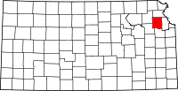 | |
| CDP | ||
| Unincorporated communities | ||
| Townships | ||