Medicine Lodge Peace Treaty Site
|
Medicine Lodge Peace Treaty Site | |
|
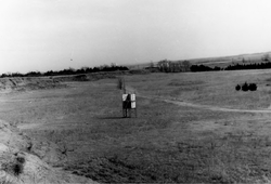
The natural amphitheater at the site, 1969 | |
  | |
| Nearest city | Medicine Lodge, Kansas |
|---|---|
| Coordinates | 37°17′41″N 98°33′42″W / 37.29472°N 98.56167°WCoordinates: 37°17′41″N 98°33′42″W / 37.29472°N 98.56167°W |
| Area | 0 acres (0 ha) |
| Built | 1867 |
| NRHP Reference # | 69000059 |
| Significant dates | |
| Added to NRHP | August 4, 1969[1] |
| Designated NHL | August 4, 1969[2] |
The Medicine Lodge Peace Treaty Site was the location in present-day Kansas of the signing of the Medicine Lodge Treaty in October 1867 by the United States government with major Western Native American tribes of the region. There were a total of three treaties, collectively grouped under one name.[3]
The area includes the treaty signing site, near the confluence of Medicine Lodge Creek and Elm Creek. It also includes the camp area on the north and south sides of Medicine Lodge Creek, where most of the Native Americans camped.[3]
The site was designated a U.S. National Historic Landmark in 1969 and listed on the National Register of Historic Places.[1][2]
See also
- National Register of Historic Places listings in Barber County, Kansas
- List of National Historic Landmarks in Kansas
References
- 1 2 National Park Service (2009-03-13). "National Register Information System". National Register of Historic Places. National Park Service.
- 1 2 "Medicine Lodge Peace Treaty Site". National Historic Landmark summary listing. National Park Service. Retrieved 2011-01-21.
- 1 2 John D. McDermott (April 10, 1969). "Special Report: Medicine Lodge Peace Treaty Site, Medicine Lodge, Kansas" (PDF). National Park Service. and Accompanying 30 or so photos, from 1969 and other
External links
- Medicine Lodge Indian Peace Treaty Pageant
- Medicine Lodge Peace Treaty - Kansas Historical Society history
| Topics | |
|---|---|
| Lists by states |
|
| Lists by insular areas | |
| Lists by associated states | |
| Other areas | |
| |
This article is issued from Wikipedia - version of the 11/28/2016. The text is available under the Creative Commons Attribution/Share Alike but additional terms may apply for the media files.